Mid-Week Links: Until Next Time

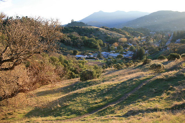
Mt. Tam with Long Shadows Thank you all who came out to last week's happy hour!  We had a small group - a couple of planning commissioners, a couple of regular readers - and it was good fun.  The next one will likely be around the end of September, so keep an eye out.  In the mean time, I'm back in DC keeping an eye out for the goings-on in Marin.

It's been two weeks with no links, so let's get caught up.

Marin County

  • What might One Bay Area learn from other regions as it crafts its Sustainable Communities Strategy?  First of all, make sure to do good outreach, and second, make sure to invest enough in transit. ABAG's outreach has thus far been horrifically bad, at least in Marin, but at least MTC is on the ball with transit investment. (SPUR)
  • As it turns out, San Rafael's red light cameras at 3rd & Irving are good for safety, reducing accidents by 12% over the last fiscal year while also reducing the total number of citations. Win/win, in my book. (IJ)
  • The Board of Supervisors wants San Rafael to take its due diligence regarding the proposed San Rafael Airport sports complex. While most of the neighbors are in unincorporated areas like Santa Venetia and so fall directly under the county, the airport itself is under the city. (IJ)
  • Apparently, George Lucas was serious when he proposed building affordable housing at Grady Ranch.  I can scarcely think of a worse place for it, though the irony is rich. (Ross Valley Reporter)
  • Then again, perhaps Grady Ranch wasn't such a slam-dunk for the environment after all... (IJ)
  • Are you a smoker living in an apartment or condo in unincorporated Marin? Better quit now - the Board of Supervisors is likely to ban smoking in apartments and condos, both indoor and outdoor, next week. (IJ)
  • West Marin tourists, park rangers, and bobcats got a pedestrian upgrade when two bridges were installed near Sausalito - one 180-foot span that bridges a creek and wetland, and another one 60-foot span. They were built so walkers could bypass nearby traffic. (IJ)
  • Sausalito's Housing Element has been rejected by HCD, which cited a lack of 20-unit-per-acre developments and zoning. The city will take a second look and consider revisions. (Marinscope)
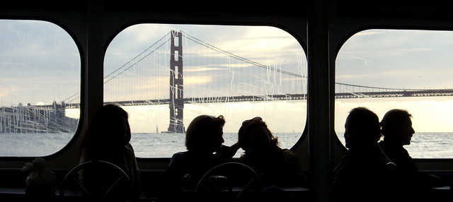
  • The 75th Anniversary of the Golden Gate Bridge, celebrated on May 27, will be a grand affair with no parking, so take transit!  There's free bike parking at the Presidio, both Muni and GGT will boost their buses, there will be buses to the Larkspur Ferry (a shock!), and it will generally be a good time. Alas, Marin Transit doesn't seem to be adding service so be prepared to walk, bike, or taxi from your bus pad or transit center of choice. Oh, and I recommend getting Clipper Cards for the family - saves you money and time boarding the bus and ferry, not to mention that it makes transfers to Muni easier. (Patch, GGB75, ClipperCard, IJ)
  • And...: The upcoming June 5 election?  Yeah, there's an app for that. (Patch) ... This week there were five DUIs on 101 in just a day. Be careful out there, people. (News Pointer) ... Bus Rapid Transit on Van Ness is a go, and is set to open in 2016. (Chronicle) ... Dispelling rumors on bike lanes and bike safety. (Mercury News) ... The Golden Gate Bridge had its share of detractors. (SFist)

The Greater Marin

  • If you missed it (I did), there's a proposal winding through Sacramento to consolidate MTC, ABAG, BAAQMD, and BCDC into a single agency called the Bay Area Regional Commission governed by 15 commissioners elected from new districts in the Bay Area.  Fearing a loss of influence, Napa is fighting this one tooth and nail. (Napa Valley Register)
  • Martinez may soon join the city of Napa in switching its downtown streets to two-way. Ought San Rafael follow suit? (Contra Costa Times)
  • In a move that defines ambition, Chicago declared that it would have no road fatalities in 20 years. (Streetsblog)
  • Sometimes we go so long without transit that we forget how to behave, or we are so used to transit we never unlearn our bad habits. SFist has a great series of articles on transit and walking etiquette that I heartily recommend to you.
  • If you want a better street and live in San Francisco, check their new website for info on how to get some street improvements on your own.  Marinites, well, check it out for some street envy. Perhaps one day even Novato will warm to the parklet. (Streetsblog)
  • Cincinnati is giving form-based zoning a try, allowing neighborhoods to develop along the lines of how they wnat to look, rather than just based on how buildings are used. (Cincinnati.com via Planetizen)
  • UPDATE: People that live where it's easy to walk from home to work or stores tend to do so, and also tend to bike significantly more than their more thinly-spread compatriots. Though the study was done in some of DC's more tony neighborhoods, I suspect you'd find the same thing in the old TOD downtowns of Marin. (Washington Post)
Come support Corte Madera in ABAG

Corte Madera will consider whether to finalize its departure from ABAG tomorrow (Tuesday) at 7:30. Come out and voice your opposition! I'll be speaking at the public comment time and I would love to have more than me there. As a reminder, Corte Madera voted to quit ABAG over what it saw as overreach by the association in housing mandates and the One Bay Area process. I strenuously opposed the decision, calling it a dramatic overreaction to nonexistent problems. It will hurt the town, in that it will get housing mandates from the state after the upcoming RHNA cycle is over in 2021, and will hurt the region as a whole, in that a growth model that fails Corte Madera may be failing the rest of the Bay Area. I will make the same arguments during the public comment period.

The New Hub Spider Map

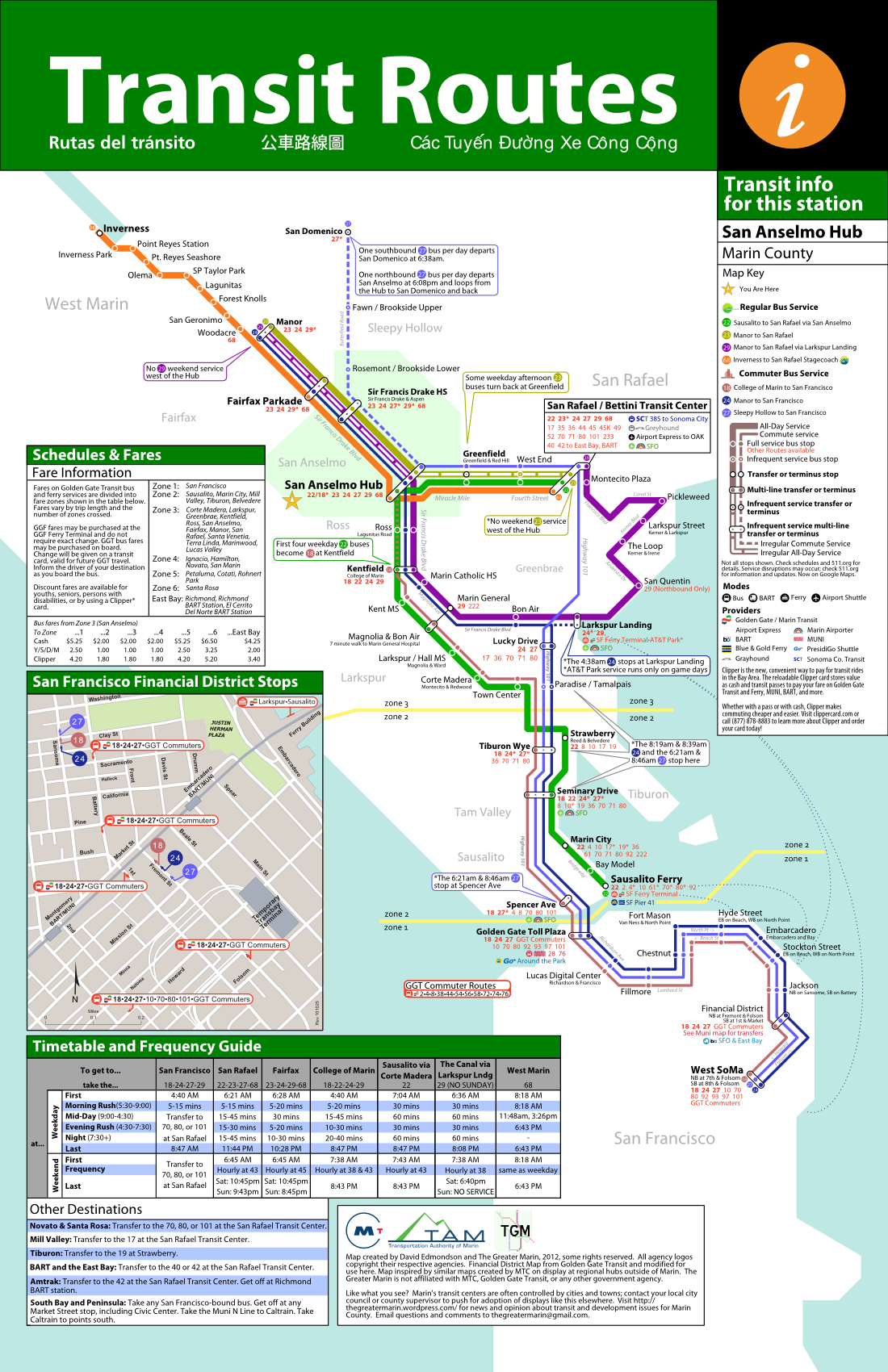
That map I posted yesterday?  I slept on it and I realized it was hideous, so I took another whack at the info boxes and I think I've come up with a usable final version of the Hub Spider Map.  Since I'll be in town this week, the map's going up at the Hub sometime over the next few days.

Since we've already discussed spider maps, I'll leave the general subject out of this post. Suffice it to say that my map shows all the regular bus routes departing from the San Anselmo Hub.  Routes to the Hub are not included, so the 22's once-per-day meandering north through Mill Valley stays off.  The purpose is to give people an idea of where they can go from the Hub without the clutter of geography.

The principal changes in this map are:

  1. Route start/end markers.  One critique I got from the first map was the difficulty in keeping track of which color corresponds to which line.  To make it easier, I've put colored markers with the route number at each endpoint.
  2. Redesigned major stations.  The old map had large, ungainly boxes for the Hub and the San Rafael Transit Center.  To streamline the map, I converted them into elongated versions of other transfer stations elsewhere on the map.
  3. Straightened the angles.  I converted all angles to the standard 45 degrees for the sake of elegance and to make it easier on the eyes.
  4. Removed the regional transit map.  Though I'd like to have the regional transit map available, it needs to be so small on a legal-sized sheet of paper that it become illegible.  Rather than deal with an illegible map, I've taken it out entirely.
  5. Reworked the info boxes.  Scheduling, directions to other destinations, and a fare information box have all been added and moved around.  The Financial District map has also moved to give space to the scheduling box.
  6. Removed Muni transfer information.  It cluttered the San Francisco portion of the map too much, and Muni buses typically don't share stops with GGT anyway.

Though it's not the best transit map in the world, I'm certainly not a graphic designer.  In all, I feel confident that the map will help riders from the Hub to understand the system better.  I suppose we shall see.

From the Archives: Crosswalks and Walkability

Tonight, I'm taking a break. I need to pack, and I've finally finished my San Anselmo spider map (PDF) in preparation for my trip back home, but I don't want to leave you hanging. I've gone through the archives and found a good piece from last year dealing with crosswalks and walkability in San Anselmo.  I'll see you at this Thursday's happy hour.

Walkability seems to be all the rage these days, and for good reason.  Any merchant will tell you that foot traffic is good for business, and any public health expert will tell you walking is good for your health.  It gets people out of cars for trips of less than a mile and puts people where they can see each other, generating the vibrant sort of street life where friends and acquaintances run into each.  It’s a win for residents, a win for businesses, and a win for the city’s health.

Crosswalks are key to ensuring good walkability.  A road system isn’t much of a road system if you need to drive 15 minutes out of your way to turn, and a sidewalk system isn’t much good if one needs to walk 15 minutes to cross the street.  A good crosswalk will enhance an entire streetscape, making it more inviting to pedestrians and more lively for all users.  In contrast, a streetscape without crosswalks can be dangerous.  If crosswalks are far enough apart, the two halves of the street will be cut off from each other, dramatically reducing the walkability of the area.

Read the rest...

Mid-Week Links: Cheers!

The Second The Greater Marin Happy Hour

Good news everyone!  The second The Greater Marin Happy Hour will be held next Thursday at San Rafael Joe's - no more 29 bus madness (sadness?) and the ferry like last time. With GGT on Google Maps, you shouldn't have any trouble finding your way, even if you work in Belvedere.  I'll have some signs out around the bar like last time, but if you can't find us just email me at theGreaterMarin [at] gmail.com and I'll try to wave you down.  I hope to see you all there!

Who: You, me, and anyone else you happen to invite (and please do invite people!) When: Thursday, May 10, 6pm, though you're absolutely welcome to come late Where: San Rafael Joe's, 931 Fourth Street, San Rafael, CA

In another bit of blog news, you'll notice over on the sidebar that I'm open for business as a communications and planning consultant. If you want my brain working for you, get in touch with me at the email address on the right.  I'll be in the Bay Area from May 10-15 and am perfectly willing to travel as needed.

Right, now that that's all done with, on to the news of the week.

Marin County

  • Golden Gate Ferry workers went on strike yesterday to protest the slow pace of talks between their union and the transit district. They may call another strike on May 10 if progress remains unacceptably slow. (Chronicle)
  • San Francisco is moving towards a true BRT line on Van Ness, with center-running lanes compatible with existing buses. The line would serve Muni routes 47 and 49, as well as GGT routes 10, 70, 80, 93, and 101. It will be a boon to all riders along the corridor, though if GGT could pick up intra-San Francisco trips it would be even better. (Transbay Blog)
  • The Doyle Drive closure went off without a hitch, and the resulting roadway looks pretty nifty.  I do wonder about the eventual 12-lane configuration - neither the bridge nor the approach can handle so much traffic. (Chronicle, SFist)
  • Larkspur mulls what to do with 2.5 acres of land on the Niven Nursery site. The frontrunner idea is a new library. (IJ)
  • Marin's population grew 0.7% this past year, rather faster than Plan Bay Area's 0.2% housing growth prediction. And here I thought we were slow-growth (no I didn't). (IJ)
  • The West Sidewalk of the Golden Gate Bridge is finally open again. (GGBHTD)
  • This Friday at 7pm, stop by the Mill Valley Library for a talk by noted urbanist Peter Calthorpe on Mill Valley, urbanism, and the Bay Area's future. Let me know how it goes. (MVPL)

The Greater Marin

[vimeo http://www.vimeo.com/40686130 w=620&h=348]

Just across the bridge, San Francisco is doing some truly amazing things to promote a more walkable, livable city.  What lessons can we learn from San Francisco, and how can we apply them to Marin?  Personally, I'd love to see a San Rafael Park(ing) Day. (Streetfilms)

  • While BART is finally coming to San Jose, transportation planners are cutting their own feet out from under themselves by significantly widening two major freeways in Santa Clara, one to 8 lanes and the other to a whopping 12. (Mercury News)
  • Operating costs for High Speed Rail won't be nearly as high as opponents claim. (Systemic Failure)
  • With more cars came more people dying on the roads, and Europe and the United States took dramatically different paths.  While Europeans got mad at the cars and pushed back in favor of more pedestrian and cycling infrastructure, the United States pushed people out of the way of the cars, razing its city centers for parking and wider roads. (Atlantic Cities)
  • Ever wondered what the view is like from atop Sutro Tower? Now you know. (SFist)

Tempest in a Teapot

Teapot, W1042 When Plan Bay Area released its draft preliminary growth numbers (yes, they’re that speculative), a cry went out around Marin that ABAG wants to cram growth down the gullet of stable and ungrowing county.  For years, Marin has lost jobs and so either lost housing units or grew at a snail’s pace.  We aren’t like the bankrupt towns of the East Bay or Delta, with vast tracts of new, identical houses.  Sadly, if regional and state agencies have  their way such reckless and unrestrained growth would come to our counties and you might as well kiss the Marinite way of life goodbye.

It’s a good narrative, but as with most sensationalist narratives of the government losing all reason, it’s pure nonsense.

Plan Bay Area, the sustainable communities strategy mandated by California, needs to accomplish a simply stated task: find out where people will live and work in 30 years, funnel that growth away from open space, and provide an effective way for people to get around without a car.  The first task requires projections of job and housing growth, the second utilizes the state-mandated Regional Housing Needs Allocation (RHNA) process, and the third uses grants to localities that want to expand or maintain their transit infrastructure.

The fear among opponents is that projections of housing growth will mean that the state will mandate that level of growth.  I suppose it’s an easy mistake to make.  RHNA numbers are released in a similar fashion, and those really are mandates for zoning to accommodate the growth.  Thankfully, Plan Bay Area projections are intended to inform the whole sustainability strategy; they don’t constitute growth mandates.  Yet even if they did, they would mandate slower growth for the county than has occurred in the recent past, though you wouldn’t know it listening to the plan’s opponents.

Between 2000 and 2010, Marin added about 622 housing units per year.  Nearly every incorporated town (excepting Larkspur and Belvedere) and every unincorporated village added housing over the past decade.  Plan Bay Area projects that growth will slow to only 272 units per year, less than half the rate of the past decade.  This rate of growth includes both affordable and market-rate housing.  RHNA will be informed by these projections, and so will mandate even less housing.

Besides, the “mandates” aren’t even mandates.  As we’ve discussed before, RHNA requires a city to do two things: zone for affordable housing, and come up with a plan to maybe have it get built.  That rarely happens.

So Marin will likely grow faster than Plan Bay Area projects, will likely be required to build less affordable housing than it has been required to in the past, and so things will carry on in much the same way they always have.  There is no vast usurpation of local control, there is no growth mandate handed down from One Bay Area, there is no UN plot to confiscate your home.  You may notice fewer news stories about grants for roads and more about grants for bikes and transit, and I guess that will be kind of disruptive.

GGT and Marin Transit are on Google Maps

Well, looks like the rumors were true: Golden Gate Transit and Marin Transit (MT/GGT) have made it onto Google Maps at last.  The news broke on Twitter when fellow blogger Matt Nelson of California Streets let me know:

While the extremely observant would have picked up the select comments and tweets that have been made about this, for the most part the efforts have gone unnoticed and unadvertised.  The chatter was that MT/GGT had wanted to get onto Google Maps last year, but some of the more complicated and infrequent routes, such as school buses that run only on Wednesdays, weren't converting effectively into the system.  The trouble pushed back the roll-out until now.

There are a few glaring oddities in this roll-out.  As of publish time, neither Marin Transit nor Golden Gate Transit have made a press statement on the subject.  You'd think that their communications departments would be incredibly excited to get this out to the public.  Perhaps, with the Doyle Drive closure and rerouting through the city this weekend, they'd rather not get people excited to use a system that isn't going to give good information until Monday.

As well, the MT shuttles, either the ones to West Marin or the ones around East Marin, seem to be missing from Google Maps.  Only routes operated by GGT are shown.  It seems odd that such a large part of our already anemic transit system would be left out, but perhaps this will be rolled out at a future date.

Google Maps uses what's called the General Transit Feed Specification, or GTFS, which is really just a specially formatted spreadsheet of all the routes, stops, and timetables in the system.  Google works with transit agencies to get the GTFS working, but generally it's up to the individual agency to complete its own project.

Google Maps does have other bells and whistles for transit.  First, it can mark down station locations.  I'm not sure why MT/GGT's stops aren't visible considering that the locations are already in the GTFS file.  Second, it can mark down the exact routing of lines that serve the stop.  If you click on a BART station, you'll see lines pop up of the entire system, and the lines that serve the station will be in bold.  Third, it can do real-time arrival information.  Not many agencies utilize that because of technical and often proprietary reasons.  However, a planner let slip to me that the Hub was slated for a real-time arrival clock in the next year or so, so perhaps real-time data is coming.  This bodes all kinds of good.

In any case, this is a huge boon to Marin's transit riders.  Tourists will be able to plot their ride from Fisherman's Wharf to Fairfax if they wanted to and know when to get back.  Open data like this will also be useful for people looking for a new place to live - Walk Score uses it to plot "distance by transit" so you can plan where you live with transit in mind.  This is an unqualified win for Marin, and a step towards a transit system that doesn't suck.

Mid-Week Links: End of the Line

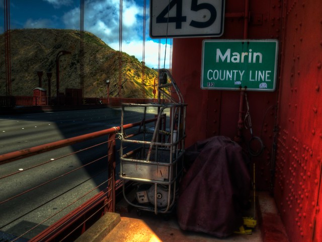
Marin County Line

Marin County

San Anselmo's Easy Street Cafe will close this Sunday after struggling with the economy and the Redhill Shopping Center remodel.  There is still hope that it will reopen somewhere else, though the odds seem slim.  With this institution's closure, speculation is running rampant that the shopping center is turning into a regular chain-dominated strip mall.  So far, eight businesses have moved out or been evicted.  You can find their letter on the Pacific Sun. On a personal note, I am quite saddened by the loss.  It's my favorite breakfast spot in Marin and I haven't found anyplace better in DC. Since I can't make it to the closing, eat some bangers and scrambled eggs for me and I'll buy you a beer at the next happy hour. (IJ, Pacific Sun)

  • Just as regulatory hurdles were cleared, Lucasfilm formerly withdrew its Grady Ranch proposal, beginning a mad scramble around the North Bay to woo what a few Marin activists said would constitute the Hollywoodization of Lucas Valley. (IJ, San Rafael Patch)
  • For Earth Day, San Rafael promoted recycling, energy efficiency, and electric cars, but remains entirely silent on walking or biking.  Perhaps next year they'll install a bike rack or two downtown? (IJ)
  • Travel on the Golden Gate Bridge is going to be terrible next week.  Not only is Doyle Drive closing, but Occupy SF plans to close the bridge on Tuesday. (SFist)
  • SMART is exploring a station near the Sonoma County Airport, which would be at their planned maintenance facility on Airport Boulevard.  Details are still sketchy, to say the least, but it would certainly make the airport a more attractive option for Marinites. (Press-Democrat)
  • SMART has approved a more sustainable pension plan for future employees than what it has now, remedying one of the Grand Jury's principal gripes about the system. (Press-Democrat)
  • The Board of Supervisors has formally requested an audit of Plan Bay Area growth projections, saying that the job growth numbers just don't seem realistic. (IJ)
  • Larkspur and MTC are looking for a few good souls to fill out their boards.  MTC has four vacancies on their Policy Advisory Council, while Larkspur has openings on the Planning Commission, Parks & Rec Commission, and the Heritage Preservation Board. Take a look to see if you want get involved. (IJ, PR Newswire)

The Greater Marin

  • When you make a great place you're making great people habitat, and that's good for the environment and all the natural habitat we need to protect.  New Urbanism is a New Environmentalism. (NRDC Switchboard)
  • The headaches caused by private bus companies in San Francisco are starting to get noticed, and the city may start to regulate. (SFBG)
  • Electric bikes can dramatically expand the reach and audience of bicycling.  In spread-out and hilly Marin, the electric assist can be a life-saver for the unfit. (Clarendon Patch)
  • Sonoma County faces a $120 million road maintenance backlog and only $4.5 million per year to fix it.  Though the county is looking for new revenues, perhaps it could spend less money on widening 101 instead. (Press-Democrat)
  • California will soon get $100 million in new electric car charging infrastructure, part of a settlement with energy companies related to the state's 2001 energy crisis.  (Chronicle)

A Radical Proposal for Biking in San Rafael

San Rafael has written off Second and Third for too long and ignored the benefits reaped from promoting bicycling.  To change it, San Rafael should take the radical step of installing a cycle track on Third, reclaiming at least that part of the city for people. Bicycling is a major part of life in San Anselmo and Fairfax.  Though both towns have a long way to go before practical cycling is feasible on its thoroughfares, both are home to the serious Bikers [Youtube] that hang out around downtown and form the heart of Marin’s bicycling culture.  Though proximity to open space may play a role, both towns have done what they could to build a biking culture by installing racks, painting sharrows (Class III lanes) and bike lanes (of the Class II variety), and planning for Class I lanes on arterials.  San Rafael, in contrast, has reserved its downtown roads for the car, pushing bikes and even people out of the way to make room for more Ross Valley car commuters.

This is odd for a number of reasons.  San Rafael doesn’t have a major population west of downtown, so the Second/Third arterials almost exclusively serve residents outside their jurisdiction.  Yet, the population they do serve are those bicycle-mad San Anselmoans and Fairfaxians.  Rather than draw on the best habits of Ross Valley, the arterials draw on its worst.

To remedy this, I propose the San Rafael Bikeway, a two-way separated Class I cycle track.  Modeled after Washington, DC’s 15th Street cycle track, the bikeway would be 11 feet wide: four feet for westbound cyclists, four feet for eastbound cyclists, and a three foot buffer.  With the complementary Class II bike lanes east of Grand Ave., the Bikeway would run two miles through the whole of downtown San Rafael.

Practically, the Bikeway would be a major boon to San Rafael.  Not only would it take some of the pressure off the roads by putting more people on bikes – a much smaller form of transportation – but it would calm traffic along Third and make the sidewalks along Third much more pedestrian-friendly.  Bike lanes of the Class I and II varieties calm traffic, meaning they bring down vehicle speeds and road noise, and the protection of a bicycle lane makes the sidewalk more inviting.  Calmer streets also tend to have more efficient traffic flow, so Level of Service would likely remain the same.

Perhaps most important is that calmer streets are safer streets.  Heavy arterials like Second and Third promote higher driving speeds and cause more severe injury crashes.  Putting in the Bikeway and calming even Third would make it a far safer street than it is today.

Bicyclists also tend to shop more and spend more than drivers.  As the Third Street merchants would be the ones with the best exposure, they would have more to gain from the track’s installation than Fourth Street, rebalancing the downtown.

Politically, the Bikeway would be a major pain for the city.  The plan envisions that the 47 parking spaces along Third Street would be next to the Bikeway during off-peak hours, providing further protection against traffic.  During rush hour, the parking lane would be a traffic lane, ensuring that cars are still easily whisked back to Ross Valley.

Though the 47 spaces represent less than 4% of parking in the area – 975 spaces are available in the Third Street garages alone – merchants and drivers view parking as sacrosanct.  Removing even a single space can lead to legislative gridlock, and displacing 47 would likely raise a righteous anger not seen in San Rafael.  On the other hand, removing a lane to make space for parking, even during off-peak hours, would likely raise stiff opposition from drivers.

To help allay such fears, San Rafael should approach the problem methodically before even announcing the details of the project.  Among the unknowns to study: how many Third Street drivers shop on Third; what’s the typical occupancy of those parking spaces; how many cyclists are expected to use the route in 5 years; and how many people will use the intersections per hour in 5 years, and what share of those are riding bikes.  The city must be ready to answer its critics from Day One.

There are a few practical design issues as well.  The route has a huge number of curb cuts, which diminish the effectiveness of the Class I concept.  The hill at Third and E is a relatively steep one for a casual bicyclist.  The Second Street segment is incredibly complicated - if Third can be narrowed without removing a traffic lane between Ritter and Union, that would make the eastern half of the route much more simple.  However, none of these problems are technically infeasible, and can be properly addressed with enough thought.

This is a radical plan, not because of the technical challenge, but because it would require San Rafael to be bold in a way it hasn’t been in the past, and to put people before cars in a way it has definitely not in the recent past.  This plan, or something like it, will reshape both the city and Ross Valley and provide an alternative infrastructure to serve Marin's cyclists.

Mid-Week Links: Keep Moving

[vimeo http://www.vimeo.com/40472684 w=620&h=349] As Marin ages - it's already the oldest in the Bay Area - keeping people active and involved in their communities means making the bus system work for them.  As commenter Dan Lyke often points out, GGT has done a terrible job of making itself friendly to the disabled and handicapped, and I suspect the elderly, when giving up their cars, will be in the same boat.  Improving transit service isn't just for young urbanites like me, or the poor, but is imperative to keeping our seniors moving.

Marin County

  • A police crackdown on crime around San Rafael's Bettini Transit Center was quite a success, resulting in 79 arrests and a marked decrease in common criminality in the area. Transit-oriented development and traffic-calming measures would help put more people on the street and keep this kind of crime from reappearing. (IJ)
  • While supporters of Lucasfilm's Grady Ranch development rallied in county board chambers, others wondered what it would take for affordable housing to grow there, as Lucas plans to sell the property for just that purpose. (IJ)
  • A pedestrian/bicycle bridge across San Rafael Creek at Grand Avenue is in the works at city hall, though funding has yet to be secured. (Patch)
  • And...: Is an 1890s-era house in Larkspur worth saving? (IJ) ... Apparently it costs $200,000 to be late with a home remodeling project in Belvedere. (IJ)

The Greater Marin

  • Golden Gate Park was partially closed to cars last Sunday, giving residents a chance to just enjoy the park without the fear of getting hit by a car. Come out to the Mission on May 6 for more! They promise no stabbings. (SanFranciscoize, Mission Mission)
  • If you didn't already know, Muni buses now sport cameras to record parking violations or cars driving in the bus-only lanes. Though great for bus riders and Muni's budget, drivers need to be on the lookout. (Muni Diaries)
  • Car-dependence in Concord has claimed many lives in car crashes, but the deaths of a father and his 9-year-old daughter have shone a spotlight on the dangers of such design. The father and daughter were riding bikes on the sidewalk when they were struck by a 17-year-old driving an SUV. (Bay Citizen)

The Limit of Marin's NIMBYism

I try not to use that term lightly.  NIMBY (standing for Not In My Back Yard) is a pretty loaded pejorative, connoting a sense of entitlement to an unchanging landscape, and an irrational opposition to the project at hand.

With Grady Ranch, I think that’s exactly what we had.

If you follow Marin’s development news, even in passing, you’ll know that George Lucas’s Skywalker Properties pulled out of an ambitious project over neighborhood opposition.  The Grady Ranch proposal was to be studio and production space on Lucas Valley Road, though all the buildings were to be shielded from view from the road.  It would have included a huge amount of land preservation and a good deal of creek restoration work.  The Lucas Valley Estates Homeowners Assocation (LVE) vehemently opposed the project, however, on environmental, quality-of-life, and other grounds.  After the County Supervisors were poised to approve the project when federal and state officials voiced concern over its environmental ramifications.  This, and the likelihood of continuing neighborhood opposition, caused Skywalker Properties to drop its proposal.

In a clearly bitter letter, the company wrote [PDF], “Marin is… committed to building subdivisions, not business.”  The company plans to sell the land for affordable housing because, “[i]f everyone feels housing is less impactful on the land, then we hope that those who need it the most will benefit.”

After the company announced it will abandon its plans, Marin’s supervisors went into crisis mode.  They offered to help defend any effort to delay the project, to approve the proposal as-is, and more, but as of Sunday night all signs indicated that the project was dead.

The whole sequence of events has left Marinites aghast.  Hundreds of potential jobs were lost.  Marin’s most prominent resident and strong county benefactor had been rebuffed.  We still remember the sting of loss when much of Lucas’ operation moved to the Presidio.

Encouraging to activists like me was how quickly the political channel has changed.  We aren’t talking about ABAG and housing quotas anymore.  The dialogue has swung away from, “We can’t possibly grow,” to the exact opposite.  Keep Marin Working, a business advocacy umbrella group, wrote in an op-ed, “Unless we take immediate steps to make Marin more business friendly, the Lucasfilm decision could be a preview of coming attractions.”  An IJ editorial wrote, “Lucas is frustrated and has had enough. It's hard to blame him.”  The Board of Supervisors wrote [PDF] that they were “deeply disappointed” over the news.  Outrage over the news reached beyond the newspaper page, though I suspect we won’t see its fullness until Tuesday morning, when supporters invited by Supervisor Judy Arnold will speak their mind in support of the project at a supervisorial meeting.

I can identify three lessons from the wreckage of Grady Ranch.

First, NIMBYism is just as repugnant to Marinites as it is to developers.  The county’s residents do want jobs and development, as long as they don’t conflict with our environmental goals of open space protection or threaten town character.  Grady Ranch was environmentally friendly and kept with the rural feel of Lucas Valley.  Though it was a greenfield development some ways from transit, it maintained open space and bolstered the environmental value of the land.  People noticed.

Second, policymakers need to limit the number of procedural hurdles a project needs to jump through, as a neighborhood will always put up more.  Our boards and councils must always be cognizant of the potential for well-educated, well-heeled residents to abuse the system, and we should seek to limit their capacity to do so.  Grady Ranch took 16 years get to the finish line because of neighborhood intransigence and died because what seemed like the end really wouldn’t be.

Third, supporters need to be vocal.  The Board of Supervisors would have approved Grady Ranch unanimously if given the chance, and that is thanks in part to vocal local support.  This was thanks to George Lucas' strong track record of development and community service.  Any other developer needs to do the same, showing that it invests in Marin and cares about its future, not just profiteering.  Supporters need to get the word out there – in editorials, letters, and in council and board meetings.  One ought never concede the conversation to conservatives through silence.

Alas, Grady Ranch may be fully dead.  Lucasfilm needs the space for filming now and will look elsewhere if they think there will be any further delays.  However, supporters of a strong and dynamic Marin should seize on Grady Ranch as a turning point, and look to the fights ahead: Mill Valley's Blithedale Terrace development, SMART station area plans, and Plan Bay Area.

Mid-Week Links: The Subdivisions

Marin County

  • LucasFilm has pulled its Grady Ranch proposal and will sell the land as affordable housing thanks to NIMBY opposition, stating, "Marin is a bedroom community and is committed to building subdivisions, not businesses." Ouch. (Pacific Sun)
  • The Town of Fairfax has a new General Plan.  Among other things, the plan gives downtown businesses the opportunity to build second-story apartment units by right, rather than seeking special approval. (Town Manager)
  • Supervisor Arnold wants to know why growth projections for Marin have fluctuated so wildly in the Plan Bay Area draft SCS, and also why they are so out of line with historic norms. If the assumptions for Marin are flawed, she writes, then the whole process for the Bay Area is flawed. (IJ)
  • The March 28 MCCMC meeting offered opponents of housing quotas and ABAG to vent their frustrations against the regional agency. In the end, they also got leftover cookies. (Twin Cities Times)
  • Staying within ABAG is not just good for Marin - it's good for the region, because what worries us ought to worry the rest of the Bay Area. (IJ)
  • Marin's Local Coastal Program has gone through a four year epic journey of Coastal Commission and West Marin politics, public comments, criticism that it does too much (or too little), and even a splash of dominion theology as the county has worked to update the decades-old document. If you need some catching up, you may want to start here. (Pacific Sun)
  • And...: The AT&T Park ferry ride is getting too complicated, and too expensive, what with online reservations and a new convenience fee. (IJ) ... A sidewalkless street in Homestead Valley is getting some sidewalks. (IJ) ... What sort of light should a bicycle have? (Mercury News)

The Greater Marin

  • The finances and projections of California High Speed Rail are under scrutiny by noted rail opponent Representative Darryl Issa, chairman of the House Oversight Committee. (Politico)
  • San Francisco's Transit Effectiveness Project SFMTA will give Muni buses signal priority by next year. I'm hoping GGT gets in on that. (Streetsblog) [edit - contrary to Streetsblog's summary, signal priority is a related but separate program from TEP.]
  • Someone in San Francisco wants to park a tiny, 130 square foot house in a driveway. The plans are actually quite nice and would make a lovely second unit, though I thought the minimum dwelling size under California state law was 160 square feet. (SFist)
  • Little City Gardens will be San Francisco's first real urban farm now that the city has approved a zoning change for the market. It will sell and grow its produce on the same property. (SPUR)
  • Cotati's downtown revitalization plan will move forward, but because it uses redevelopment funds the vote is up for state approval. (Press-Democrat)
  • The Southern California Association of Governments - ABAG and MTC's Los Angelino cousin - approved its version of Plan Bay Area.  The sustainable communities strategy will spend half its transportation funding on mass transit rather than cars over the next 25 years, though a number of communities said it didn't go far enough. Streetsblog has details. (SF Chronicle, Streetsblog)

The Centrality of Housing

In the 1970s, the progressive view was to get people out of the city and back to the land, to grow your own food, make your own power, and retreat from the devastation wreaked by cities on the environment.  The idyllic life waited where the pavement ended, and many of those who embraced that lifestyle moved to Marin.  We didn’t realize then what we know now: cities are our best hope for the future, and that where we live is intimately connected with the health of our planet and our communities.  As Marin engages in a great and necessary debate over regionalism and housing, it is important that we not choose self-destructive conservatism over conservation. The conservative line is that Marin cannot accommodate anyone else, and that growth must remain slow or stagnant for the good of the county and the planet.   Bob Silvestri, a Mill Valley community activist, has said that density and transit-oriented development are bad for the environment and increase, rather than reduce, greenhouse gas emissions.  Greenhouse gases, he says, should be limited in industry and power but not in our personal lives.  Accommodating more people in Marin would ultimately increase our carbon footprint per capita and reduce our overall quality of life.

The conservationist line is that people will move somewhere, and Marin is better placed that elsewhere to limit sprawl at the outskirts of the region.  Density brings more efficient use of infrastructure and energy, happier and healthier people, and a more dynamic city.  The Natural Resources Defense Council actively advocates for more compact towns and cities through infill development, arguing that they reduce overall energy usage and keep open space safe from development.

Everything I have seen since leaving Marin has shown me that the conservationist's view conforms more closely with reality than the conservative's. From walkable city centers to small towns in Vermont, the best places, the areas where I felt most at home, were the ones that were more compact, where housing is within walking distance of stores, offices, parks, schools, and mass transit.

Having amenities and housing within walking distance of each other is itself a good.  Though you could ask a patron of Sun Valley Market or a resident of downtown Mill Valley, or think back on that European trip, you could also look at a 2011 research review from the Victoria Transport Policy Institute.  It says, in part, that promoting walking as part of everyday life, such as in a daily commute, has measurable health benefits.  A study from New Zealand showed that for every mile walked rather than driven the country saves 48¢, and for every mile biked the country saves 19¢.  Given the higher health costs in the US, that could be significantly higher.

Walkers also spend more.  A study from the United Kingdom, also cited by the Victoria review, shows those who primarily walk to shop spend £91 per week while those who principally drive spend only £64 per week.  Given that the shoppers are walking, they will necessarily support whatever retail is nearby.  Infill development near town centers, then, will bring shops their best customers.  Others have described that bicyclists also spend more than drivers.  Encouraging walking and biking to and around a downtown, then, will be a local economic stimulus.  Providing housing in or near downtown will install permanent, well-paying, healthier customers for retailers.

Environmentally, housing location and housing density matters as well.  If we avoid greenhouse gasses and transportation for a moment, we find that denser and more walkable housing decreases the amount of runoff per-capita and decreases the amount of lawn fertilizers and such that get washed into waterways.  A single paved acre will cause just as much runoff whether it has 1 family or 30 living on it.  Spreading those 30 families out to 30 different houses that need roads connecting all of them and parking lots to store their cars (an average of three are built for every car added to the road) will result in far more than a single acre of impervious surface.

Greenhouse gases are trickier to tease out.  While studies (PDF) show (PDF) that transportation-related greenhouse gases drop precipitously once people move away from car usage, Silvestri recently cited a study of New York City that finds higher rates of greenhouse gas emissions per capita than lower-density developments.  This directly contradicts studies done by the United Nations, New York City itself, and many others.  I couldn't find the New York City study, but similar research done on Australia finds essentially the same point.  In such instances, it is the common energy consumption - common areas, parking garages, and the like - that sucks up the excess energy, as well as increased overall consumption.  A broader study (PDF) examining the United States find an opposite relationship, so it may be that Australian development patterns are not translatable to the American urban reality.

Parsing the two opposite conclusions is not the thrust of this piece.  Suffice it to say that the bulk of research shows that the location and type of housing influences greenhouse gas emissions.  In addition, the densities Marin is contemplating are nowhere approaching Manhattan or Melbourne, and so would fall into the bottom of any conceivable greenhouse gas U curve.  Building more densely would decrease greenhouse gas emissions in transportation - the research on that is essentially unanimous - and any additional costs can be made up in green building strategies that ought to be standard in Marin to begin with.

Lastly, housing location determines how much open space is preserved.  Though our region could go sprawling through the hills of the East Bay and into the Central Valley, it is concomitant upon the already existing towns and cities to build where infrastructure already exists, even if in relatively low densities.  It saves money for the cities out on the edge (just ask Stockton how its sprawl is paying for itself) and preserves open space in areas where land trusts do not tread.  Pushing a slow-growth agenda in Marin just means pushing a faster-growth agenda everywhere else.  The Bay Area will grow, and I'd rather see it happening along Miller Avenue than on Central Valley farmland.

Where conservatives and conservationists ought to agree is that local control is a good thing.  We shouldn’t need regional agencies telling us what to do.  Affordable housing mandates do little to increase affordable housing, and inclusionary zoning decreases the amount of housing built, driving up the market price. Sacramento should stop raiding our housing budgets and allow localities to actually build.

But we cannot be so blinded by the important pursuit of local control that we lose sight of the connections that tie Marin to the rest of the region and country and world.  How and where we build our housing is intimately connected to the health of our residents, the health of our planet, and the health of our communities, and for every resident we turn away another home must be built elsewhere, and there's no guarantee that other place will be as socially conscious as we are.

Keeping the drive through that was always there just because it was always there is not a recipe for sustainability; it’s a recipe for stagnation.  That’s exactly what we’ll get if the county’s conservatives have their way, and we’ll become environmentalists concerned more about preserving our parking lots than preserving the Delta, or coastal San Mateo, or rural Napa, or the Great Plains, health nuts unconcerned by active living, and citizens unmoved by the hardship of downtown merchants.  That's not a Marin I would recognize.

Mid-Week Links: Colombian Roast

[vimeo http://www.vimeo.com/39704761 w=620&h=349] Medellín has a transit system unlike any other.  For the steep mountainsides there are gondolas and escalators; for the center city, there are metro trains and BRT, and for everywhere else there's a burgeoning bikeshare system. Whenever I see movies like this, I imagine what kind of place Marin might have been if the trains had never stopped running, if BART had made it across the bridge, if we didn't value mall parking above people and the planet.  What kind of a country would we be if, rather than putting cars before people, we put people before cars?

Marin County

  • The Ritter Center will expand into a temporary medical space, thanks to approval by the San Rafael council Monday night, but will be limited to only 60 clients per day rather than the 65 requested. (Pacific Sun)
  • Opponents of the Albert Park minor league plan have filed suit, arguing that professional baseball violates the park's deed restriction against commercial activity. (Patch)
  • If you want to influence your town, show up to public meetings, if only to counterbalance the protestors that tend to show up instead. (Herald)
  • The Board of Supervisors delayed a vote on Lucas Valley's Grady Ranch, pending review of environmental concerns raised by the Corps of Engineers and others. (IJ)
  • And...: Corte Madera started work on a new public plaza and cafe at its town-owned shopping center. (IJ) ... San Anselmo approved a new parking lot across from downtown. (IJ) ... Novato will install six electric car charging stations. (IJ) ... San Anselmo is considering major improvements to Greenfield Avenue. (IJ)

The Greater Marin

  • Congress approved a 90 day extension of federal transportation legislation, ensuring the gas tax and road construction funds did not end last weekend. The House never took up the Senate transportation bill, and the result is all kinds of bad. (The Hill)
  • Cost estimates for California High Speed Rail plummeted $30 billion under a new business plan released this week. (SFist)
  • Golden Gate/Marin Transit may not be the best transit system in the world, but at least it's typically on time - something Muni can't really boast. (SFist)
  • In the City often?  Need a break from the bustle?  You may want to investigate the privately owned public spaces that dot the landscape. (SFist)

How Fantastical Is the Fantasy?

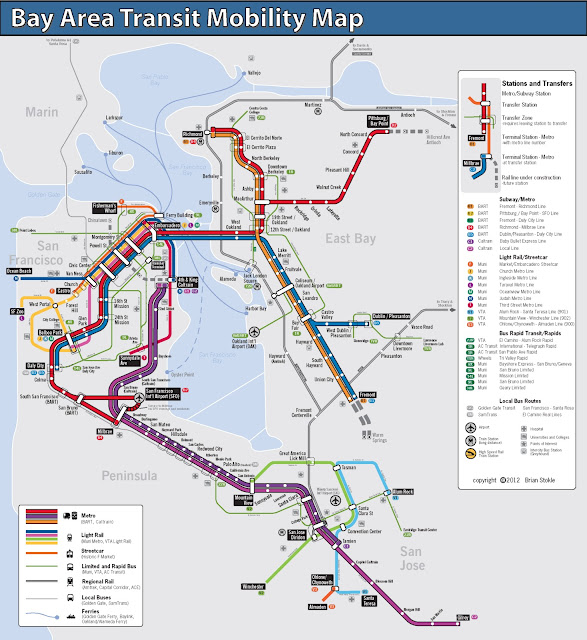
Copyright Brian Stokle The fantasy transit map of the Bay Area I brought up on Wednesday had me thinking a fair amount about Marin's transit options.  Though we are typically the odd county out when it comes to fantasy transit improvements – though Napa certainly gets the short end of this particular map’s stick – Brian Stokle’s map adds two thoughtful improvements to the county’s transit system, and I think we’d do well to explore them, as well as a third.

I should mention that I appreciate the value of bus-only lanes to a degree, but in suburban settings it is sometimes better to mix them with three-person carpools as well.  In Northern Virginia, the casual carpool system functions as another transit system, vastly improving the efficiency of private cars and, therefore, the existing car-based infrastructure.  Mixing buses and cars isn’t always the best idea, but I think for Marin it makes perfect sense, both for political and practical reasons.

The 29R Rapid Bus

The 29R rapid bus line runs in a kind of loop between Fairfax, San Anselmo, Greenbrae, Larkspur Landing, the Canal, downtown San Rafael, Miracle Mile and finally back to the Hub, where I assume it would turn around.

Rapid bus isn’t the bus rapid transit (BRT) system that we’re used to hearing about – it doesn’t have its own lanes or stations.  Rather, the rapid bus concept functions as an express, limited stop bus with some structural changes beneath the surface, mostly to how the bus handles intersections.  These, along with high frequency (every 15 minutes, maximum), makes the bus a viable alternative against the car.  Even without the frequency improvements, adding speed to a bus line makes it less expensive to run and more attractive to potential riders.

The 29R route makes sense.  The Fairfax-San Rafael corridor is the county’s densest, and the narrow valley makes it well suited to a rapid bus line.  The Greenbrae stretch, though not nearly as dense, is an important transportation corridor, and building a rapid bus line here would serve populations that are otherwise left behind by SMART.  Greenbrae is also the kind of suburban strip that is easily converted to higher, more urbanist uses.

The drawback to a rapid bus line that it doesn’t have its own corridor.  Sir Francis Drake gets backed up during the morning rush between Fairfax and the Hub, as well as though Ross and near the Greenbrae Interchange, and a rapid bus shouldn’t be allowed to get stuck in that mire.  The same goes for Second Street in San Rafael.

To compensate, the 29R should be complemented with limited dedicated lanes.  Center, the old rail right-of-way between San Anselmo and Fairfax, might be re-purposed as a rush-hour bus and carpool lane.  It’s odd to imagine a surface street being carpool and bus only, but it would take a great deal of pressure off Sir Francis Drake and speed service along the corridor.  Yolanda and Landsdale Stations, the old light-rail stops, could be reactivated as bus stops.

Though we can’t do much about the Sir Francis Drake through Ross, the boulevard widens enough at College of Marin for dedicated lanes, though an initial segment of lanes should be built from El Portal Drive to the interchange.

The Canal’s traffic patterns are less familiar to me, but it is imperative the bus not travel the narrow streets in the neighborhood, sticking instead to the much wider and straighter roads closer to the freeway.  It’s close enough to the Canal that it will be accessible, but it will keep the bus moving fast enough to justify its “rapid” moniker.

The ultimate cost would likely be in the tens of millions, and building such a system will require more forward-thinking on development issues, but the ultimate reward would be much improved Central Marin circulation.

The 80R Bus Rapid Transit

Much more ambitious is the 80R Bus Rapid Transit (BRT) line, running from Santa Rosa to the Transbay Terminal.  Presumably, the line would have limited stop service on its own dedicated lanes for the whole trip, and would share the BRT lanes with other buses running along the corridor.  It would duplicate SMART’s service between Santa Rosa and Larkspur Landing, so I wouldn’t recommend building the line north of San Rafael.

A small portion of this line is already being built by SFMTA on Van Ness, which is getting its own dedicated lanes.  Presumably other streets will be similarly improved, but that’s just for San Francisco.  The Marin and Sonoma stretch will be extraordinarily expensive, involving rebuilt or widened freeway overpasses at minimum and possibly even new tunneling in the Marin Headlands.

The first portion of a BRT system is its dedicated lanes.  Ideally, these lanes will be permanently off-limits to private cars, and would certainly be off-limits to single-passenger only vehicles, and they would stretch along the entire length of the line.  This includes the stretch of freeway south of Marin City, which could mean some extremely expensive tunneling projects or a narrower freeway.  The Golden Gate Bridge itself would need dedicated bus lanes, which in theory would double the capacity of the bridge but would be politically challenging to build.

The other portion of a BRT system is its stops.  Like a train system, the stops would be located along the right-of-way; for the 80R, that would mean building new ramps directly between its lanes and freeway overpasses, where the BRT stations would be constructed.  Alternatively, passengers might board the bus at the freeway level in an enclosed station, and access would be provided from the street level.  These would be expensive as well, and the 80R would likely rival SMART in its costs.

Once finished, though, the system would be a transit lifeline for San Franciscans working north and North Bay residents working south.  As it stands,San Francisco’s Marin-bound buses leave only every hour or so in the morning, making transit commutes rather inconvenient.  BRT would need to run every 5-15 minutes to make the investment worthwhile, tying the City to the county in a way it has never been.

What’s Missing? BART

The missing piece is a strong connection from the Transit Center to the Richmond BART station and its Amtrak connections.  Though today the 40 and 42 buses don’t get a lot of ridership, building a rapid bus or BRT line with direct connections between San Rafael and Richmond would be a boon to Contra Costa County, one of the largest sources of Marin’s in-commuters.

A rapid bus line would start at the Transit Center and proceed along Francisco Boulevard, entering 580 at the bridge.  It would make a straight shot to the Richmond station and turn around, altogether taking 30-40 minutes.  A BRT line would run exclusively on the freeway, with its only stops being at Richmond, the Marin side of the bridge, and San Rafael.  Such a run would take about 20-30 minutes.

Though it would face the same challenges as the 29R and 80R, I like this route because it would provide easy transit between the Delta, the East Bay, and Marin while connecting Marinites with existing rail options the county doesn't have.  Given that the balance of commuting is East Bay to Marin, it might make more sense to build it as an AC Transit system, freeing Golden Gate Transit from making such a huge investment for residents outside its district.

In Sum

In sum, the two improvements, plus mine, are strong service improvements for Marin.  Other parts of Marin could use a rapid bus system similar to the 29R, especially the Mill Valley to Sausalito corridor.  Less plausible is a SMART service improvement, providing 30 minute headways all day, and even less would see the system double-tracked and electrified with 5-15 minute headways, which would likely require another ballot initiative.

Fantasy maps like Stokle’s aren’t meant to be entirely practical, of course – they’re meant to make us imagine what our cities can be like, and what they might be like if we ever get around to it transit improvements.  I’d like to see more of this – how about you?

Mid-Week Links: Transportation Fantastic

A unified transit map of the Bay Area is an elusive thing, though others have tried.  Building such a map should be the job of MTC, but just diagramming major routes over such a massive region as the Bay Area is a noble and necessary undertaking.  Brian Stokle, for SPUR, did just such a thing, and the result highlights the disconnected nature of our systems as well as the centrality of San Francisco to the region.  It's starting to make waves elsewhere, and I'll be addressing his fantasy map's vision for Marin later this week.

Marin County

  • West Marin's farmworkers will have a chance to live where they work under a new program by the county to build and rehabilitate homes, showing that good urban policy is good rural policy. (IJ)
  • Opponents to regionalism get organized with the founding of the Marin County Communities for Local Control.  Involved politicians are a who's-who of Marin's conservatives - relatively speaking, of course. (IJ)
  • Hopefully these opponents know that Plan Bay Area does not supersede local planning or land use law. (Spotswood)
  • Larkspur's SMART station is held up by Anderson Drive.  San Rafael paved over the tracks to extend the road in 1997 and now doesn't have the money to make the crossing safe. (IJ)
  • The Ritter Center needs more space for its clinic, and it shouldn't have to wait for a downtown San Rafael strategic plan before it expands into temporary space. (IJ)
  • After last year's successful launch, food trucking will be expanded at Larkspur Landing to a week-long presence.  This shows the strong desire for something more than just a parking lot at the ferry terminal. (Patch)
  • Mark your calendar: On April 4, Supervisor Kinsey will talk about transit in Northwest Marin and the possibilities of linking Petaluma to Tomales via Dillon Beach. (IJ)
  • NIMBYism rules in Mill Valley, where the Blithedale Terrace development hit a snag on Monday when the planning commission decided not to forward the EIR to the council for approval.  A special study session will be planned instead to address concerns about size, density, and traffic. (IJ)

The Greater Marin

  • While Marin considers its own bikeshare system, DC's system shows it does far more than just provide bikes: it boosts transit ridership, bike ridership, and provides for a significantly healthier region. (Wash Cycle)
  • ...and more bikers means a healthier economy, with more window-shopping and better engagement with the street than one gets out of just driving. (Streetsblog)
  • High-occupancy toll lanes are opening around the Bay Area, but not Marin. (SF Chronicle)
  • Napa challenged its preliminary draft RHNA numbers and uncovered problems with ABAG's data analysis.  The next draft numbers will likely show significantly fewer housing numbers.  I wonder if this will alter Marin's allocation. (Napa Valley Register)
  • The World Health Organization has a new tool to evaluate the economic and health benefits of better cycling and walking infrastructure, facilitating cost/benefit analyses for planners and advocates alike. (Streetsblog)

Leverage the Golden Gate Transportation Monopoly

Golden Gate toll plaza // San Francisco // California // USA You may not realize it, but the Golden Gate Bridge Highway and Transit District has an effective monopoly* on travel to San Francisco from Marin.  If you take transit, of course, you’re using GGT, but if even if you drive you have a toll to pay.  This gives the district enormous market power to influence the travel decisions made by Marinites, power that it should use for good.

The Marin-San Francisco transportation market has three principal products – driving, bus travel, and ferry travel.  Directly, the car has a $5 round trip toll, the bus has a $6.80 to $16.40 round trip fare, and the ferry has a $9.70 to $11.40 $17.50 round trip fare.  The car also has fuel, insurance, parking, and depreciation costs as well, but none of these are controlled (save parking costs at park-and-ride lots) by the district.

What strikes me about this situation is that the district charges the least for the most high-impact transportation mode, the car.  The negative externalities of car ownership go far, far beyond simply tailpipe pollution: the cost of car storage that get dumped into housing costs through mandatory minimums; the cost of parking lots on the pedestrian environment; the cost to our mental and physical health driving everywhere; the ongoing slaughter of drivers and pedestrians on the roads; and the sheer cost of maintaining the physical infrastructure needed to carry all these cars around.  By charging significantly less for driving than other modes, the district promotes this kind of unsustainable mode choice.

If the toll were increased to $7, making the cheapest bus fare competitive against driving, one would see a significant boost in bus trips from southern Marin.  If the toll money were plowed back into service improvements, the district would create a positive feedback loop, allowing the district to simultaneously discourage driving and provide a better transit product.  Even better, it would allow the district to move towards its goal of 50% farebox recovery, as the increased ridership would bring in more money and the right transit improvements would decrease costs.

The district did explore a congestion pricing scheme a few years ago that would have bumped the toll to $8 during peak hours.  Though I’m sure San Franciscans would have been happy to have fewer suburban drivers on their roads, the plan was dropped because it was seen as an unnecessary tax on drivers.  Hopefully the plan will be revived to help pay for the district’s $87 million Doyle Drive deficit, though given the district’s belief that ferry riders should pay it through a fare increase I don’t hold out hope.

Though this does sound like a plan to sop the driver for the rider, there are a few things to keep in mind.  First, the driver can always become a rider, and doing so would likely be better for everyone involved, especially if the bus can become competitive with the car in speed as well as cost.  Second, the drivers that don’t switch will see benefits in traffic and, if enough drivers switch to buses, see a significant decrease in travel time.  Though it would cost more for them to drive, they would get a better product than they had before.

In short, the district needs to examine its pricing schemes as a singular system, not as a set of disconnected fares and tolls, and establish a better balance between driving and riding costs.  Doing so would reap benefits for drivers in the form of less congestion, riders in the form of better transit, Marin in the form of more livable and walkable communities, and San Francisco in the form of less suburbanite traffic.

*Yes, I realize Blue & Gold Fleet operates a ferry, but its round-trip fare is double that of Golden Gate's and so isn't terribly important to this discussion.  If we were talking about the transit market in Tiburon, of course, they'd play on center stage.

Mid-Week Links: Afternoon on the Bay

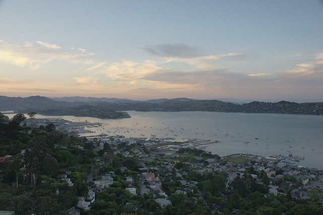
late afternoon above Richardson Bay, Sausalito, CA

Marin County

  • Neighbors to the proposed Grady Ranch development have appealed the county's approval of the project. The Lucas Valley Estates Homeowners Association alleges Grady Ranch would cause too much noise, light pollution, and be a general nuisance. (News Pointer)
  • The San Rafael Airport Rec Center project could run afoul of new California regulations on development near airports.  Though the project fit the old standards, a consultant has been hired to ensure it meets the new ones as well. (IJ)
  • Now that nobody is running for Ross Town Council, it's up to potential candidates to file for a write-in candidacy.  If there's an insufficient number of write-in candidates, the three positions will be appointees. (Ross Valley Reporter)
  • Sausalito wants to ease the problem of bike tourists getting stuck in town by setting up a ferry reservation system for cyclists, a far more efficient method than the current first-come-first-served method.  Expanding San Francisco's bikeshare system to town may also help the more casual riders that don't want to cross the bridge. (IJ)
  • San Anselmo's moribund nightlife will get a boost this summer, as two wine bars are slated to open downtown - a near-first for the town. (Patch)
  • Novato's revenues are better than expected, to the tune of $600,000.  Though the city is still in austerity mode, an expected transfer of $300,000 from the rainy day fund has been canceled. (Advance)
  • Southern Marin's bikepaths got a $118,000 infusion of maintenance money from TAM.  Though chump change compared to road maintenance, the grant is a welcome recognition of the paths' importance. (Marinscope)

The Greater Marin

  • San Francisco's performance parking experiment is finally yielding positive results, with spots opening up around high-priced areas and filling up in cheaper areas. (New York Times)
  • Meanwhile, New York City is suffering thanks to its onerous parking minimums, which drive up the cost of housing in an already expensive city.  Though the practice of banishing parking minimums in favor of parking maximums is recommended in the draft Plan Bay Area, Marin's transit districts would be wise to take heed. (Streetsblog)
  • Then again, pushing for strictly infill development and densification by loosening regulation won't solve our housing problem given the pace of infill development, the extraordinary costs of consolidating properties, and political wrangling necessary to actually build the thing.  (Old Urbanist)
  • A 2001 study argues that transit-oriented development is not a traffic cure-all, as much of the benefits of TOD comes from densification and better location than simply better travel modes. (Half-Mile Circles)
  • If we want biking to take off, we must take it seriously as a form of transportation first and recreation second, something Americans typically don't do. (RPUS)

Charge to Park, Not Ride

SausalitoTomorrow, the Golden Gate Bridge, Highway and Transportation District (GGBHTD) officials will debate whether to hike the cost of ferry rides for Clipper Card holders, which would raise $2 million to help close an $87 million deficit caused in part by costs associated with the Doyle Drive reconstruction.  As long as the parking lot is free, this is the wrong move for the District.  Charging for parking would discourage driving to the ferry terminal and encourage people to bus or carpool, freeing some of the parking lot for mid-day ferry drivers, putting more people on buses and bikes, and perhaps even boosting, rather than suppressing, ferry ridership.

Marin Transit or GGT should ensure there is a convenient bus transfer in Larkspur, however.  The 15 minute, freeway-bound walk from the nearest bus pad is sometimes called the Walk of Shame, and the 29 bus from either Ross Valley or the Transit Center is about as fast as molasses on a cold day.  Sausalito, also in the plan, doesn't fare much better with the bus route but at least its connections aren't equated with shame and embarrassment.

Transit-oriented redevelopment

Long-term, the GGBHTD should partner with the City of Larkspur to redevelop its Larkspur Landing parking lot as a transit-oriented village.  As it stands, it's about as far from Market Street, time-wise, as San Francisco's Inner Sunset neighborhood, and with the coming reconstruction of the Greenbrae Interchange and SMART station it stands to become the most transit-rich point in the County outside downtown San Rafael.

My very rough calculation, based on the findings of county-wide land values in the Tiburon Housing Element, places the parking lot's market value at between $48 million and $55 million, assuming 45-unit-per-acre housing.  If the land were leased from GGBHTD, it would add around $1 million to $2 million per year of direct income, and around $1.3 million in new fare revenue, assuming transit is the primary mode of transportation for the residents.  In all, it would equate to around 8% of the ferry's cost.

For Larkspur, it would provide a boon in sales tax revenue from tourists and residents alike.  Indeed, if density limits were lifted, the units would likely be studios or one bedrooms, too small to put a strain on the school system and the income would be a huge boon to town coffers.

But for the moment...

Parking lot development long-term conceptual thinking.  Tomorrow's vote is just about whether to raise the fares of ferry riders, and the answer should be a firm no.  Raising the price of parking would have a number of positive knock-on effects to commuting and parking patterns at both Sausalito and Larkspur by improving parking turnover availability for mid-day riders, while encouraging carpooling, biking, and busing, making more efficient use of the lots and the travel systems in place.

A Greater Marin

[vimeo http://www.vimeo.com/27744328 w=601&h=338] What’s your favorite place in Marin?  For some, it’s the top of a nearby hill – one can see for miles, in sync with the nature of the place: dry grass, an oak grove to one side, and the smell of the open space.  For others, it’s their downtown, where one can park once and stroll along the main street, eying what’s for sale, meeting neighbors and friends by happenstance.  These two places, nature and the town, are the two pillars that make Marin great.  I love the above video because it captures both.  Yet, though we can safely lock nature away from development, we cannot do the same for our town centers.  Every decision of how we grow, and where we grow, makes our county better or worse.  Here is where we can make a greater Marin, or not, and that is why I started The Greater Marin.

Marin itself was raised on rail, with tiny bits of transit-oriented development blossoming into the towns we have today.  Though downtown San Anselmo is probably the best example, growing as it did from nothing, you can see pockets of it along Center, as you go towards Fairfax.  At the two old platforms that used to be Yolanda and Landsdale station, you can see little bits of commercial zoning amidst the housing.  Odds are, you live in transit-oriented development.

After the Golden Gate Bridge was built with the car, rather than the train, in mind, development in Marin exploded.  The freeway was built, bisecting San Rafael and pushing development north to Terra Linda and beyond.  Though we won out against any more freeways, one can best see the effects of car-oriented design in Terra Linda and Smith Ranch: large parking lots, wide streets, fast cars, and nowhere to walk to.  How many of us have walked from the Civic Center to Northgate, or the Century Theater in Smith Ranch to the strip mall down the street?  They’re not far from one another, but the design is antithetical to the kind of wonderful places that warm our hearts when we think of what makes Marin what it is.

I was born and raised in San Anselmo, and though I moved away to pursue school and a career after high school, my heart, not to mention my family, stayed behind.  One idiosyncrasy Marinites share with New Yorkers is the firmly held belief that our home is the greatest place to live in the country, if not the world.  Though I feel the truth in that, my exposure to other places like Vancouver and Washington, DC, showed me the pride and sense of place other cities feel.  They try to replicate the patterns of growth that created Marin’s centralized structure of small towns clustered around commercial centers, and it works.  The lessons learned by Vancouver and Washington when they try to become Marin can be applied back to Marin.

Yet when I went exploring for thinkers working to make Marin a better place, I found none.  The strongest movement that dealt with transit was RepealSMART, and the only debate of urban affairs was over affordable housing in Novato.

So I dove in, figuring that even my voice, however distant, was better than none at all.  This blog has a vision of Marin with strong, unique towns at its core.  The vision has three elements:

  1. Move away from the car.  Though the car will always be a large part of our low-density county, it needn’t be the principal means of transportation.  Marin’s geography lays our towns in thin strips, and good transit service can serve most of a town without much problem.  In addition, our towns are small enough and weather mild enough that bicycling for most of our trips is a real possibility, provided the infrastructure is there to make it as safe and inviting as hopping in the car.
  2. Focus development around town and transit centers.  What growth does occur, including affordable housing, should be put where it will strengthen town centers, or build new town centers, and strengthen local character.  Our downtowns are often marketed as on the brink of disaster.  Growing downtown means growing the customer base, and that means healthier retail and stronger communities.
  3. Keep Marin, Marin.  The explosive, sprawling growth of San Mateo and Contra Costa are antithetical to what Marin ought to be.  They built density with the car in mind, with large 20 story buildings, wide streets, massive parking lots, and little streetlife.  If we build with the person in mind, our two- or three-story height limits will keep the village character intact, and invite us to walk along what are now pedestrian the wastelands beyond our town centers.  Every new building, every zoning change, should be done with the person, and the streetscape, in mind.  European villages ooze character, and every part of Marin can do the same.

In short, I write with a vision for Marin that is person-oriented, not merely transit-oriented, and one that sees rampant car use as a threat to our county’s character.  I want Marin’s character to grow and strengthen.  We can rest on our necessary victories in the Great Freeway Rebellion and fight all change as an evil, or we can keep exploring how to make a great county greater.  I hope you’ll join the conversation.