The kids want Marin but not the car

Star-spangled banner The media was abuzz last month with news that the country is driving less than we have since 1996 and a report find that this trend will likely continue for at least another 30 years. Simultaneously, reports of housing preference finds that Americans increasingly want walkable, bike-friendly places to live. Both trends are most pronounced in Millennial and Boomers, the two largest cohorts working their way through our demography.

While most of the country's suburbs grapple with some seriously car-centered places that are rapidly losing value, Marin is a special case. Our network of walkable town centers is precisely what people are looking for. They provide independence the sprawl of other places can't. Even our arterial roads (mostly) have sidewalks, an amenity other cities dream of.

But we do need reform to capture this market, or Marin risks losing its children.

The push against driving

For the last 8 years, travel patterns have been shifting dramatically in the United States.

Since 2005, vehicle miles traveled - how many miles Americans drive - has been in decline. According to USPIRG, Americans now drive about as much per capita as we did in 1995 and as much overall as we did in 2004, while Californians have returned to 2005 and 1995 levels, respectively. Nationally, 16 to 34-year-olds drove a whopping 23 percent less in 2009 than they did in 2001.

Taking its place have been bicycling and transit, the use of which has climbed to record levels. Bicycling rates are tough to measure, thanks to very low starting numbers, but at least in San Francisco it grew 71 percent from 2006-2011. Easier to measure is the growth in transit usage, which is up 12 percent since 2002 and is now at a level similar to the 1950s. Young people, meanwhile, are taking transit for 40 percent more miles than their age group was 8 years ago.

USPIRG thinks this trend will continue, as the number of teenagers and young adults with drivers' licenses has declined significantly - to levels not seen since the 1970s - and shows no sign of abating. Consumer surveys show little interest in driving or cars among the young, with most viewing car ownership as a burden instead of a freedom. Instead, mobile devices have become symbols of freedom and status. Even AAA admits that any operation of these devices in a car, even by voice, is incredibly unsafe.

This shift in preference marks a significant difference of opinion from their parents' generation, which saw cars as signs of adulthood, freedom, and status. However, even those Boomers are starting to drive less. As they retire, they'll be able to cut the daily commute. And, over the next 20 years, more and more will age out of driving. This will further depress our VMT.

The push for walkability

Though many have gone through an urban phase before decamping to the suburbs, no modern generation has so embraced the city as the Millennials.

Across the country, this preference has shown up in price spikes around downtown cores, some of which have been in decline for decades. And it's not just the big name cities, either. While Detroit, Washington, and New York get headlines, places like Kansas City, MO, and Charlotte, NC, are seeing their downtowns' fortunes revive.

Driving the demand for city living is demand for high access by foot and bike to jobs, shops, and services. Though some love the bustle of the city, others just want the pleasant walk to the store, whether in a city or a suburb. Marin's town cores offer the balance of city and suburb that is all too rare outside New England.

Yet the continued focus on drivability over biking, walking, and transit puts a damper on Marin's ability to capitalize on this natural advantage. Rather than expand our town centers, we allow them to be islands of walkable living in a sea of pedestrian-unfriendly arterial roads. We value them, true, but we keep them in a box.

Instead of just preserving them, we ought to allow them to expand. Why should downtown Mill Valley be contained north of Sunnyside? Or downtown San Anselmo remain a 6-block strip along San Anselmo Avenue? Only Fairfax has expanded its downtown zone, replacing all its parking-heavy Highway Commercial zone with Downtown zoning.

Yet even within town cores, housing for singles - one bedrooms and studios - are strongly discouraged by a potent mix of parking minimums and density limits. Between town cores, the bicycling infrastructure needed for the most utilitarian trips - with cargo bikes or small children - is practically nonexistent.

Does this mean the end of the single-family detached home in Marin? Hardly. Though the more strident opponents of change in Marin claim any change means wholesale demolition of car-centric neighborhoods in Marinwood and Novato, there is still absolutely a place for them in the housing mix. Rather, what Marin needs is more diversity of transportation and housing options, not less, as has lately been the case.

If Marin wants to keep the residents that made the county a counter-culture mecca while attracting a new generation to a quieter alternative to San Francisco and Oakland, it will need to address this shifting reality. Eventually the Boomers will be unable to or unsafe to drive (asking them to purchase a self-driving car is simply outsourcing the problem), and the Millennials that should take their place will want better bike lanes and better transit options.

If we don't adapt, Marin risks becoming an exclusive enclave for the rich and retired, hardly a fitting end to the hippies who put Marin on the map.

How to Make Safe Novato Streets

If last month’s tragedy taught Novato anything, it’s that residents need to take road safety as seriously as they do housing elements. Lives, not just town character or property values, can hang on things we hardly ever think about. Where should the first stop sign be when we enter Novato? What about this road makes the speed limit seem so low? There are easy ways to reform Novato’s streets to be safer for drivers, bikers, and pedestrians, but they only take us so far. Going further would require Novato to rethink the fundamental purpose of its roads. But let’s start easy.

The Gateways

The points of greatest danger are the approaches into the city, where people transition from highway to city driving. In these areas, speeds officially fall from 45+ miles per hour down to 25 or 35, though roadway design and culture tack on another 5-10 miles per hour.

To bring people from highway mode and into city mode, Novato has employed stop signs and stop lights, but these are insufficient. Coverage of the Ratliff crash included quotes from people grousing about high vehicle speeds where she was killed, yet the only indication of a falling speed limit was the speed limit sign. Everything else about the road screamed at the driver, “It’s safe to drive fast here.”

European cities use a combination of special road paint, stop signs, and roundabouts to calm traffic and get drivers into urban driving mode. Roundabouts would be a bit much for a conservative city like Novato, but paint and stop signs certainly aren’t.

Different shoulder paint tells drivers that a change is coming, while a stop sign would clearly delineate where the change actually is. The key is to get drivers out of what is essentially an automatic driving mode and into a more attentive mode. On a rural road or Highway 101, one never expects things to jump out in front of the car. The road, through paint and a stop sign, will alert drivers to this change, making them more attentive to the increased complexity of city driving.

The Arterials

Novato’s streets are themselves unsafe. At a typical driving speed of 40 miles per hour, pedestrians hit have a very low chance of survival. At the same time, the streets can have lanes as wide as those on a freeway (about 12 feet), putting drivers back into a highway mode. These arterial roads should be redesigned for safety. Above all, that means narrowing lanes to 10 feet in a process called a lane diet.

Unlike a road diet, which removes lanes to provide space for a center turn lane or a median, a lane diet just narrows the existing lanes and gives the excess space over to parking, biking or sidewalks. Novato roads already have center turn lanes, medians, and parking.  It’s hard to imagine using 28 feet (two lanes plus narrowing existing lanes) for anything useful without land accompanying land-use reforms.

But four 10-foot lanes with a center turn lane would do plenty of good for street safety. Lane diets reduce crash rates, sometimes as much as 43%. Vehicle speeds, too, are reduced by road diets and lane diets, meaning those crashes that do occur are less likely to be serious. The fact that street capacity would remain essentially unchanged is an added political bonus. Introducing lane diets to Novato arterials would make them objectively better roads.

The Bike Lanes

We still need to deal with 8 feet of extra road width on our dieted streets. Rather than using it on sidewalks, Novato should convert its class II bicycle lanes to class I cycle tracks.

Cycle tracks are fully separated bicycle paths that have buffers or barriers between them and the automobile traffic and are best suited for roads with high traffic volume or high vehicle speeds, i.e., arterial roads.

NACTO’s bicycle lane guide recommends cycle tracks widths of at least five feet with a three foot buffer. If we combine the width removed from our road lane diets with the width of existing class II bike lanes, there is enough space for a cycle track going in either direction. This improvement would increase safety for bicyclists by getting them away from car traffic without banishing them from the street entirely, increase safety for pedestrians by putting space between them and traffic, and increase bicycling by providing infrastructure appropriate to the road.

Costs are relatively minimal, at least compared to what we spend on road infrastructure. Cycle tracks typically range from about $100,000 to $165,000 per mile. For about $3.35 million, Novato could install cycle tracks on every arterial street in the city; it could do every rural arterial for about $970,000 more. Considering that we’re spending 270 times that on highway expansion, it might be worth more attention from TAM and city hall.

Such an expansive investment in bicycling in Novato would be transformative. While transit and walking aren’t terribly efficient modes of transportation through most of Novato, the bicycle is. If the city provided the infrastructure for in-city trips, it would cut down on traffic and improve the health and quality of life any resident that can ride. At least one study found that cycle tracks increase bicycling by 250% and that in turn increases safety for all road users, from driver to pedestrian, by making drivers more aware of vulnerable users and calming traffic.

Last week's post exhorted Novato to stand and say enough: enough death, enough apathy. Rather than leave it up to the process, Novatans should tell the council to fix gateways roads, shrink lanes, and invest in bicycle infrastructure that fits the needs of the road. It’s not an issue of road capacity, for it would hardly change. It’s an issue of political will on the part of Novato’s councilmembers, city staff, and residents. They have the power to make safe their city’s streets. Or they could call deaths on their streets inevitable and do nothing at all.

It's Our Infrastructure that Kills Us

When a car and a person collide, survival is all about speed. Almost everyone survives getting hit by a car going 20 miles per hour; at 30, survival is a bit better than a coin toss at 55 percent. Only 15 percent of people survive a crash at 40 miles per hour. Novato’s main roads are legally limited to 35 miles per hour but, given a comfortable five mile per hour margin, are effectively 40 mile per hour zones. In some places, the lanes are as wide as those on a freeway, giving the illusion of safety at 50 or 55. Novato is a dangerous place to be a pedestrian, and it’s dangerous by design.

Last Thursday, Hailey Ratliff was riding her bike home from her new middle school. A recent transplant to Marin, the seventh grader was settling in well, and it seemed like the move would be a success.

Elsewhere in the United States, the ability to ride a bike home from school is a rare privilege. Many new schools are built with only the car in mind, along wide roads that lack sidewalks, let alone crosswalks or bicycle lanes. Only 15% of American children walk or bike to school, down dramatically from even 20 years ago when half could get themselves to and from their classes.

As she was on her way home, someone else was driving into town on Novato Boulevard. As the road winds through rural Novato and West Marin, cars can speed along at 50 or 55 miles per hour, an easy five or 10 miles per hour above the posted speed limit but we typically concern ourselves with.

As the driver would have just started to slow down for the first stop sign that marks the entrance to Novato, Hailey somehow got in the driver’s path. The SUV struck her with such force it left Hailey’s helmet and shoes in the road and threw the bike back into a telephone pole.

The road where the two collided is actually wider than the rural road just before. Drivers respond to visual cues better than posted speed signs to determine a “safe” speed. We all know what it’s like to feel like we’re driving safely, only to be pulled over for speeding. The new tunnel for Doyle Drive is an example – its wide lanes and easy curves are at odds with the 35 MPH posted speed limit. Where Hailey was hit, the eastbound lane effectively widens to 15 feet as the paint delineating the shoulder is almost worn away. The center turn lane that suddenly appears makes passing cars feel like they aren’t going so fast, giving the illusion that it’s safe to drive even faster than before. Though the speed limit drops to 35 normally and 25 during school hours, that road is built for 50.

So while the collision between Hailey and that driver was probably the result of inattention by one or both of them, it was the speed that killed Hailey Ratliff, a speed that we normally shrug our shoulders about. It’s a speed that Novato encourages through roads designed for cars, not people. Hailey should be alive today, but the negligence and auto-oriented myopia of Novato’s planners made that road entirely unsafe. It’s our infrastructure that killed Hailey Ratliff, and it will keep on killing us until we say enough.

Mid-Week Links: Progress

July 4th, 2009

Marin County

  • Contract negotiations between Marin Transit and GGT are starting to pay off, though a timeline for finishing the new contract is still elusive. The MT board delayed a decision on Monday, deciding to let the negotiations play out. (IJ)
  • Structures built in the SMART right-of-way, i.e., stations, will not be required to go through the local design review process thanks to legislation introduced by Assemblyman Michael Allen and passed by the state legislature. They will, however, still be subject to local zoning ordinances. (Pacific Sun)
  • The new federal transportation bill, recently signed into law, will likely cost Marin some $500,000 in Safe Routes to School funding. Local sources of funding means the program will stay alive in the county, but with rather less robust finances. There is, of course, much more to the bill. (IJ, Streetsblog)
  • The Marin County election season is heating up again, with Sausalito's hand-slapping Mike Kelly retiring after eight years on the council being the biggest news so far. In all, 28 positions around the county will be on the ballot come November. (IJ)
  • The venerable anchor-out community of Sausalito holds some of the most colorful, despondent, independent, thoroughly old-school Marinites in the county. With the America's Cup around the corner, some of the anchor-outs wonder if their time is up. (Bohemian)
  • Novato's new city office building broke ground on Tuesday, signalling an end to one of the major controversies swirling around the community, though don't count on hearing the end of it at council meetings. (IJ)
  • Since the Pacifics began playing at Albert Park, there have been few problems, despite the vociferous arguments made during the process to approve the team's use of the field. (IJ)
  • And...: GGT apparently runs unscheduled ferries between Sausalito and San Francisco to pick up bikers. Why not put them on the books? (IJ) ... San Rafael touts the recent HOV freeway widening as consistent with its Climate Change Action Plan. (News Pointer) ... Give your ideas for the Larkspur's SMART Station Area Plan this Monday at 6:30pm. You already know my idea. (IJ)

The Greater Marin

  • Plan Bay Area has been criticized as too oppressive and too dictatorial to communities that believe all development is character-destroying development. In trying to ameliorate these concerns, PBA may have become too weak to actually achieve its goals. (Underground Science via Google Cache)
  • The legal hurdles for California High Speed Rail got a little bit shorter this week. Five lawsuits are in settlement, and other opponents have been cowed by the project's recent victory in the state legislature. (Mercury News)
  • Downtown Phoenix, Arizona, really isn't that great, but it doesn't have to be. Shade, density, non-car connections, and a grocery store would all make the core of that desert metropolis more livable. (TDG)
  • Demand for walkable neighborhoods is at an all-time high. Riding high on the trend are new urban cores like Bellevue, Washington or Silver Spring, Maryland, which have retrofitted their suburban downtowns into something much more traditionally urban. (Fiscal Times)

The Toll

  • A 60-year-old bicyclist was sent to the hospital last night after a crash involving a car driver in downtown San Rafael. The driver stayed on the scene. (IJ)
  • Jessie Garcia died Saturday while driving in Santa Rosa. A vengeful driver struck his car instead of her boyfriend's motorcycle, which she had been aiming for, causing his vehicle to flip and burst into flames. That driver, Heather Holmes, has been charged with second-degree murder. (Press Democrat)

Have a tip? Want to contribute? Email me at theGreaterMarin [at] gmail.com.

Tiburon's Transit Gets Wind in its Sails

Bus service in Tiburon is the worst-performing part of the Marin Transit (MT) system. Fares cover about 12% of the operating costs (the target rate is 20%), and a paltry 12 riders per hour take the bus. To address the situation, MT has begun the Tiburon Transit Needs Assessment, a process that will end with changed routes, better service, and more. The listed alternatives for improvement are a step in the right direction. Pursuing a blend of route changes, structural changes, and better transfers to 101 and the ferry will give residents and workers on the Tiburon Peninsula a better bus and attract more ridership.

What's There Now

Tiburon is served by two bus lines, the commuter Route 8 and local Route 19, the Blue & Gold Ferry, and paratransit. Route 8 goes from Belvedere to San Francisco via 101 and carries about 57 passengers per weekday on its very few runs south. Other than school runs to Redwood High, Route 19 runs from Belvedere to Marin City via Strawberry and carries about 345 passengers per weekday and about 280 passengers per weekend.

Blue & Gold Ferry operates between Tiburon and San Francisco, a run that takes about 25 minutes. Though about double the price of Route 8, it takes half as long to reach the City which suits its well-heeled travelers fine.  Unfortunately, the ferry doesn't accept Clipper Cards and doesn't have timed transfers with buses in the middle of the day.

To address the problems of low ridership, MT has developed a whopping 15 proposed service changes ranging from a shorter, more frequent line to improving bicycle access. You can see all the proposals here.

There are three types of alternatives: the first deals with bus route length and frequency, the second with paratransit like dial-a-ride and taxis, and the third with non-bus transportation.  When presented with such a plethora of options, it's good to keep in mind some core transit rules (most of which I unabashedly take from Jarrett Walker):

  1. Well-spaced high-frequency corridors that intersect in a grid and anchored at walkable destinations.
  2. Easy connections between transit modes and lines.
  3. People tend to stick with transit once they're used to it.
  4. Pedestrian-friendly areas around stops and stations.

These fit well with some of the comments from ferry riders who were asked what would get them on the bus:

  1. Increase service frequency, especially around peak hours
  2. Closer bus stops
  3. Faster travel time (mutually exclusive with closer stops)

As of press time, the online survey wasn't closed, so we don't know for certain what their preferences are. However, Robert Betts, the Marin Transit planner charged with the changes, said preliminary feedback at workshops showed a strong desire for better service frequency, connectivity to schools, and improving Blue & Gold Ferry's role in the peninsula's transit network.

Let's see how the alternatives stack up against the recommendations.

Fixed Route: Alternatives 1a-1e and 3a-3b

Of the fixed route plans, none meet all the recommendations, though 1a comes closest. With 30 minute headways all day, the shuttle service (I hope they call it something that doesn't connote the wretchedness of getting around an airport) between downtown Tiburon and Strawberry should be the backbone of Tiburon service. I'm not so enthusiastic about 1b (downtown to Marin City via Mill Valley) or 1c (downtown to Manzanita Park & Ride) mostly because of frequency and cost. Well-timed transfers could do it better.

Adding the school route of alternative 1e to Marin Catholic High School would complete the transit picture, giving kids an alternative to car ownership and taking a helluva lot of cars and their novice drivers off the road. I'm less enthusiastic about alternative 1d, which adds two rather roundabout school routes. I'd rather see them branded as school supplementary service rather than proper bus lines, and, given what they serve, I'd rather the cost come from an agency other than Marin Transit.

Unfortunately, 1a misses the connection to Highway 101. The freeway is the north-south artery of our transportation system. While some routes connect at Strawberry, Routes 18, 24, 36, 70, 71, and 80 all bypass the shopping center for the Tiburon Wye bus pads. This wouldn't be a big deal if transfers were easy between 19 and the bus pads, but interchange's horrid cloverleaf layout means anyone who needs to transfer between southbound 101 and the 17 must walk half a mile to make the connection. Transfers to northbound 101 aren't bad at all, though the bus stops are just signs on poles in some ugly parking lots.

Such a poor connection dramatically reduces the route's effectiveness.  This is a bus network after all, and network effects are powerful.

Redesigning the interchange isn't in the scope of work, so routing has to be the solution. Alternative 1a should be modified to run buses across the overpass and turn them around just after the offramp's intersection with E. Blithedale. There's a parking lot there that would work well as a turnaround. Though the extra routing would add two to three minutes to the total round trip, it would dramatically improve the connection to southbound 101 and therefore the bus line's usefulness.

Blue & Gold Ferry is the best way for residents to get to the city, bar none. It's classy, it's fast, it's comfortable, and it drops people off in the heart of the financial district. It's hindered by low frequency, high cost, and poor transfer to buses.

Alternative 3b addresses the frequency concerns. Tiburon is undergoing a downtown improvement project, which would address the car-oriented nature of most of its downtown, but adding more people to the tip of the peninsula would mean traffic hell further up Tiburon Boulevard. MT should push Blue & Gold to do more and cheaper runs to the City to support a more people-friendly downtown.

The other part of 3b would establish ferry links with Sausalito. While I appreciate the thought, the beauty of Blue & Gold's routing is the effective express route to the City. The point of an intermediate link to Sausalito would be strictly for tourists, hindering the livability of Tiburon and therefore it's attractiveness to tourists in the first place. If the route would function as a water taxi, I'd be concerned about profitability. Still, Blue & Gold is a for-profit company; they wouldn't initiate a loss-making run.

Alternative 3a pushes Blue & Gold to adopt the Clipper Card, partially addressing the transfer issues between the two systems. I can't see anything wrong with unifying fare media.

Demand-Response Service: Alternatives 2a-2e

No matter how Route 19 is changed, a good chunk of the Tiburon Peninsula will go without transit. The twisting, disconnected streets and cul-de-sacs make effective transit service impossible beyond Tiburon Boulevard, but there is still a need for transit in those areas. People with disabilities, the elderly, and others need to have a way to get around.

Demand-response service allows people to order transit so they don't need to walk to a bus stop. The alternatives presented range from taxi vouchers to semi-fixed route service.  In honesty, I don't know nearly enough about Demand-Response Service to assess these options in depth, but I do have some more surface-level thoughts.

Taxi vouchers (alternative 2d) may be the best way to get people out of their homes. Most of the households are the peninsula are relatively wealthy. Though sharing a ride with a number of people may be okay, I suspect taxi service would be more familiar and comfortable to elderly people from that background.

Advertising services that are already or will soon be in place makes sense no matter how you slice it, so I'm surprised alternative 2e is presented as just another option. The rest I have no meaningful way to evaluate, and none of them are part of the feedback I've heard from Marin Transit or the existing conditions report.

Non-Transit Solutions: Alternatives 3c-3e

These alternatives present options that don't involve Marin Transit actually putting vehicles on the road or vouchers in peoples' hands, and they're all good.

Once tourists get to Tiburon, a bike would be the best way for them to get around. Alternative 3d proposes a bike share system, which would presumably be part of the San Francisco/BAAQMD system opening this fall. Such a system would be used by residents that don't want to drive up Tiburon Boulevard and by daytrippers from San Francisco and the Peninsula, where the BAAQMD system will be implemented first. What it should not be is a single station in downtown. If sprinkled up the peninsula along Linear Park they could be used for regular trips. Adding a single station would be useless to residents.

Tourists like long, leisurely rides that don't fit with the strictly utilitarian role of a bike share system. Bike rental kiosks (alternative 3c) would make more sense for them. Visitors could get up the peninsula to see the views across Richardson Bay or head to Tiburon Uplands.

For either type of bike system, it would reduce bicycle crowding on ferries and improve circulation around town for drivers (who wouldn't have to deal with more cars on the road), residents, and visitors. We'll have to wait for TAM's report on bike share this fall, but there's no reason Tiburon or MT couldn't start marketing the town to bike rental shops.

Build a Better Route

The alternatives presented will only go so far in promoting transit use. The urban environment along the route is extremely unfriendly to bus travel. Sidewalks, crosswalks, and bus shelters along the route appear only every so often, rendering the pedestrian - as all bus riders are at some point - feeling like an interloper in a car-dominated landscape.

Improving the rider experience, no matter which mode, will make the bus feel less like a second-class form of transportation. At its least expensive, Tiburon should improve connections to frontage streets and paths where they're lacking. Often the only safe way to bike or walk is on the frontage road, so it's important they be connected to the stops.

Bus shelters, though more expensive than straight pavement, are important to keeping riders out of the elements. Tiburon Boulevard isn't the most meteorologically friendly location for waiting at a bus stop, after all, and the combination of rain and the Richardson Bay winds can make umbrellas useless.

Crosswalks and sidewalks are more heavy-duty interventions but would give people better access to bus stops that may not be immediately in front of their street. If it did undertake the improvements, Tiburon would also improve access to Tiburon Linear Park and other services on the south side of Tiburon Boulevard.

The improvements to Route 19 are commendable, and integrating Blue & Gold Ferry into the public transit network will do wonders for the town. If Marin Transit pursues a short but (relatively) high-frequency bus line and creates a strong connection with 101 corridor, they'll give Tiburon, its residents and workers, the kind of transit they want and deserve.

Expect another few public outreach sessions before the draft report is presented to the MT board at the end of the summer. Whatever the recommendations, implementation likely won't start until the end of the year. In the mean time, take the survey, read the reports, and show up to those public meetings. You can sign up for a newsletter at the bottom of the reports page.

Mid-Week Links: Build to the Boom

[youtube http://www.youtube.com/watch?v=26xOvGADc4c]If you have 45 minutes, listen to Chris Leinberger's presentation in Kansas City about walkable housing development. He makes a strong argument for building more walkable centers for those that want it - exactly the sort of thing Marin and Sonoma are planning around their SMART stations and exactly the way our towns were built a century ago. (SGA)

Marin County

Golden Gate 75th Anniversary Fireworks

  • Caltrans has allocated another $112 million to widening Highway 101 between Sonoma and Marin, not quite enough to bridge the $177 million gap in its billion-dollar widening project, duplicating much of SMART's future service. (NBBJ)
  • Golden Gate Ferry workers went on a surprise strike last Saturday to draw attention to stalled contract negotiations. Terminal attendants want a raise as compensation for new duties they took on after ticket takers were laid off, while sailors and captains want private quarters aboard the ferries, among other complaints. (IJ)
  • The Board of Supervisors spent $75,000 in discretionary funds this quarter on items ranging from high schools to the opera. Where did your Supervisor invest discretionary funds this quarter? (IJ)
  • As expected, Novato will move ahead with its downtown office plan, voting 3-1 to proceed with construction. (Pacific Sun)
  • The Drake's Bay Oyster Company has been farming oysters in Drake's Bay for over a century, but the National Park Service may not renew their lease. Though the arguments for and against renewal have revolved around science, the basic question is philosophical - whether a wilderness area should have commerce. (Pacific Sun)
  • A nifty tool developed by the Greenbelt Alliance shows the various greenfield developments on open space. Though it doesn't seem comprehensive, for what it has it's quite useful. (Greenbelt Alliance)
  • If your bike was stolen recently, it may be in police custody. Hundreds of bikes were found after SFPD busted up a ring of thieves, and they've released pictures of the merchandise. (SFist)

The Greater Marin

  • As it turns out, Marinites aren't the only ones who value their walkable town centers. Homes in walkable neighborhoods command significantly higher prices than places that are not. Even Des Moines, IA, is getting in on the action. (NYT, Des Moines Register)
  • The explosive growth and new-found prosperity of Washington, DC, is based on childless singles and couples, who each net the District about $6,000 more per year than those with children. (These are the same folks Marin excludes due to density policies.) Now that these singles are getting married, can Washington adapt? (Atlantic Cities)
  • About 25,000 San Franciscans were forced off the road when a handful of people driving private automobiles, with police escort, pushed their way into a street fair on Sunday. The action ended the celebration and opened the way for through traffic. (Examiner.com)
  • The Golden Gate Bridge was never in danger of collapsing on its 50th Anniversary, despite the spooky sight of a bridge flattened by the massive crowd in the middle. (Mercury News)
  • How hard would it be to rebuild the Golden Gate Bridge were it done today? Given environmental review, agency oversight, and a more contentious political environment, it's safe to say it would be tough. (IJ)
  • The tallest building in the West will redefine San Francisco's skyline and serve as the centerpiece of the new Transbay Terminal. The building was approved over objections from people concerned about shadows. (Chronicle)
  • The sector plan for Santa Rosa's northern SMART station is coming together nicely, with a great deal of effort to move people away from cars, reconnect the street grid, and apply the kind of density this sort of project can support. Not everyone is happy, however, with Coddington Mall managers especially concerned over new rights-of-way called for in the plan. (Press-Democrat)

Mid-Week Links: Until Next Time

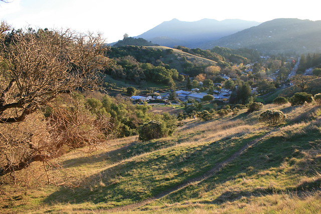
Mt. Tam with Long Shadows Thank you all who came out to last week's happy hour!  We had a small group - a couple of planning commissioners, a couple of regular readers - and it was good fun.  The next one will likely be around the end of September, so keep an eye out.  In the mean time, I'm back in DC keeping an eye out for the goings-on in Marin.

It's been two weeks with no links, so let's get caught up.

Marin County

  • What might One Bay Area learn from other regions as it crafts its Sustainable Communities Strategy?  First of all, make sure to do good outreach, and second, make sure to invest enough in transit. ABAG's outreach has thus far been horrifically bad, at least in Marin, but at least MTC is on the ball with transit investment. (SPUR)
  • As it turns out, San Rafael's red light cameras at 3rd & Irving are good for safety, reducing accidents by 12% over the last fiscal year while also reducing the total number of citations. Win/win, in my book. (IJ)
  • The Board of Supervisors wants San Rafael to take its due diligence regarding the proposed San Rafael Airport sports complex. While most of the neighbors are in unincorporated areas like Santa Venetia and so fall directly under the county, the airport itself is under the city. (IJ)
  • Apparently, George Lucas was serious when he proposed building affordable housing at Grady Ranch.  I can scarcely think of a worse place for it, though the irony is rich. (Ross Valley Reporter)
  • Then again, perhaps Grady Ranch wasn't such a slam-dunk for the environment after all... (IJ)
  • Are you a smoker living in an apartment or condo in unincorporated Marin? Better quit now - the Board of Supervisors is likely to ban smoking in apartments and condos, both indoor and outdoor, next week. (IJ)
  • West Marin tourists, park rangers, and bobcats got a pedestrian upgrade when two bridges were installed near Sausalito - one 180-foot span that bridges a creek and wetland, and another one 60-foot span. They were built so walkers could bypass nearby traffic. (IJ)
  • Sausalito's Housing Element has been rejected by HCD, which cited a lack of 20-unit-per-acre developments and zoning. The city will take a second look and consider revisions. (Marinscope)
  • The 75th Anniversary of the Golden Gate Bridge, celebrated on May 27, will be a grand affair with no parking, so take transit!  There's free bike parking at the Presidio, both Muni and GGT will boost their buses, there will be buses to the Larkspur Ferry (a shock!), and it will generally be a good time. Alas, Marin Transit doesn't seem to be adding service so be prepared to walk, bike, or taxi from your bus pad or transit center of choice. Oh, and I recommend getting Clipper Cards for the family - saves you money and time boarding the bus and ferry, not to mention that it makes transfers to Muni easier. (Patch, GGB75, ClipperCard, IJ)
  • And...: The upcoming June 5 election?  Yeah, there's an app for that. (Patch) ... This week there were five DUIs on 101 in just a day. Be careful out there, people. (News Pointer) ... Bus Rapid Transit on Van Ness is a go, and is set to open in 2016. (Chronicle) ... Dispelling rumors on bike lanes and bike safety. (Mercury News) ... The Golden Gate Bridge had its share of detractors. (SFist)

The Greater Marin

  • If you missed it (I did), there's a proposal winding through Sacramento to consolidate MTC, ABAG, BAAQMD, and BCDC into a single agency called the Bay Area Regional Commission governed by 15 commissioners elected from new districts in the Bay Area.  Fearing a loss of influence, Napa is fighting this one tooth and nail. (Napa Valley Register)
  • Martinez may soon join the city of Napa in switching its downtown streets to two-way. Ought San Rafael follow suit? (Contra Costa Times)
  • In a move that defines ambition, Chicago declared that it would have no road fatalities in 20 years. (Streetsblog)
  • Sometimes we go so long without transit that we forget how to behave, or we are so used to transit we never unlearn our bad habits. SFist has a great series of articles on transit and walking etiquette that I heartily recommend to you.
  • If you want a better street and live in San Francisco, check their new website for info on how to get some street improvements on your own.  Marinites, well, check it out for some street envy. Perhaps one day even Novato will warm to the parklet. (Streetsblog)
  • Cincinnati is giving form-based zoning a try, allowing neighborhoods to develop along the lines of how they wnat to look, rather than just based on how buildings are used. (Cincinnati.com via Planetizen)
  • UPDATE: People that live where it's easy to walk from home to work or stores tend to do so, and also tend to bike significantly more than their more thinly-spread compatriots. Though the study was done in some of DC's more tony neighborhoods, I suspect you'd find the same thing in the old TOD downtowns of Marin. (Washington Post)

From the Archives: Crosswalks and Walkability

Tonight, I'm taking a break. I need to pack, and I've finally finished my San Anselmo spider map (PDF) in preparation for my trip back home, but I don't want to leave you hanging. I've gone through the archives and found a good piece from last year dealing with crosswalks and walkability in San Anselmo.  I'll see you at this Thursday's happy hour.

Walkability seems to be all the rage these days, and for good reason.  Any merchant will tell you that foot traffic is good for business, and any public health expert will tell you walking is good for your health.  It gets people out of cars for trips of less than a mile and puts people where they can see each other, generating the vibrant sort of street life where friends and acquaintances run into each.  It’s a win for residents, a win for businesses, and a win for the city’s health.

Crosswalks are key to ensuring good walkability.  A road system isn’t much of a road system if you need to drive 15 minutes out of your way to turn, and a sidewalk system isn’t much good if one needs to walk 15 minutes to cross the street.  A good crosswalk will enhance an entire streetscape, making it more inviting to pedestrians and more lively for all users.  In contrast, a streetscape without crosswalks can be dangerous.  If crosswalks are far enough apart, the two halves of the street will be cut off from each other, dramatically reducing the walkability of the area.

Read the rest...

Mid-Week Links: Cheers!

The Second The Greater Marin Happy Hour

Good news everyone!  The second The Greater Marin Happy Hour will be held next Thursday at San Rafael Joe's - no more 29 bus madness (sadness?) and the ferry like last time. With GGT on Google Maps, you shouldn't have any trouble finding your way, even if you work in Belvedere.  I'll have some signs out around the bar like last time, but if you can't find us just email me at theGreaterMarin [at] gmail.com and I'll try to wave you down.  I hope to see you all there!

Who: You, me, and anyone else you happen to invite (and please do invite people!) When: Thursday, May 10, 6pm, though you're absolutely welcome to come late Where: San Rafael Joe's, 931 Fourth Street, San Rafael, CA

In another bit of blog news, you'll notice over on the sidebar that I'm open for business as a communications and planning consultant. If you want my brain working for you, get in touch with me at the email address on the right.  I'll be in the Bay Area from May 10-15 and am perfectly willing to travel as needed.

Right, now that that's all done with, on to the news of the week.

Marin County

  • Golden Gate Ferry workers went on strike yesterday to protest the slow pace of talks between their union and the transit district. They may call another strike on May 10 if progress remains unacceptably slow. (Chronicle)
  • San Francisco is moving towards a true BRT line on Van Ness, with center-running lanes compatible with existing buses. The line would serve Muni routes 47 and 49, as well as GGT routes 10, 70, 80, 93, and 101. It will be a boon to all riders along the corridor, though if GGT could pick up intra-San Francisco trips it would be even better. (Transbay Blog)
  • The Doyle Drive closure went off without a hitch, and the resulting roadway looks pretty nifty.  I do wonder about the eventual 12-lane configuration - neither the bridge nor the approach can handle so much traffic. (Chronicle, SFist)
  • Larkspur mulls what to do with 2.5 acres of land on the Niven Nursery site. The frontrunner idea is a new library. (IJ)
  • Marin's population grew 0.7% this past year, rather faster than Plan Bay Area's 0.2% housing growth prediction. And here I thought we were slow-growth (no I didn't). (IJ)
  • The West Sidewalk of the Golden Gate Bridge is finally open again. (GGBHTD)
  • This Friday at 7pm, stop by the Mill Valley Library for a talk by noted urbanist Peter Calthorpe on Mill Valley, urbanism, and the Bay Area's future. Let me know how it goes. (MVPL)

The Greater Marin

[vimeo http://www.vimeo.com/40686130 w=620&h=348]

Just across the bridge, San Francisco is doing some truly amazing things to promote a more walkable, livable city.  What lessons can we learn from San Francisco, and how can we apply them to Marin?  Personally, I'd love to see a San Rafael Park(ing) Day. (Streetfilms)

  • While BART is finally coming to San Jose, transportation planners are cutting their own feet out from under themselves by significantly widening two major freeways in Santa Clara, one to 8 lanes and the other to a whopping 12. (Mercury News)
  • Operating costs for High Speed Rail won't be nearly as high as opponents claim. (Systemic Failure)
  • With more cars came more people dying on the roads, and Europe and the United States took dramatically different paths.  While Europeans got mad at the cars and pushed back in favor of more pedestrian and cycling infrastructure, the United States pushed people out of the way of the cars, razing its city centers for parking and wider roads. (Atlantic Cities)
  • Ever wondered what the view is like from atop Sutro Tower? Now you know. (SFist)

Walkable Centers, Walkable Stations

If our local transit agencies ever revamp their bus maps or create supplements like my spider map, they should mark important stops as walkable centers, branding them like rail stations even if SMART will never go anywhere near them. Inspired by David Klion's metro station walkability rankings for the DC area I decided to make my own.  I was curious how our various bus pads and transit hubs stack up against one another in part out of curiosity, and in part to see whether major improvements could be made around our town centers and bus pads.  Using Walkscore, I got the following rankings, in order:

  1. Santa Rosa Town Center, 98
  2. Mill Valley Town Center, 97
  3. Fairfax Parkade, 95
  4. San Rafael Transit Center, 94
  5. Copeland Street, Petaluma, 94
  6. Terra Linda Bus Pad, 86
  7. Larkspur Town Center, 83
  8. San Anselmo Hub, 82
  9. Sausalito Ferry, 82
  10. Rohnert Park, Town Center, 82
  11. Ignacio Bus Pad, 80
  12. Cotati Town Center, 80
  13. Tiburon Town Center, 78
  14. Strawberry Transit Center, 75
  15. Novato Transit Center, 75
  16. Marin City Transit Center, 75
  17. Rowland Avenue Bus Pad, 74
  18. Lucas Valley Bus Pad, 74
  19. Corte Madera Town Center, 72
  20. Civic Center, 72
  21. Paradise Drive Bus Pad, 71
  22. Larkspur Landing, 71
  23. Ross Town Center, 69
  24. Delong Bus Pad, 68
  25. Lucky Drive Bus Pad, 68
  26. Tiburon Wye Bus Pad, 68
  27. Canal (Average), 67
  28. Seminary Drive Bus Pad, 66
  29. College of Marin 63
  30. Manzanita Bus Pad, 60
  31. N San Pedro Road Bus Pad, 58
  32. Spencer Avenue Bus Pad, 55
  33. Atherton Bus Pad, 51
  34. Alameda del Prado Bus Pad, 34
  35. Marinwood Bus Pad, 18
  36. Manor, 12

A few things stick out to me.  First, bus pads are far less walkable than town centers, though most of them are walkably close to amenities.  Especially surprising was the Lucas Valley bus pad, which is within walking distance of quite a few commercial outlets.  It is apparently more accessible than bus stops in downtown Ross and Corte Madera.  Second is the high accessibility of older towns and low accessibility of newer areas.  Third is that Marin's development is remarkably walkable compared to that of the DC metro area.  The average score for Marin is just a hair under 71, the same as DC's subway station average of 71, though some of the suburban counties have averages in the 40s. Lastly, there is no stop in Marin with a perfect 100.

One should keep in mind that Walkscore doesn't include the actual pedestrian environment. I'd much rather spend an afternoon in downtown Corte Madera than around the Smith Ranch Road office parks. Rather, Walkscore tells us that the bones of a real, metro-esque system are already in place, and that these neighborhoods, if retrofitted for walkability and served properly by transit, could take off.  It also tells us that development and the bus system have gone hand-in-hand: the various walkable (or at least accessible) centers around the county are served by the bus.

And these are the places that should be branded as transit hubs.  In DC, unlike the Bay Area, metro stations are the centers of a huge amount of development.  Cities market their metro stations as potential downtowns, and conversations about urban planning, office development, and more revolve around transit accessibility.  DC's metro map makes it easy for people to know how to get where they want to go, and businesses can market themselves with ease.  The carless Washingtonian may never get on the bus, but they know how to get where they need to go if it's next to a Metro station.

The same sort of branding and mapping could bring investment to the various gray fields around our bus hubs.  The Hub, for example, has an abandoned construction project not more than 500 feet away.  It's built into the hillside, so a taller building of four stories or more is certainly feasible.  Something similar might be built around Smith Ranch Road on either side of the freeway, while the huge parking lots around downtown Tiburon and Larkspur Landing could be put to far better use than car storage.

Because these centers are already walkable, they could in theory support more transit than is currently in place.  Marin's buses are blessed with walkable areas and mostly simple routes.  They just need that push to succeed.

Mid-Week Links: Two Steps Back

Marin County

  • San Rafael, planning as it is for a revitalized Station Area, thought it a good idea to eliminate the crosswalk at Third and Cijos, calling it a danger to pedestrians.  Rather than pedestrians being the ones complaining, it was the motorists.  There has not been a single accident at the Cijos crossing, and the one-way traffic was controlled from the nearby Lincoln intersection.  In place of the crosswalk, there's now a pedestrian barrier.  At least there are crosswalks nearby.  (Pacific Sun)
  • Seventy units of affordable housing have been announced for Marinwood at the Marin Market site.  Although near bus pads, the affordable housing site is far from amenities.  Hopefully the developer will be required to improve the crossing over the freeway to the northbound pad. (IJ)
  • SMART should buy the Whistlestop building, as the train project will render it useless to the seniors nonprofit. (IJ)
  • San Anselmo is considering how to improve its Safe Routes to School Program at a community meeting tonight, and as of press time no decision had been made. Among the proposals are adding sidewalks and crosswalks, adjusting signal timing, and a pedestrian barrier along Sir Francis Drake Boulevard. (Patch)
  • The Greenbae Interchange Project and the Wincup development will both proceed roughly as planned, as MacFarlane Developers and TAM have reached an agreement on how to accomodate both projects. (IJ)

The Greater Marin

  • If you missed a One Bay Area planning meeting, now's your chance to at least get your opinion in.  The Plan is soliciting online comments, and I encourage you to take the time to make your voice heard. (Sacramento Bee)
  • The Golden Gate Bridge has installed speed signs for cyclists on the western sidewalk, although there isn't a speed limit on the bridge for bicyclists. (SF Examiner)
  • Doyle Drive's second phase may be delayed because some state and federal funds haven't materialized as expected. (IJ)
  • A Santa Rosa school may not open for want of a sidewalk.  The sidewalk was to be built with redevelopment money. (Press Democrat)
  • Cotati's ambitious downtown roundabout plan, which stirred up so much controversy, is also in doubt thanks to issues stemming from redevelopment funds. (Press Democrat)
  • Sonoma County's roads are absolutely terrible, at least according to a map prepared by the county's Transportation and Public Works Department. Road maintenance is severely underfunded in Sonoma, and some activists are pushing hard for change. In that light, a proposed road maintenance property tax could do the trick. (Press Democrat, Petaluma360)
  • Level of Service, or LOS, is an absolutely terrible way to measure how well a city street performs its many duties, as it focuses solely on moving cars - not people - swiftly along. (Streetsblog)

The SMART Area, Part 4: Buses, and the Future

Golden Gate Transit

Over the last few days I've been posting my impressions and comments regarding the San Rafael SMART Station Area Plan. It’s such a large, complicated, and potentially game-changing document that it needed more than just a single post. So far, we’ve covered land use and parking, and mobility, and this last post will cover buses the future of the site.

The hero of mobility in the Station Area Plan will not be SMART; it will be Golden Gate Transit. If a Sonoman wants to get to San Anselmo, she will likely go by bus. If a new resident in the Area Plan wants to go to San Francisco, he will go by bus. And if a Corte Maderan needs to get to Santa Rosa, she'll probably take a bus first. Yet, the bus system, as it stands, is widely lamented as inadequate, especially on weekends. How to improve long-range (beyond 2 miles) mobility for residents in and through the area, and how to accommodate the increased service in the study area, should certainly be part of the conversation.

The typical Marin bus route runs every 30 to 60 minutes and is far slower than driving an equivalent distance thanks to a few crazy loops, some too-compact stop densities, lack of signal priority, long stop layovers, and the general restrictions of running on surface streets in traffic. Although there is an effective and complicated transfer system, thanks to a 95% on-time rate, the bus as it currently stands is not a car-replacing transit system.

This bodes ill for transit-oriented development in the Plan Area, not to mention other towns that want to orient their ABAG zoning towards transit – essentially the whole of Marin except for Novato. Without an adequate framework, increased population will lead to more sprawl, meaning more traffic, more pollution, and less open space. We must make the bus work.

There's a debate in the activist community regarding how exactly to do that, but it comes down to a few priorities: improve the absolute quality of the bus service through frequency, improve the relative quality of the bus service by making cars a less attractive choice, and improve the efficiency of rider collection by putting residents and jobs near the stations. In the ideal this means bus rapid transit or just separated lanes, but in Marin's medium-term, such BRT lines on the old rail rights-of-way are probably politically infeasible, and auto mode share would likely remain too great to support the service. Express buses, however, make perfect sense.

Whenever I ride GGT, I hardly see any on-and-off boarding between major stations; people are going from center to center, and ridership is not evenly distributed along the route. GGT should acknowledge this and operate a high-frequency town-to-town express network. GGT's last semi-comprehensive system analysis showed that such express service, combined with developing a system of “green hub” transfer points, would benefit a huge number of riders. If marketed with SMART – a rubber-tire rail – GGT could have a success and draw riders out of the new developments along the SMART corridor.

To boost ridership more generally, GGT should mail every adult within a half-mile radius of the Transit Center a pre-loaded Clipper card with a year-long GGT unlimited ride pass, perhaps in conjunction with the proposed Zipcar membership. San Rafael should allow local businesses to cash-out of some parking requirements by purchasing annual transit passes for their employees. Boulder did something similar to these proposals and saw drive-alone rates drop from 56% to 36%, with the bus taking up the slack. Give people something of value, and they will respond.

The Area Plan makes no mention of improving overall bus capacity or promoting ridership, but it does make some recommendations on how to move the Bettini Transit Center to the SMART site. None of the proposals struck me as particularly attractive, as most of them involve transforming the blocks around the SMART station into rather pedestrian-unfriendly surface stations akin to the Bettini Transit Center today. Other proposals, such as putting bus bays along Heatherton and under the freeway are more attractive from a pedestrian perspective but offer limited capacity.

If San Rafael decides it needs a new parking garage west of 101, the bus terminal should be located to the ground level, giving riders a more weatherproofed facility and allowing the height above the terminal to be used effectively. Bettini's lack of developability is one of the major arguments in the Area Plan for its demolition, so the city should try to lump its desired but ugly infrastructure together. Using the example diagrams from the Area Plan, such a garage would likely provide between 10 and 20 bus bays, depending on the configuration and location of the garage.

The Future

SMART is coming to town, whether people want it or not, and with it will hopefully be a new neighborhood and a new swagger for San Rafael. The city has a chance to come to the forefront of urban policy in the North Bay through innovative (for Marin) land use practices like form-based zoning, parking minimum reform, and true transit-oriented development. Until now, these have simply been words in general plans and housing elements, but San Rafael may actually make it happen. The opportunities here should excite everyone who supports a more walkable, livable, and sustainable Marin.

That's not to say there aren't challenges. Parts of the city staff have a history of choosing car capacity over pedestrian-friendliness, and powerful organizations such as the San Rafael Neighborhood Association could still throw their weight against passage. Both impulses should be resisted by the Council. The opportunities are too great to let this plan slip by.

The Citizens Advisory Committee is meeting on February 2 at 7pm in San Rafael's Community Development Conference Room. The draft plan will go before the City Council some time in March. The Greater Marin will likely be back to its regularly scheduled programming Wednesday.

The SMART Area, Part 3: Mobility

Over the next few days I’ll be posting my impressions and comments regarding the San Rafael SMART Station Area Plan. It’s such a large, complicated, and potentially game-changing document that it needs more than just a single post. Today we tackle the interplay of cars, bikes, and pedestrians. So far, we’ve covered land use and parking, and the last post will cover buses and the future of the site.

The SMART Downtown Station Area is set in a car-centric environment, complete with an elevated freeway and its ramps, pedestrian barriers, dead street frontage, narrow sidewalks, and open lots. There is no traffic calming, little in the way of bicycle infrastructure, and a push to move more and more cars through. This is a transit-oriented development, deliberately focused around means of getting around that don’t include a car. While it does not address needed bus improvements, the Station Area Plan tackles the other issues by building needed infrastructure for walking and cycling. It takes a step back by altering the street network to accommodate more traffic, giving one San Rafael Planning Commissioner “heartburn”, but overall the plan is solid where it chooses to look.

Cars

Highway 101, built as an upgrade to the old Redwood Highway to speed cars to the Golden Gate Bridge and San Francisco, bisects San Rafael. Irving and Heatherton are functionally the frontage roads, one-way strips running north and south respectively, and Second and Third are the on and off ramps, running one-way east and west respectively. This poses immense problems for active living, as a glorified freeway ramp is no place to put a pedestrian or a bicycle.

Car lanes are 12 feet wide, as wide as a freeway lane, but facilitating speed. Timed lights to keep traffic moving and encourages driving at the speed limit but contributes to noise and the perception of danger. There are no traffic-calming measures that I can think of.

For a transit-oriented community this is problematic, but it is understandable given the geography. In most other cities, traffic is funnelled through specific arterials on a wide grid, though if there is a problem on one street, others nearby can soak up the spillover. San Rafael is the primary freeway entrance for Ross Valley, and the whole of downtown is only five blocks wide. Speeding 24,000 cars per day on and off the freeway is a huge challenge for San Rafael, and this is a way to address the problem.

With more density coming to this area, the Area Plan has proposed adding right-turn lanes off Heatherton to Third, increasing the outbound capacity and allowing the roads to keep flowing freely. Unfortunately, the plan proposes doing this while removing a crosswalk along Heatherton to prevent pedestrians from interfering with traffic flow. This is foolish in the extreme, despite the improved bus travel times. Most traffic through this area is pass-through, and there is more than enough capacity on Mission, Fifth, and Fourth to absorb the increase in westbound traffic from these projects. San Rafael needs to focus on calming Second and Third rather than simply pushing more cars through, especially here.

Bicycling

I remember reading a blog comment once to the effect of, “I’ve been car-free in Fairfax for years, but only because I have a bike.” Golden Gate Transit has somewhat thin service for being a car replacement so bicycle ownership is a must for the car-free, and this is almost as true in San Rafael as it is in Fairfax.

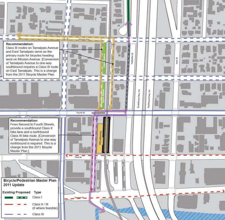
Improving the bike-unfriendly areas around San Rafael, especially under the freeway and along Second and Third, are absolutely essential to allow car-free travel around Marin, and the bike lanes included in the plan accomplish at least a bit by facilitating the bicycle connection between Irwin and the multi-use path behind the San Rafael Corporate Center. MCBC has called for a Class I bike lane (or multi-use path, what the rest of the country calls a cycletrack) on West Tamalpais instead of the planned bike lane on East Tamalpais. This is another good idea to be explored, as cycletracks would go a long way to promoting bicycling in all parts of Central Marin, and a good one on West Tamalpais could be a model.

Pedestrians

Walkability is the foundation of a livable neighborhood, a fact acknowledged by the Area Plan. Walking around the Transit Center is a pain, with missing crosswalks, long curb-cuts, and pedestrian barriers at key intersections. Walking under the freeway is unpleasant, especially at night, and the narrow sidewalks put the cars far too close to pedestrians. To solve this, the Area Plan calls for more crosswalks, removal of extraneous curb-cuts, and widening or adding sidewalks throughout the area.

Unfortunately, the most pressing pedestrian problem is handled in an astonishingly ham-fisted sort of way. When SMART arrives, it will be directly across Third from the Transit Center, and there are huge desire lines running between the two facilities. San Rafael, concerned that people would run across Third to catch their bus, wants to erect a pedestrian barrier along most of the length the station's Third Street side, forcing pedestrians to cross at either Heatherton or West Tamalpais, eliminating mid-block crossings from East Tamalpais by commuters desperate to catch their bus. This is the opposite of pedestrian-friendly.

A far better solution would be to initiate a block-long crossing, starting 30 seconds after a train pulls up and lasting 45 seconds, during which time cars would be unable to turn right. As SMART will run only once every half-hour, it would not be too disruptive of bus and car traffic, and Heatherton traffic would still be able to move south during the crossing. To prevent commuter desperation, buses should be instructed to wait a short time after the train arrives, and SMART itself should have real-time departure information displayed in the train for buses at whatever its next stop is.

Overall, the mobility issues addressed by the Station Area Plan are quite large and are handled competently.  Beyond the bizarre pedestrian barrier, removed crosswalk, and new right-turn lane at Third and Heatherton, walkability and bikeability are improved dramatically under this plan.  In our fourth and final installment, we'll tackle buses and the future of the area.

Going Downtown

Marin's downtowns are rich, vibrant places, but they're typically seen as historic shopping districts rather than places to live and work - Downtown San Anselmo is not considered to be the same as The Flats, although they are literally on the same blocks.  When redevelopment peaks its head out, it becomes lost in a sea of parking (as in the San Rafael Corporate Center), gets stymied by illogical density limits (as in the Second & B Monahan proposal), or dumbed-down by developers that see Marin as just another suburb (as in Larkspur's Rose Garden development). Few bold developments do get built in our town centers, and the most important one of late - Novato's Millworks - is perceived as a failure despite low vacancies.

One reason this might be is due to residents' perceptions of urban living.  Many Marinites are San Franciscans who left the city in the 1970s and 1980s.  Urban living, with its grit, crime, and bad schools was not for them, so they sought suburbia and wilderness at the nadir of America's cities. For a while, most commercial development was in shopping centers along 101, and most residential development was suburban tract homes.  Marin never went as far as Santa Clara, but that was largely due to geography - it's no accident that the most car-centered areas of Marin are the flattest.

Old Urbanist offers a broader view than my particularly local theory.  He argues that the American conception of cities has always been the separation of residences and commerce, exemplified in the downtown/suburban divide.  The commercial interests didn't want to give up their prized land at the center of town, so residents had to sprawl further outward, prompting more and more innovative transportation technologies culminating in the automobile.  Old Urbanist writes, "Once cars began to proliferate in the 1920s, the response was not, in most cases, to entice suburbanites with visions of urban living, but to either make valiant attempts at mass transit systems or, more often, to turn over large swathes of the downtown to the car."  The car made it economical for jobs to sprawl with the people, and downtowns declined.

This was just as true in Marin as it was in San Francisco.  Offices that moved to Marin went to Terra Linda or Greenbrae, and retail followed.  Meanwhile, to accommodate Highway 101, San Rafael wrecked its inner waterfront and devoted half of its downtown to car throughput.  The old rail right-of-ways became arterial roads, making shopping centers almost as accessible as downtown.  Without a large built-in population, the historic cores necessarily declined.

To really renew our downtowns, we need to alter our perception of them.  Our town centers are not just old-timey shopping centers competing with the strip-mall shopping centers but vibrant urban spaces for business and residences alike.  Thankfully, this shift has already begun.  Downtown housing is a recurring theme in Marin's draft housing elements, coming up even in the elements of Belvedere and Corte Madera.  San Anselmo going so far as to rezone its downtown core to allow for second-story apartments.  But this principally accommodates new residents; the old ones that fled the city still perceive density as an evil that brings the crime, grit and traffic of the 1970s, and that perception hinders development now.

In forgotten regional cores like Nashville's, people are accidentally finding out that they really love living walkable, connected lives in the city. Rebuilding Place in the Urban Space looked at Nashville's revival and proposed that, rather than leave revitalization to chance, downtown chambers of commerce or business improvement districts should actively market urban living.  They might rent a model unit and decorate it exclusively from local stores, or organize walking tours of the city.  Such measures would reacquaint Marinites to the kind of urban living our cities can support and show that it doesn't have to be like the old San Francisco.  Indeed, residents moved to San Francisco to enjoy the urban lifestyle and moved out because they had families.  Perhaps they can see that they can have that lifestyle again without going back to the City, and perhaps then residents will ask more from developers than just more detached housing.

Mid-Week Links: Problem/Solution

[youtube http://www.youtube.com/watch?v=6dNMGDVBtQc] As any company can tell you, the product is only as successful as the marketing, and Los Angeles took it to heart.  Not only was designing a good transit "product" important, but selling it to the public was immediately useful.  Other agencies would do well to do the same.

Marin

  • A sprawling development of 12 homes in Santa Venetia has been rejected by the Marin County Planning Commission.  The issue goes to the Board of Supervisors next. (IJ)
  • Druid Heights, an alternative community "whose members were dedicated to radical artistic, philosophical, spiritual, political and sexual experimentation," is profiled by the IJ on news that it qualifies as an official historical site.  The irony is lost on the writer. (IJ)
  • Novato joins Corte Madera in considering a pot club ban. (IJ)
  • Downtown Novato's Business Improvement District is doing good work to make the street a commercial destination. (Advance)
  • In what seems to be a weekly occurrence, all northbound lanes were closed on Highway 101 due to a crash.  Two people were injured. (Patch)
  • George Lucas wants to turn Lucas Valley's Grady Ranch into anoffice complex for 340 employees in a manner similar to Skywalker Ranch. (IJ, Patch)
  • Marin's $50 million renovation of its new Marin Commons space is slated to begin next year.  A government anchor tenant is a savior for the location. (BizJournal)
  • Marin local businesses felt the touch of this year's surging shopping season, posting a fabulous Shop Local Saturday. (IJ)
  • The Marin City Transit Center got a $500,000 facelift and finally opened for business.  Bike parking and an information kiosk were apparently less important than trees, and will go in in the next couple of weeks. (IJ)
  • This year might be the last that Marinites will be able to sled in downtown San Rafael thanks to budget cuts (IJ)
  • Like the library?  Love infrastructure?  San Anselmo is seeking applicants for its Capital Program Committee and Library Board. (Town of San Anselmo)
  • A driver struck and injured a cyclist in San Anselmo. (IJ)
  • More inconclusive reports on the Drakes Bay Oyster Co. affects on wildlife. (IJ)
  • SMART may be controversial, but two of the most beloved bits of Marin infrastructure - the Ferries and Bridge - were controversial in their day, too. (IJ)
  • Polling suggests that SMART still enjoys strong support, but there are questions about its methodology. (IJ)
  • Tam Valley is home to a dangerous and well-traveled intersection, but one of the few that lacks sidewalks or good pedestrian and bicycling amenities.  Kathy McLeod wants to change that. (Patch)
  • Café Gratitude is closing or selling all its NorCal locations, including the one in San Rafael, but it still totally wants you to buy its stuff.  The closures are a result of multiple employee lawsuits. (SFist)
  • The Sausalito Chamber of Commerce is moving into its recently-purchased mixed-use building on Bridgeway.  I wonder if an employee will get the top-floor apartment... (Marinscope)
  • Are you prepared for the Big One? (SFist)

The Greater Marin

  • Vancouver is pursuing urban planning that makes people healthier and fights obesity.  How?  By getting people out of cars and onto sidewalks, bikes, buses and trains. (Globe and Mail)
  • Although California High-Speed Rail is undergoing some tough times, the short-sightedness of governors elsewhere means the project gets their funding. (SFist, New York Times)
  • Readers should know that zoning is important for the future and form of any city.  How important?  Edward McMahon celebrates 85 years of zoning regulations by looking at its philosophical basis, while Stephen Smith looks at the origins of zoning: New York progressivism.  (Urban Land Institute, Market Urbanism)
  • The exurb, of which the Bay Area has blessedly little, is not coming back. For Sonoma and other outer counties, the future rests in their own economic vibrancy. (New York Times)
  • Lastly, there is a pie cake, and it's called a Cherumple.  This "dessert version of the turducken" weighs around 21 pounds.  Bring friends. (Boing Boing)

Mid-Week Links: We'll Cross that Bridge

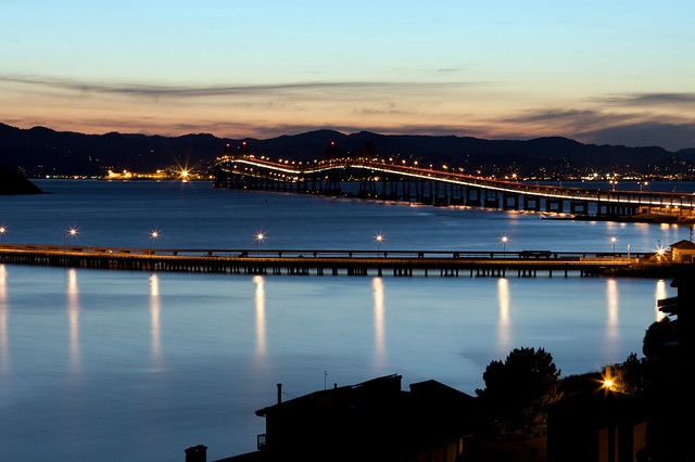
Richmond - San Rafael Bridge

San Rafael

It's been a busy week in the County Seat after a few weeks of Novato hogging the spotlight, and why not?  There are plenty of empty lots to fill, streets to calm (or not) and parks to lease.  The big news, of course, is that baseball is coming to San Rafael now that the City Council has approved the lease of Albert Field to Centerfield Partners.  There's talk of a lawsuit from some neighbors, but they haven't yet decided whether to sue or not.

Now that there will be a major pedestrian destination in San Rafael, the city will double-down on pedestrian improvements and try to really solidify a place as a walkable city, right?  Actually, no.  The city has deemed two intersections along Third Street, both within a quarter-mile of the Transit Center, to be too dangerous to cross.  Rather than try to improve the crossings and calm the raging one-way traffic, the city will make it illegal to cross there by removing the crosswalks.  Brilliant.  The city will hold a public hearing if it hears enough objections from pedestrians.

Greg Brockbank officially launched his campaign for mayor at a party on Sunday.  In his speech, he listed things he'd like to see to build up San Rafael: more events, more affordable housing, a shuttle, a downtown hotel, a music pavilion, and drawing seniors downtown.  I'd like to add more crosswalks to that list.

A bit further north, a long, long dead Sizzler's near Los Ranchitos will be renovated into a hardware store.  This is an undeniably good thing, as North San Rafael has lacked one for over a year.  As well, the County is evaluating the old Fireman's Fund building at 1600 Los Gamos as to the feasibility of it housing a public safety complex.

Elsewhere in Marin

  • The Ross Valley real estate market is "holding steady," while White Hill and other Ross Valley schools are moving forward with plans to build more classrooms.
  • The Town of Ross will hold its annual Town Dinner next Friday, September 30.  Get home from work early for some community cheer.
  • The oldest business in Marin, Smiley's Schooner Saloon in Bolinas, is up for sale.
  • Once again, the Mill Valley Council changed course when confronted by small and vocal opposition, voting unanimously to reject a plan to installing a paid-for electric car charging station.
  • Meanwhile, Mill Valley will likely spend around $400,000 to patch, not repave, their roads.
  • CalTrans will repave (PDF) a half-mile stretch of Tiburon Boulevard in downtown Tiburon at a cost of $1.2 million.
  • Dick Spotswood wanted the facts on affordable housing, and, courtesy of Stand Up for Neighborly Novato, here's some facts for Novato.
  • The IJ comes out in favor of Novato's planned downtown city offices, citing economic and symbolic reasons.
  • Yet despite this renewed push to have a heart, the city continues its sprawling ways.
  • Larkspur's planning director, Nancy Kaufman, has retired to do watercolors and planning consulting.
  • MCBC is beefing up its efforts to improve open space bike trails.

SMART News

The SMART project keeps chugging along, with new and old ideas coming up in the editorials of local papers.  Mike Pechner opined in the IJ that purchasing CalTrain trainsets would save money over the Japanese DMUs SMART currently has on order.  I haven't seen a good comparison, but individually motorized carriages is best-practice in Europe and Asia.  Amtrak faces the same questions as SMART, which the Infrastructurist has kindly parsed for us.

Another ongoing debate is the effect of the system on home prices.  Conventional wisdom is that homes increase in price when they have proximity to transit, although some believe the noise of the trains will lower house prices.  Half-Mile Circles has a fabulous literature review for anyone's perusal on the subject.

Meanwhile, the North Bay Business Journal wonders if an excursion train like the Vine Line is possible along the SMART corridor.  The short answer?  No.

The Greater Marin

  • Contra Costa's Lafayette and Orinda want better downtowns, but it's sparking some debate in the communities about what is, or is not, appropriate.  Marin needs a debate like this.
  • Streetsblog wonders whether our transit systems should strive for profitability or coverage.
  • Wondering what San Francisco was up to this past weekend?  Enjoying Chinatown and North Beach streets by closing them off to cars, that's what.

Walkability, Thy Name Is Crosswalk

Walkability seems to be all the rage these days, and for good reason.  Any merchant will tell you that foot traffic is good for business, and any public health expert will tell you walking is good for your health.  It gets people out of cars for trips of less than a mile and puts people where they can see each other, generating the vibrant sort of street life where friends and acquaintances run into each.  It’s a win for residents, a win for businesses, and a win for the city’s health.

Crosswalks are key to ensuring good walkability.  A road system isn’t much of a road system if you need to drive 15 minutes out of your way to turn, and a sidewalk system isn’t much good if one needs to walk 15 minutes to cross the street.  A good crosswalk will enhance an entire streetscape, making it more inviting to pedestrians and more lively for all users.  In contrast, a streetscape without crosswalks can be dangerous.  If crosswalks are far enough apart, the two halves of the street will be cut off from each other, dramatically reducing the walkability of the area.

San Anselmo serves as a good example of good and bad crosswalk planning.  There are certain stretches where crosswalks are commonplace, mostly along San Anselmo Avenue downtown and Sir Francis Drake from Tamal Avenue to Fairfax.  Outside of these areas, walkability seems to be an afterthought, especially along Redhill and Center, where crosswalks can be almost half a mile apart.

The map at right shows the disconnect.  I’ve highlighted all crosswalks over or next to arterial roads in red.  The longest stretch without a crosswalk is on Center, where two crossings are nearly a half-mile apart from one another.  A sidewalk ends without a crossing, and cars tend to speed along that stretch of road.  On Redhill, there’s a commercial strip in the median that has no crosswalks except at the beginning and end.  For the 18 years I lived on Forbes, which forms a T intersection with that strip, I only saw a parade of rotating businesses occupying the buildings.

Especially within a half-mile of the Hub, San Anselmo’s principal bus terminal, pedestrian traffic should be encouraged as much as possible.  With its arterials forming barriers, businesses become isolated from one another, diminishing the appeal of downtown as a destination, and businesses cannot easily draw from its own population base.  San Anselmo, Fairfax and Ross should do a pedestrian traffic survey, identifying areas of possible improvement.  I suspect that adding crosswalks and calming traffic would be among the recommendations.

San Anselmo has the potential to become a walkable town with vibrant streetlife in its core and a healthy, walking population, but it needs to invest in the infrastructure to make it happen.