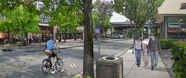
 Over the next few days I’ll be posting my impressions and comments regarding the San Rafael SMART Station Area Plan. It’s such a large, complicated, and potentially game-changing document that it needs more than just a single post. Today we tackle land use. Subsequent posts will examine parking, mobility, and the future of the area.
San Rafael has released its draft downtown SMART Station Area Plan, and I must say that I’m excited. So many good policies are wrapped into this – reducing parking requirements, form-based zoning, traffic calming, street engagement – that it has the potential to change the face of San Rafael and Marin by showing what can be accomplished with sensible zoning and real walkability. While not a 180-degree turn in local planning practices, it’s pushing that direction. If comments from the Planning Commission are any indication, there’s a hunger to go all the way, and that can only mean good things.
If you’re just joining us
San Rafael’s Station Area Plans cover the immediate areas around the upcoming Civic Center (for another post) and downtown SMART stations. The downtown station will be located at the current site of Whistlestop Wheels and will be the terminus for the system’s Initial Operating Segment (IOS), which will extend north to Guerneville Road in Santa Rosa, roughly 37 miles away.
To prepare for the incoming train, San Rafael convened the Advisory Committee, consisting of representatives from San Rafael; the San Rafael Redevelopment Agency; SMART; the Golden Gate Bridge and Highway District (GGB), which operates GGT; Marin County; Marin Transit; and the Transportation Authority of Marin. Their mission: to create the first real transit-oriented, mixed-use communities in Marin since the end of the Northwest Pacific Railroad in 1941.
This location is almost antithetical to transit-oriented development, located as it is next to the elevated section of Highway 101 that cuts San Rafael in half. Second and Third are extremely busy arterials that function as extended freeway ramps, and the area is dominated by parking lots and auto-oriented uses, such as gas stations and body shops.
Almost antithetical, but not quite. The station neighbors the Bettini Transit Center, which has buses departing frequently to all over the Bay Area and sees thousands of riders per day, and the Fourth Street commercial corridor. Existing residential neighborhoods have a strong walking component, even under the freeway. In other words, the neighborhood may be ugly but it is the transit and commercial nexus of the county, and that makes it ripe for redevelopment.
Better zoning
The key to development in this area is fairly basic: make it a place people want to walk around in and stay through safe sidewalks and streets, calm traffic, interesting sights and sounds, and high degrees of connectivity. This is exactly what the plan advocates.
For land use, the plan recommends increasing height limits along Heatherton to 66 feet, enough for five-story structures, and to raise the limit to 56 feet along Irwin, as well as along Fourth Street to Grand. Within these zones, the floor-area ratio would be raised to 2.0 and 1.5, respectively, while both areas would see density requirements lifted. Residential uses would not count towards FAR, while parking minimums would be relaxed, although not eliminated.
I wrote last week about the need for residential development within the core, and the above would aid immensely in this endeavor. Conceptual plans for the blocks immediately surrounding the station show the possibility of hundreds of new homes. Given that a household can support 73 square feet of retail, just the example developments would support close to 20,000 square feet of retail. Given the slack retail market in San Rafael, this will be a major boon to neighboring businesses. With office development and the centrality of San Rafael to Marin, retail is likely to do extremely well.
The Montecito Neighborhood Association, which represents homeowners along Fifth Street between Irwin and Grand, complained that increasing height along Fourth on their block would overshadow their homes, and I’m inclined to agree. Really aggressive land-use liberalization could accomplish the same goal of pulling the downtown core across the freeway without increasing heights at all. Perhaps the city could lift lot coverage maximums, implement a setback maximum, and lift parking requirements while maintaining a two-story height limit.
I hope that the Montecito Neighborhood Association will not come out against larger portions of the plan than just those that would effect their own homes, and so far they have limited their strong opposition to just those recommended changes on the eastern side of the freeway. If they do begin to oppose developments in places that would not effect their homes, San Rafael could have a problem on their hands.
I’m concerned about crowding out the possibility of a second track through town, however. If the system performs better than anyone expects, it could lead to major problems down the line and severely limit capacity. I don’t want planning now to put a ceiling on the system if we don’t have to.
In any event, these land use patterns are new and innovative for Marin. The Planning Commission was strongly in favor of the plan, and some even wished it would go further, instituting parking maximums or abolishing the minimum altogether, but they also felt that San Rafael was not ready for that sort of thing. This sort of change comes slowly, and the Station Area Plan is the first step.