Freeways Don’t Need to be a Housing Show-Stopper

It’s common sense that living near a freeway isn’t healthy. The pollution from the cars and grit from the roadway make for what most would term a wholly unpleasant experience. Unfortunately, the only places for infill development, not to mention quite a few SMART stations, are near Highway 101. Before any post-SMART buildings are built, communities in Marin and Sonoma need to take measures to mitigate these negative health effects, or we’ll simply be building health problems for the future. Roadway pollution is almost entirely from tailpipe emissions, and most of the health effects are from particulate material, that brown smoke most recognizably seen coming out of large truck exhaust pipes.  It’s nasty stuff (PDF), not only because the shape of the particles increases the risk of asthma and lung cancer but because they carry heavy metals, which can contribute to diminished brain formation in children.  Gases, such as carbon monoxide, are less hazardous to the health of nearby residents.

These particulates, at least when they come from a freeway, are concentrated within 200 feet of the road, though they are measurable up to half a mile away during the day and 1.5 miles away during the early morning hours.  In Marin, that means a huge portion of the county lives with 101’s pollution: all of San Rafael, most of Novato, Greenbrae, Mill Valley, Corte Madera and Larkspur, Marin City, and Sausalito lives within the freeway’s pollution plume. Only Ross Valley and West Marin don’t need to deal with the problem, though arterial roads generate their own plumes.

Within that 200 foot buffer, though, is the most danger, and the most opportunity to cut pollution.  Solid barriers, such as sound walls, send the pollution upward, dispersing it but still leaving high concentrations near the freeway.  Plant barriers (PDF) also send a plume upward, but much less pollution reaches the areas near the freeway. Instead, they collect the particulates on leaves and act as natural filters.  Using both solid barriers and plant barriers, of course, yields better results than using only one.

Practically, this means that, wherever pollution is a concern, local government and Caltrans should try to plant trees and build walls to contain and filter out the pollutants.

Another tool in our air pollution mitigation toolbox is building design. Most people spend most of their time inside. When discussing pollutants, it’s ultimately about how the pollution gets into apartments or offices. Most obviously, plants can be grown on rooftops and on the sides of buildings to filter pollutants in concert with whatever is next to the freeway. Inside the building, the county can require air filters.

Air filters for freeway pollution are effective. Most particulates can be filtered with specialized HVAC systems that, though they run upwards of $700 per apartment unit per year to operate, though yield an estimated $2,100 in health care savings annually.  These systems are required in San Francisco for developments near freeways and are a logical step for Marin to take. The county might go the extra step to subsidize the filters for affordable units included in market-rate developments.  However, these don’t filter out ultrafine particles, which constitute most of the particulates in freeway pollution. Laboratory-quality HEPA filters are even more expensive than San Francisco’s standard, but not much more, and could be encouraged through subsidy or required by law.

Exposure could be further limited by encouraging office development closest to the freeway.  The buildings, along with rooftop gardens, would act as a pollution wall for residences further back.

In short, while air pollution is a major concern for building new residences along the freeway, it should not be a show-stopper. Building higher up the valleys or sprawling outward in other parts of the region will only make traffic and pollution worse. The North Bay's governments need to make mitigation part of their building codes before any more major developments are built if they want to get ahead of the curve. It will save them money in the long-run and will make their new communities far more livable than they would be otherwise.

Can SMART Double-Track?

The currently planned SMART line, while a much-needed addition to our region’s transportation mix, is inadequate as a car replacement.  The trains will run every 30 minutes during rush hour, once in the middle of the day, and not at all at night.  This is well below the generally accepted 15-minute minimum for show-up-and-go service that you would get on BART.  To bring SMART up to that level of service will require an investment, but not as dire an investment as typically thought.

The easiest problem to solve is that of mid-day service.  SMART should just run trains during that timeframe, problem solved.  Freight could roll during the unused nighttime hours.

The problem of long headways, however, is a physical constraint.  SMART operates on a single-track corridor with sidings to allow trains to pass one another as they move in opposite directions.  The double-track segments will make up about 17% of the corridor, but that’s just enough to allow 30 minute service and not much more.

To double-track, California law requires a 44-foot right-of-way: 15 feet from the track’s center (centerline) to the edge of the right of way, 14 feet from centerline to centerline, and 15 feet on the other side.  SMART’s corridor typically includes a mixed-use path as well, which is another 12 feet wide, bringing the preferred right-of-way width to 56 feet.

While most of the right-of-way is wide enough for two tracks and the path, in three locations – Petaluma, Novato, and San Rafael – the width available drops to 50 feet and the mixed-use path will need to be moved to a parallel street.  Still, in each of these segments it's trivial to double-track. In San Rafael, however, we face a much different situation.  The right-of-way narrows to 30 feet from Puerto Suello Hill to the Downtown San Rafael station, substantially less than required by California for a second track.

Thankfully, the segment is short enough that it doesn’t need the second track.  The 1.8 miles will take about 2.5 minutes to traverse.  If we include a 2 minute pad and schedule our northbound and southbound trains to arrive at San Rafael at the same time, there will never be any conflict and therefore no need for a second track.

This solution does introduce some constraints on future SMART operations.  Dwell times would need to be introduced to ensure punctuality at San Rafael.  Headways could never be less than 7 minutes at current speeds (2.5 minutes for the southbound train to clear + 2.5 minutes for the southbound train to clear + 2 minute pad).  It might be possible to double-track the tunnel, which doesn’t need as much width, and squeeze out another minute of headway, but by then there would be other problems of capacity that could be solved more cheaply.

The cost-per-mile of double tracks varies from project to project.  A double-track project in Carlsbad had a cost of $9.68 million per mile; another project in New York State had a cost of $5.28 million per mile (PDF); and a third in Florida gave about $5 million.  These give an estimated cost of between $284 million and $549 million.  The lower figure is more in line with industry standards, and it’s roughly half the cost SMART will spend on physical rail on its existing right-of-way.

The last piece to the puzzle, rolling stock, is similarly expensive.  The Nippon-Sharyo DMUs used by SMART cost $6.67 million per train.  At my proposed 15 minute headways, SMART would need 15 trains, 9 more than currently on order, at a cost of $60.03 million.  At the maximum service of 7 minute headways, SMART would need 28 more trains than currently on order, costing $186.76 million.  The next logical steps – electrification to speed trains, grade separation to eliminate street crossings, and automated trains to decrease costs – would squeeze more capacity out of the line, but that’s beyond this exercise.

We do this for transit and frequency

Every city on the route, except Novato, wants to accommodate new construction around their SMART stations.  Given the trendiness of smart growth and transit-oriented development, city planners and councils are giddy with the possibilities.  In Windsor, the city has applications for 1,150 new apartments despite the fact that Windsor isn’t even on SMART’s initial operating segment.

Yet there won’t be much rail transit for them to orient around.  Buses can take up the slack, but they are slower than SMART and are forced to mix with traffic on 101.  The train will outperform buses in every measure except frequency of service, and providing more of that premium transit product would keep more people off the roads.  One ridership study for a SMART corridor with 15 minute headways estimated 24,000 trips per day, a sizable percentage (one-quarter to one-third) of the transportation market between Sonoma and Marin.

But this project is for a Phase 3, not for the current IOS.  SMART has yet to prove its worth to the North Bay, and the North Bay has yet to prove it can support a rail line.  The density of jobs, residences, and activities is currently quite low near the planned stations.  The capital improvements needed are expensive, as are high frequencies, and it’s not clear they would be worth the investment.  SMART can't write off that possibility, however, and needs to engineer its tracks to allow double-tracking in the future. Though it styles itself a commuter rail, SMART could be the primary transit artery for Sonoma and Marin, and it needs to be ready to fill that role if it comes. Until then, the least it could do is run trains whenever it can: 30 minute headways, all day, every day.

GGT and MT: More than a marriage of convenience

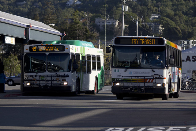
Transit Rush Since January, Marin Transit (MT) officials have been renegotiating their contract with Golden Gate Transit (GGT), which currently provides the bulk of local service throughout the county.  MT says they're paying GGT too much to operate the local routes and want to lower the contract's $16 million cost. This makes sense, given MT's rather severe budget crunch, but from a rider's standpoint the marriage has been more than simply money. Unified bus service has put Marin head and shoulders above the balkanized systems in other counties, especially Sonoma. Keeping it intact, or at least keeping inter-operator cooperation, is vital to transit in the North Bay.

While high-level debates of who runs what buses where are important to those who run the buses or those who pontificate about those who run the buses, regular riders typically don't care. They get where they need to go whether it's on GGT, MT, or Muni. It's like passing from one jurisdiction's roads to another. Drivers don't care who maintains the the roads as long as they work.

The seams between transit agencies are rather more visible than the seams between roads, though. Transfers, schedules, routing, maps, branding, and more all serve to differentiate one system from the next. Within the Bay Area, not all transit agencies even have the same fare medium, forcing people transferring from one to the other to carry a Clipper Card and pounds of assorted change. Transfers aren't always honored between agencies either, needlessly increasing costs for riders.

To use the driving metaphor again, imagine buying a local road map that left out all the state-owned roads and highways, requiring you to buy a second map that only shows state-owned roads and highways. Drivers would never put up with such a thing, but that's the situation in the Bay Area.

SPUR has argued for a more integrated system for the whole Bay Area, unifying the various systems' branding, maps, and fare structures while keeping the agencies separated. It would also allow agencies to pick up and drop off passengers within other agencies' areas. GGT buses, in other words, could pick up someone along Van Ness and drop them off at Lombard, or AC Transit could start running buses through Marin.

While this is an ideal situation, it's a long way from current reality in most of the region, with one exception: Marin.

Marin's local contracting scheme with GGT has given Marinites a mostly integrated local and regional transit system (shuttles and Stagecoach aren't seamless with regular operations). Transfers are easy and painless, GGT can operate throughout Marin as it sees fit, and riders are none the wiser. Even bus branding, while different, is similar enough that buses blend easily.

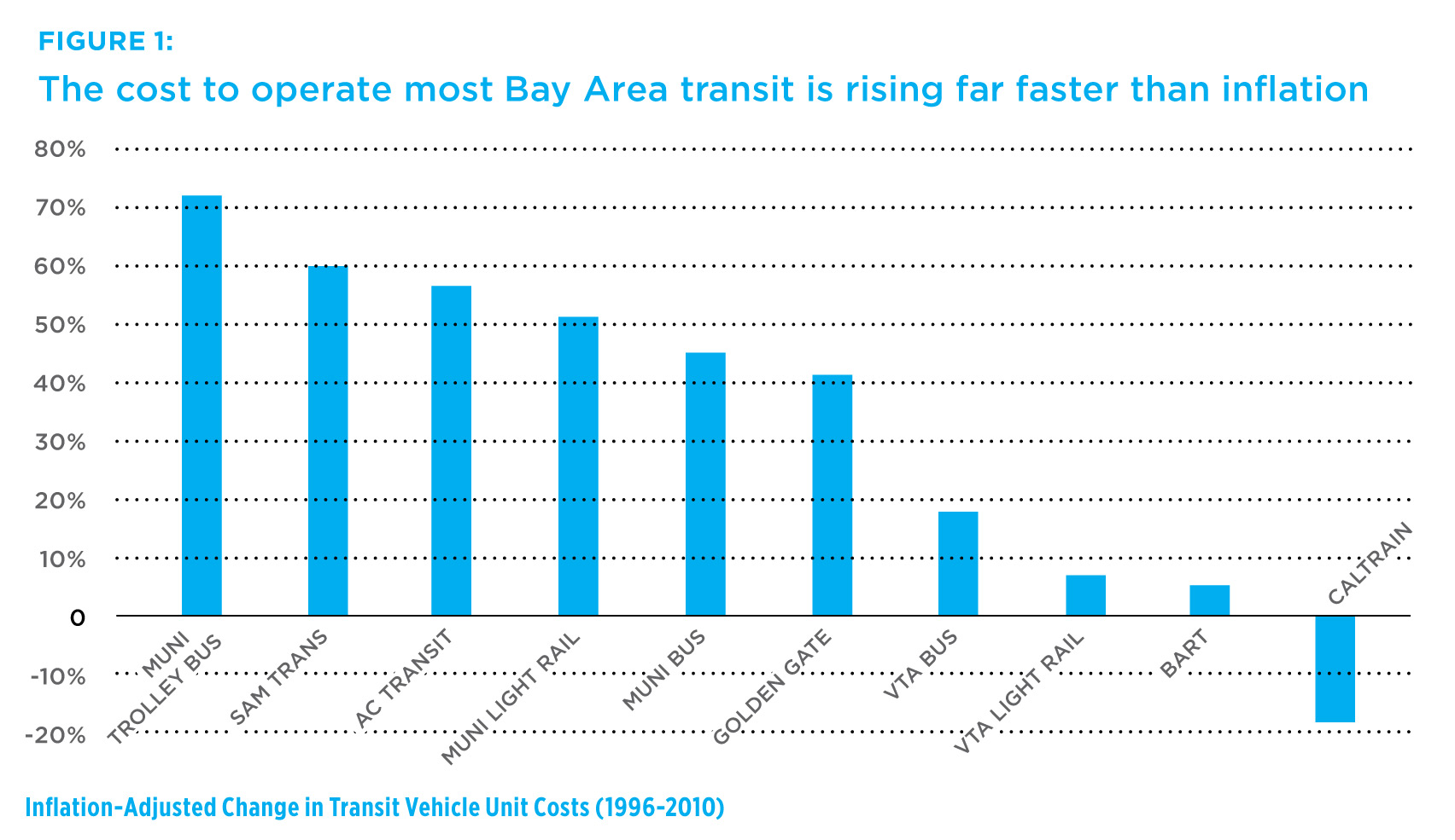
Alas, the benefits to riders have come at a steep price for Marin Transit. GGT's contract mandates 5% increases in payments every year, a hefty cost for the tiny agency. GGT's contract also slows service changes dramatically. Change to Tiburon bus service, for example, will take an astounding 18 months to implement. Other improvements, such as real-time arrival service, have been offered on Stagecoach for years but still aren't part of the GGT-operated lines.

Though these cost increases are slower than other regional agencies, the contract's slow-walk of service changes means Marin Transit can't respond to lower or higher demand in a timely fashion. The constantly increasing costs, too, have put MT on an unsustainable financial path. They'll be out of reserves by the end of FY2014, and out of money entirely by FY2017.

MT has a responsibility to taxpayers and riders to stay in service and should negotiate hard for a better and sustainable contract. If it can't come to an agreement with GGT, it should find another provider. But both GGT and MT should keep in mind the benefits of a unified transit service for the county. For the sake of Marinites, I hope they can make this partnership work.

Bad Ideas in Sacramento County

Sacramento has done great things lately. A new light-rail line extends from downtown to a rapidly redeveloping neighborhood near the river. A strong Sustainable Communities Strategy was recently approved by the region. Smart growth is taking root in the sprawling region.

Unfortunately, old habits die hard. The Sacramento Bee reports that Sacramento County supervisors approved a smart-growth redesign of Watt Avenue, an aging, low-density commercial strip, and immediately granted a waiver for Wal-Mart to move in to the very heart of the corridor, the part closest to the city and closest to light rail.

Staff argued that Wal-Mart would generate jobs, provide access to cheap groceries, and help catalyze growth in the area. Supervisors reportedly were only concerned with pedestrian safety and not the store's traffic or the store's design. It also apparently didn't occur to them that supermarkets would move in on their own as the corridor developed.

I can't comment on the wisdom of a smart-growth corridor extending in a thin, four-mile line through some fairly suburban neighborhoods far from the central city, though at first glance the land-use and parking requirements don't seem particularly progressive. What I can comment on is placing a suburban-style, car-centric Wal-Mart where the supervisors want to encourage anything but driving.

In short, it's crazy, a poison pill.  Nobody likes to walk by a strip mall parking lot.  When was the last time you walked next to a 10-acre parking lot on a summer day? What about walking through it to get to the bus?  Now imagine doing that in a Central Valley summer.  I shudder to consider it.  If Sacramento County wants to build a walkable, transit-oriented corridor, they need to stop granting approvals for projects that stand in direct contradiction to their goals.

It's like saying you want to lose weight, but you still let yourself have McDonald's for lunch every day. Your goal is at odds with your actions, and any progress you might make will be slowed or stalled entirely because of it.

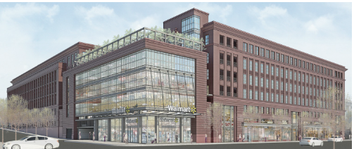
Department stores, the classier ancestors of the big-box genre of stores, were once an integral part of walking around downtown. Macy's, now more associated with the mall, even throws a parade in New York on Thanksgiving to celebrate its connection with that most urban of communities.  Wal-Mart is trying to recapture that feel in Washington, DC, building urban-style stores with apartments and offices above and smaller shops along the sides.  The parking lot is an underground garage.

Wal-Mart, in other words, didn't need a waiver from the density minimums and could have anchored the smart-growth corridor with a smart-growth store. The Sacramento County Board and staff should have pushed for something better, but instead they will be saddled with a strip mall in a place that is supposed to be the opposite.

Thankfully, Marin's governments are a bit more savvy, and Marin's residents are much more wary, than to allow such a fiasco. What we do allow, though, are sprawl projects that take life out of our downtowns. Hanna Ranch, for instance, could have been a major boost to downtown Novato had the city been willing to push the project there. Instead, it will be a greenfield sprawl development beyond that giant dead-end called Vintage Oaks.

While we draw up new general plans, our governments and people need to keep in mind their more philosophical goals: to protect the character of each town, to strengthen and preserve town centers, and to focus what growth we do allow in ways that will do those things. Otherwise, we risk just the sort of near-sighted foolishness exemplified in Sacramento County's decision, and that would be a tragedy.

Some solid recommendations for Tiburon

Tiburon Marin Transit (MT) recently began to study how to improve service on the Tiburon Peninsula. I addressed the current situation and the various options in a previous post I wrote a few weeks ago, so I won't go into them here.  Now, though, MT staff have released their draft recommendations for comment, and I'm extremely impressed.  Nearly all of my recommendations were taken, or were arrived upon separately.  There were some changes, however, so let's look over the highlights.

Item 1: Implement a Tiburon Community Shuttle program.

The route will run between downtown Tiburon and Strawberry every 20-30 minutes, timed with the ferry, and run between 6:00am to 10:30pm.  The last run of the day would run through Mill Valley to Marin City.

Though I like the service span and frequency, MT proposes deviating the route eastbound from Strawberry.  Going east, the bus would serve Belvedere Drive through Strawberry, hitting a currently unused bus stop at Belvedere & Ricardo while bypassing the eastbound stop at Tiburon & N Knoll.  Splitting service like this is strange and makes for a worse transit system in general.  Bus stops should be paired with each other wherever possible, even when the geometry of turning around makes that difficult.  Residents living on Knoll probably won't need to go to Strawberry; they'll probably need to head to Tiburon, and need to take the bus in that direction. Diverting the bus would mean an extra half-mile walk for them to the nearest eastbound bus stop.

Strawberry residents face the same problem, but only one new bus stop would be served, and it wouldn't be far from another, at Tiburon & Belvedere.  The only way this would be of use would be if there is a minimal pause at Strawberry, allowing N Knoll travelers to ride west to Strawberry before continuing their eastbound journey to Tiburon.

The projected cost for the new route would be around $473,000, down from $629,000 for the current routing.

Item 4: Make Blue & Gold Public

The ferry route in Tiburon is vital to the health of the transit system and, though it should be better integrated into the transit system, it is largely working well.  Blue & Gold is a privately run company with higher-than-average fares and a parking fee. Despite that, the ferry runs a profit and sees 625 passengers per day ply the route between Tiburon and The City.

MT staff recommend turning the route over to a public agency, either the Water Emergency Transportation Authority (WETA) or GGT.  I dislike the idea.  Though it would improve the amount of service on the route, what is currently offered is well-used and well-liked.  I fear that GGT or WETA would make the parking free and lower fares while increasing service, ensuring an ongoing operating deficit.  Though it may attract more riders, free parking would also attract more traffic onto Tiburon Boulevard and put pressure on the town to build more parking in its already parking-saturated core.

Better would be to work with the system in place.  Blue & Gold should arrange with WETA and MTC to be part of the 511.org system, take Clipper, and still operate as a for-profit company.  Any additional service should be operated by Blue & Gold and paid for with an operating subsidy from the interested agency.

Items 5 & 7: Improve Connections to Regional Services & Implement Passenger Access and Transfer Improvements.

A very strong recommendation is to improve access to Highway 101 (p 14, PDF). As I wrote, Tiburon's transit needs to be integrated into the greater transit system of the county, especially to the 101 trunk.  The Tiburon Wye, sadly, is extremely unfriendly for transfers to and from Strawberry or Tiburon.  Though I proposed something of a patch over the issue, to extend the new shuttle route out to a turnaround at Tower Drive, it turns out that Caltrans already has an answer.

For $3 million, Caltrans has some preliminary plans to reposition the bus stops at the Wye so they're closer to the overpass and won't require pedestrians to cross the on or off ramps.  At the west side of the freeway, a turnaround would actually allow both surface street and freeway buses to share a single stop, knitting the two services together in a way I hadn't even thought would be worth proposing.  This is a superb design, and may even allow GGT to cut commuter Route 8.  Rush service at the Wye is good enough that any wait would likely be only a few minutes.

Item 8: Marketing

It will be absolutely necessary to market these new services to the people of Tiburon.  Transit usage is very low on the peninsula, and I suspect people won't flock to the new service because it just won't be a viable option for most.  The recommendation is to develop a flyer and to distribute it around the peninsula.  If it's like any other pamphlet I've seen, it will be placed in little displays but rarely taken.

More expensive, but more effective, would be a mass mailing to every household in Strawberry, Tiburon, and Belvedere, but go beyond simply the pamphlet.  Enclosed in each or in a random selection would be a $10 Clipper card and a note encouraging people to try transit.  Only 6.3% of Route 19 riders use Clipper at the moment, so there is a lot of room to grow. If Blue & Gold is interested, it could also include a free round-trip ticket aboard the ferry for a commute.

Many of the tickets and Clipper cards wouldn't be used, but some of those that do use them would find transit so much easier than they imagined and would become frequent or semi-frequent users.  Boulder, CO, found that giving away transit passes helped build strong transit usage in their bus-only system.  Given the poor connections to 101, MT may want to wait until the system is fully built and the Wye reconstructed before asking people to come on board.

Other Item: Real-Time Arrival

Something particularly exciting, which I've pushed for in the past, is the use of a real-time arrival system and signs.  MT wants to place the signs at high ridership stops at Strawberry and Tiburon & Main downtown, as well as in shops near particular stops.  The shops would be especially handy, as it would give riders the ability to get morning coffee while waiting for the bus so they would know exactly when to leave.  The real-time system is online, so people could take to their computers and smart phones to find out when the next bus is arriving and when to leave the house.  Ideally, this system would also include Blue & Gold Ferry departures and arrivals.

MT should ensure the system is included in its marketing materials, as GGT-operated routes don't have real-time arrival systems yet and so would likely be unfamiliar to casual users.

In Sum...

MT has some solid recommendations.  Though some need improvement, such as those for Blue & Gold, but most are good or better than I even though were under consideration, as with the Tiburon Wye.  After reading the draft, I'm highly optimistic about the chances of transit on the Tiburon Peninsula.

Frequency 101

Transit Center

Keeping time. Photo by Egan Snow.

Though Marin has done a really fine job with what bus resources it has - indeed, its service puts Washington, DC's suburban service to shame - it doesn't do justice to its geographic blessings, or the transit-oriented towns it serves. To get Marin on the move, GGT should reconsider the basic structure of its service.

The ideal transit system is a grid of high-frequency corridors. Though it requires transfers, if the bus or train comes every five minutes it's not that much of a problem. San Francisco, Vancouver, and even Tallahassee , Florida, have designed highly successful transit grids.

Alas, Marin's valleys preclude development of a high-frequency grid. Instead, our geography is in a trunk and feeder system. Just like the streams that made our valleys all fed into the Bay, our feeder roads all lead to the Highway 101 trunk. Only two town centers, those of Novato and San Rafael, fall along the trunk, and the rest are at least half a mile up the valleys from the freeway. Though not ideal, this system gives us a number of advantages.

Foremost among these is that our trunk is a freeway. From an urban design perspective 101 is atrocious, but from a speed perspective this is wonderful. Unlike surface streets that require constant stopping and going and cars parallel parking and red lights and pedestrians and all the other nonsense that makes buses drive slowly and a city worth living in, a freeway is empty of all but cars, freeing drivers to push their buses far beyond their normal surface speed. As well, bus stops are relatively infrequent, only as often as an on- or off-ramp, so they don't slow down the bus much.

Secondly, our branches aren't twisty little things that look great only on a drafting board. There's not enough room for that. Instead, we have fairly linear arterials along valley floors with towns positioned right along them. Even sprawling Novato has only a couple of real arterial roads. Most anywhere you want to be is within a half-mile of these roads.

Lastly, nearly all our local buses intersect the trunk. There are very few valleys coming off of valleys like Sleepy Hollow and Sun Valley to muddle things. This means that one could run a bus along the branch from one end to the other and always, either at the endpoint or the midpoint, there will be a transfer to a fast north-south line, which where the real distance is in the system.

Sonoma, also part of the GGT system, doesn't have quite the same linear structure as Marin, but the county's principal town centers lie along 101 and so are similarly well-served (in a manner of speaking) by the freeway.

As an added bonus, our towns are compact. Walkable destinations are easy to find, and office parks are clustered. San Francisco isn't too far away, sitting at the base of our trunk, and the East Bay is easily accessible from Central Marin.

While our bus lines generally follow this system, the trunk lacks true high frequency. A common complaint among commuters to Marin from San Francisco is the awful northbound frequencies. All three all-day routes - 70, 80, and 101 - leave at the same time from the City, and each is a different level of express. Within Marin, wait times are inconsistent, fluctuating between 6 minutes and 30 minutes for most of the weekday. In Sonoma, GGT runs consistent, though infrequent, one hour headways.

The Frequent Trunk

Golden Gate Transit and Marin Transit should set a goal of no more than 30 minutes between San Francisco and Santa Rosa, and 15 minutes between San Francisco and Novato. This minimum level of service should go from 6am to 9pm weekdays and 9am to 9pm on weekends, roughly when service levels drop off in the existing service. The weekday service works out to about 268 revenue hours - 97 hours for the Novato-SF route, 171 hours for the Santa Rosa-SF - about 83 hours more than GGT currently runs. Weekend service would need 214 hours, about 62 more than currently available.

According to GGT's latest operating reports, our weekday service increase would cost about $3.3 million per year, and the weekend would cost $1 million, increasing annual operating costs by 6%. It may be possible to roll some commuter bus service into the morning schedule to decrease costs as well, which may go into an express service like what the 101 and 101X do now. Revenue from congestion pricing on the Golden Gate Bridge, as well as general toll hikes to bring them in line with transit fares, could easily cover the cost.

The Frequent and Accessible Feeder

This is a bus network, not simply a bus line, and we ought not forget about the feeder lines.

Of the feeders, the most prominent are those centered around San Rafael's Bettini Transit Center. Not only do they have cross-platform connections (to borrow a rail term) to 101 bus service, but they serve the most densely populated areas of Marin - Ross Valley, Central San Rafael, and the Canal - and the East Bay. These should be high priorities, with a minimum combined headway of 20 minutes on each axis. The Canal, which already has 15 minute headways, should maintain them.

(Though under the current system reliability and speed should come before frequency, I do agree with last week's commenter Jarrett Walker that frequency is more important overall. If paired with an improved 101 bus system, my concept for Route 580 should absolutely put frequency ahead of style.)

Other valleys should seek minimum headways of 30 minutes between their town centers and the freeway. North San Rafael and Hamilton have uniquely transit-unfriendly designs but the bulk of Marin's population could be well-served by semi-frequent service along valley-floor arterials.

Just as important as frequency are the connections between 101 and the local feeders. Bus pads are typically awful things, and some routes - such as Tiburon's Route 19 - don't even connect well with the bus pads that are available. GGT and Marin Transit must push for stairs, better shelters, paved paths, clear signage, and onramp underpasses to facilitate transfers between local feeders and the 101 trunk as well as to surface streets. They should design each interchange as a single transfer area and provide maps for each, similar to the Larkspur Ferry map (PDF). Improvements like this are sometimes provided already, but should be standard. Though luxury isn't necessary, customers should be comfortable when transferring and when waiting. That is the glue that makes the network really hum.

You'll notice I haven't touched on density, signal priority, BRT, SMART, or the speculative Fairfax-San Rafael streetcar. While each of these things could dramatically improve service along the 101 corridor, they aren't necessary to make a successful system. Using the infrastructure we have today it's possible to make a high-class transit system for the North Bay. GGT should focus on network-wide improvements, and the key to a better bus system lies along Highway 101.

Improve the East Bay Connection

GGT wants a better bus line to the East Bay, but unless it learns the lessons of the 101 it will remain an underused connection for the region. Quietly, Golden Gate Transit has begun to unofficially examine improvements for Routes 40 and 42, the two bus lines across the Bay to Richmond and El Cerrito. Though it hasn’t been asked to by MTC or Marin Transit, GGT believes the lines could do better than they have and want to speed up the connection for cross-bridge commuters.

Not only are they not express – both buses plod along local Marin streets before the bridge – but they’re not branded for East Bay service.  To seriously rework East Bay service, GGT should approach the problem by learning from Route 101 and give the East Bay a fast and frequent Route 580.

Routing, Frequency, Speed

The three concepts of routing, frequency, and speed are interconnected. Where a bus goes lengthens or shortens its route, making it faster for riders and cheaper for transit agencies as fewer buses are needed to maintain a high frequency.

Ridership data for the 40/42 corridor shows only four major stops: the Transit Center, Point Richmond, Richmond BART, and El Cerrito del Norte BART. The Route 580 should only make stops here, as well as one stop in downtown Richmond – if the city will ever become vibrant, the renaissance will start here.  This routing means a speedy trip along Highway 580 and the Richmond-San Rafael Bridge without dealing the plodding pace of Marin’s surface streets.  A round-trip should take a bus less than an hour and a half, meaning 30 minute headways are possible with only three buses running the route.

Though on the map it makes sense to go straight to El Cerrito del Norte, Richmond is a much more heavily-used station than Del Norte. It slows down service a bit, but nearly as many people use Richmond (158 boardings/alightings per weekday) as Del Norte (243 boardings and alightings per day). Cutting out the Richmond station would isolate a densely populated part of the city and force riders to or from there to take BART or AC Transit at either end of their journey. It would also isolate any Amtrak commuters that don't want to park in the East Bay.

A second, local bus would take over the current Route 40. Though slower, it would service Anderson, East Francisco, and Cutting.  Marin Transit has a stake in keeping that line running, even if the line doesn't perform well, to provide transit service for those areas that otherwise would go without.

Branding

The route number 580 is absolutely important to promote ridership in the car-centric counties of Marin and Contra Costa. Route 101 has been a smashing success not only because it operates as a reliable express to San Francisco but because of its branding. Unlike the other links to the City (routes 10, 70, and 80) even the most casual transit user can guess that the 101 goes on the freeway to San Francisco and back again.

The branding also properly evokes the kind of feeling one gets when driving on a freeway: you’re going somewhere, and you're going there fast.  In this case, the destinations are Amtrak, BART, and, most importantly, Richmond itself or, from the East Bay, the very center of Marin's bus system. The current branding and routing of the 40/42 feels like a shuttle service, a Band-Aid reminding riders that a better transit system is just across the Bay, if only they'll use it.

Sometimes, branding can make or break a product, and this is certainly true when wealthy Marinites will take inconvenient but luxurious transit (the ferry) instead of convenient but less-luxurious transit (the bus). If you've ever watched Mad Men, you know how advertisers (fictional ones, at least) take a great deal of time to come up with the proper brand for a product to convey the intangible emotions that go with it. GGT should absolutely drop the 40/42 designation for 580.

The East Bay is Marin's second-largest source of workers, and they work all over the county. The East Bay is also a destination for a great deal of Marin's commuters, and access to BART is vital to the health of the county.  Access to world-class transportation systems deserves a world-class response. A 580 express bus is just the way to provide it.

An Extraneous Park

On Saturday, the San Anselmo Chamber of Commerce announced that George Lucas had given some downtown land to them. The vacant building would be torn down and a park, complete with statues of Yoda and Indiana Jones, would be erected in its place.

Perhaps I'm a curmudgeon to think so, but this doesn't seem like the best idea.

The Rundown

George Lucas owns 535 San Anselmo Avenue, a one-story, roughly 6,000 square-foot building with three retail spaces (parcel number 007-213-24, if you care about such things). The 1970s-era building opens onto the police parking lot in the rear and lies adjacent to Town Hall. According to Patch, Lucas was approached by the San Anselmo Chamber of Commerce to donate the land and building, together worth about $2 million, for a park.

Lucas agreed, and now planning is on the way to transfer the land, demolish the buildings, and build a new park in downtown. The chamber is thrilled. Its president, Connie Rogers, told Patch, "This is going to be great for the city. It will increase revenues for the merchants and bring people to the town center."

For those of you who don't know, George Lucas is a San Anselmo local. He's been heavily involved with town improvements, and you can see the results along Miracle Mile in front of United Markets. The recent demolition of the very old Amazing Grace Music building and the renovated replacement just up the median is his handiwork.

In a much more high-profile case, Lucas recently pulled out of his Grady Ranch film studio project in Lucas Valley over neighborhood opposition, vowing to put affordable housing at the location instead.

More Green Isn't Always Good

Though a park, without considering the context, can be a good thing, if we pull back our view from the site and look at all the networks in the area, it doesn't make sense.

First, we have the parcel's current use, as retail. San Anselmo lives on sales tax, and a large part of that comes from downtown merchants. Though a park may attract more people to downtown, it's likely they will mostly be geeky tourists and those of a sort that see the World's Largest Fork. The park would ride on the cachet of Lucasfilm's characters, and it's doubtful the tourists would generate enough revenue to offset the loss from what would be there otherwise. That space will not remain vacant forever, and when it is filled it will be more valuable as productive land than as value-enhancing park space.  Creek Park and Town Hall's front lawn are our green spaces, and they have served well as the town's living heart.

Even more valuable would be to demolish and rebuild as a two-story structure with housing above. The second floor could provide four to six units, depending on size, and would lock in another four to six families to do most or all of their shopping downtown, boosting sales tax for the town.

If the units are studios or one-bedrooms, both of which are in short supply in Marin, they would likely be starter units for 20-somethings that want to live in town, or empty nest units for people that want to downsize out of their family home, meaning they would add value to the school district without adding children to the district.  That brings us to San Anselmo as part of the regional housing market. George Lucas wants to build houses in Grady Ranch; why not focus on building them in the center of our towns instead, in places like 535 San Anselmo?

From an urban perspective, the buildings at 535 are important for the town center's "urban room". They're part of the wall of interesting shops and businesses that line San Anselmo Avenue. Think about that curve in the road by Hilda's Coffee and the feeling of security and home you get standing there. How different that is from the feeling we get on South San Anselmo Avenue!  That difference is what separates a true downtown from just another commercial strip.

Demolishing 535 would open up the room to a parking lot, giving uninterrupted views from the Coffee Roasters to Library Place and the fences behind. Though good landscaping in the park could minimize that damage, a too-open street with views of noninteractive buildings and a parking lot deadens the streetscape. Unless something else is built behind the park to interact with it and block the views, the park would likely be a loss to San Anselmo Avenue's streetscape.

Downtown is also part of the Ross Valley Flood Protection District, and our urban core could get a major overhaul. Though it's still in preliminary phases, the plan calls for the shops that extend over the creek, behind the Coffee Roasters, to be demolished. This would mean a new extension of Creek Park, which would render the Lucasfilm Park extraneous. Alternatively, it could mean a complete reshaping of downtown; let's build a park if someplace needs to be demolished to keep the town safe, not just because the Chamber of Commerce thinks it's a good idea.

This park should not go through. Despite the positives it may bring, the potential downside of a missing tooth is too great for San Anselmo to ignore. If the Chamber wants to boost business downtown, it should not do so by demolishing shops for open space. It should do so by strengthening our center and getting people to live downtown. Our merchants, and the character of our town, thrives on residents, not visitors.

A park to attract visitors instead of shops to attract shoppers would move us into a more fickle, less stable situation, and that's a bad idea.

Tiburon's Transit Gets Wind in its Sails

Bus service in Tiburon is the worst-performing part of the Marin Transit (MT) system. Fares cover about 12% of the operating costs (the target rate is 20%), and a paltry 12 riders per hour take the bus. To address the situation, MT has begun the Tiburon Transit Needs Assessment, a process that will end with changed routes, better service, and more. The listed alternatives for improvement are a step in the right direction. Pursuing a blend of route changes, structural changes, and better transfers to 101 and the ferry will give residents and workers on the Tiburon Peninsula a better bus and attract more ridership.

What's There Now

Tiburon is served by two bus lines, the commuter Route 8 and local Route 19, the Blue & Gold Ferry, and paratransit. Route 8 goes from Belvedere to San Francisco via 101 and carries about 57 passengers per weekday on its very few runs south. Other than school runs to Redwood High, Route 19 runs from Belvedere to Marin City via Strawberry and carries about 345 passengers per weekday and about 280 passengers per weekend.

Blue & Gold Ferry operates between Tiburon and San Francisco, a run that takes about 25 minutes. Though about double the price of Route 8, it takes half as long to reach the City which suits its well-heeled travelers fine.  Unfortunately, the ferry doesn't accept Clipper Cards and doesn't have timed transfers with buses in the middle of the day.

To address the problems of low ridership, MT has developed a whopping 15 proposed service changes ranging from a shorter, more frequent line to improving bicycle access. You can see all the proposals here.

There are three types of alternatives: the first deals with bus route length and frequency, the second with paratransit like dial-a-ride and taxis, and the third with non-bus transportation.  When presented with such a plethora of options, it's good to keep in mind some core transit rules (most of which I unabashedly take from Jarrett Walker):

  1. Well-spaced high-frequency corridors that intersect in a grid and anchored at walkable destinations.
  2. Easy connections between transit modes and lines.
  3. People tend to stick with transit once they're used to it.
  4. Pedestrian-friendly areas around stops and stations.

These fit well with some of the comments from ferry riders who were asked what would get them on the bus:

  1. Increase service frequency, especially around peak hours
  2. Closer bus stops
  3. Faster travel time (mutually exclusive with closer stops)

As of press time, the online survey wasn't closed, so we don't know for certain what their preferences are. However, Robert Betts, the Marin Transit planner charged with the changes, said preliminary feedback at workshops showed a strong desire for better service frequency, connectivity to schools, and improving Blue & Gold Ferry's role in the peninsula's transit network.

Let's see how the alternatives stack up against the recommendations.

Fixed Route: Alternatives 1a-1e and 3a-3b

Of the fixed route plans, none meet all the recommendations, though 1a comes closest. With 30 minute headways all day, the shuttle service (I hope they call it something that doesn't connote the wretchedness of getting around an airport) between downtown Tiburon and Strawberry should be the backbone of Tiburon service. I'm not so enthusiastic about 1b (downtown to Marin City via Mill Valley) or 1c (downtown to Manzanita Park & Ride) mostly because of frequency and cost. Well-timed transfers could do it better.

Adding the school route of alternative 1e to Marin Catholic High School would complete the transit picture, giving kids an alternative to car ownership and taking a helluva lot of cars and their novice drivers off the road. I'm less enthusiastic about alternative 1d, which adds two rather roundabout school routes. I'd rather see them branded as school supplementary service rather than proper bus lines, and, given what they serve, I'd rather the cost come from an agency other than Marin Transit.

Unfortunately, 1a misses the connection to Highway 101. The freeway is the north-south artery of our transportation system. While some routes connect at Strawberry, Routes 18, 24, 36, 70, 71, and 80 all bypass the shopping center for the Tiburon Wye bus pads. This wouldn't be a big deal if transfers were easy between 19 and the bus pads, but interchange's horrid cloverleaf layout means anyone who needs to transfer between southbound 101 and the 17 must walk half a mile to make the connection. Transfers to northbound 101 aren't bad at all, though the bus stops are just signs on poles in some ugly parking lots.

Such a poor connection dramatically reduces the route's effectiveness.  This is a bus network after all, and network effects are powerful.

Redesigning the interchange isn't in the scope of work, so routing has to be the solution. Alternative 1a should be modified to run buses across the overpass and turn them around just after the offramp's intersection with E. Blithedale. There's a parking lot there that would work well as a turnaround. Though the extra routing would add two to three minutes to the total round trip, it would dramatically improve the connection to southbound 101 and therefore the bus line's usefulness.

Blue & Gold Ferry is the best way for residents to get to the city, bar none. It's classy, it's fast, it's comfortable, and it drops people off in the heart of the financial district. It's hindered by low frequency, high cost, and poor transfer to buses.

Alternative 3b addresses the frequency concerns. Tiburon is undergoing a downtown improvement project, which would address the car-oriented nature of most of its downtown, but adding more people to the tip of the peninsula would mean traffic hell further up Tiburon Boulevard. MT should push Blue & Gold to do more and cheaper runs to the City to support a more people-friendly downtown.

The other part of 3b would establish ferry links with Sausalito. While I appreciate the thought, the beauty of Blue & Gold's routing is the effective express route to the City. The point of an intermediate link to Sausalito would be strictly for tourists, hindering the livability of Tiburon and therefore it's attractiveness to tourists in the first place. If the route would function as a water taxi, I'd be concerned about profitability. Still, Blue & Gold is a for-profit company; they wouldn't initiate a loss-making run.

Alternative 3a pushes Blue & Gold to adopt the Clipper Card, partially addressing the transfer issues between the two systems. I can't see anything wrong with unifying fare media.

Demand-Response Service: Alternatives 2a-2e

No matter how Route 19 is changed, a good chunk of the Tiburon Peninsula will go without transit. The twisting, disconnected streets and cul-de-sacs make effective transit service impossible beyond Tiburon Boulevard, but there is still a need for transit in those areas. People with disabilities, the elderly, and others need to have a way to get around.

Demand-response service allows people to order transit so they don't need to walk to a bus stop. The alternatives presented range from taxi vouchers to semi-fixed route service.  In honesty, I don't know nearly enough about Demand-Response Service to assess these options in depth, but I do have some more surface-level thoughts.

Taxi vouchers (alternative 2d) may be the best way to get people out of their homes. Most of the households are the peninsula are relatively wealthy. Though sharing a ride with a number of people may be okay, I suspect taxi service would be more familiar and comfortable to elderly people from that background.

Advertising services that are already or will soon be in place makes sense no matter how you slice it, so I'm surprised alternative 2e is presented as just another option. The rest I have no meaningful way to evaluate, and none of them are part of the feedback I've heard from Marin Transit or the existing conditions report.

Non-Transit Solutions: Alternatives 3c-3e

These alternatives present options that don't involve Marin Transit actually putting vehicles on the road or vouchers in peoples' hands, and they're all good.

Once tourists get to Tiburon, a bike would be the best way for them to get around. Alternative 3d proposes a bike share system, which would presumably be part of the San Francisco/BAAQMD system opening this fall. Such a system would be used by residents that don't want to drive up Tiburon Boulevard and by daytrippers from San Francisco and the Peninsula, where the BAAQMD system will be implemented first. What it should not be is a single station in downtown. If sprinkled up the peninsula along Linear Park they could be used for regular trips. Adding a single station would be useless to residents.

Tourists like long, leisurely rides that don't fit with the strictly utilitarian role of a bike share system. Bike rental kiosks (alternative 3c) would make more sense for them. Visitors could get up the peninsula to see the views across Richardson Bay or head to Tiburon Uplands.

For either type of bike system, it would reduce bicycle crowding on ferries and improve circulation around town for drivers (who wouldn't have to deal with more cars on the road), residents, and visitors. We'll have to wait for TAM's report on bike share this fall, but there's no reason Tiburon or MT couldn't start marketing the town to bike rental shops.

Build a Better Route

The alternatives presented will only go so far in promoting transit use. The urban environment along the route is extremely unfriendly to bus travel. Sidewalks, crosswalks, and bus shelters along the route appear only every so often, rendering the pedestrian - as all bus riders are at some point - feeling like an interloper in a car-dominated landscape.

Improving the rider experience, no matter which mode, will make the bus feel less like a second-class form of transportation. At its least expensive, Tiburon should improve connections to frontage streets and paths where they're lacking. Often the only safe way to bike or walk is on the frontage road, so it's important they be connected to the stops.

Bus shelters, though more expensive than straight pavement, are important to keeping riders out of the elements. Tiburon Boulevard isn't the most meteorologically friendly location for waiting at a bus stop, after all, and the combination of rain and the Richardson Bay winds can make umbrellas useless.

Crosswalks and sidewalks are more heavy-duty interventions but would give people better access to bus stops that may not be immediately in front of their street. If it did undertake the improvements, Tiburon would also improve access to Tiburon Linear Park and other services on the south side of Tiburon Boulevard.

The improvements to Route 19 are commendable, and integrating Blue & Gold Ferry into the public transit network will do wonders for the town. If Marin Transit pursues a short but (relatively) high-frequency bus line and creates a strong connection with 101 corridor, they'll give Tiburon, its residents and workers, the kind of transit they want and deserve.

Expect another few public outreach sessions before the draft report is presented to the MT board at the end of the summer. Whatever the recommendations, implementation likely won't start until the end of the year. In the mean time, take the survey, read the reports, and show up to those public meetings. You can sign up for a newsletter at the bottom of the reports page.

Don’t Cut the Street Crimes Unit

9 Last Monday, San Rafael staff submitted their proposed budget. Among the cuts is a $380,000 item to cut the San Rafael Police Department's Street Crimes Unit. Two of the four officers charged with this task are retiring, and the proposal on the table would leave those two positions open. The remaining two officers would be rolled into the general SRPD patrol force, leaving them to react to crime that happens rather than intercept crime before it happens.

This is a problem.

SCU is a division of the San Rafael Police Department (SRPD) that proactively addresses criminality, from vagrancy to vandalism to gang violence. Their mission is to make the streets safer for residents and businesses by working with federal and state law enforcement, building relationships with communities, and intercepting crime before it becomes a problem.

Units like SCU are vital to a city’s crime-fighting force. A proactive approach shines a light into the darker places of a city, ensuring that even crimes that occur in private are addressed, even if nobody calls it in to 911. This takes pressure off 911 and patrols who otherwise have to deal with the results of those private crimes: drugs, gangs, vandalism, and a general feeling of lawlessness that breeds more crime.

Tamping down on the reactive arrests reduces costs to the county by reducing the number of arrests and the severity of the crimes, meaning fewer and lighter prison sentences and less complicated prosecutions.

San Rafael does have these problems. It’s home to two rival gangs, the Norteños in Terra Linda and Novato, and the Sureños in the Canal, and it's likely they were involved in a Gerstle Park gang killing last year. A recent crackdown on crime in eastern downtown led to 79 arrests for everything from vandalism to drugs, while downtown merchants south of Fourth often report shady goings-on by their stores.

By keeping crime at a minimum, San Rafael will be helping its merchant core, ensuring demand for new retail and boosting sales taxes at existing places of business.  Though downtown is most visible to Marinites, boosting business in the Canal also requires pushing out criminality and fostering a sense of safety for merchants and shoppers.

Cutting SCU would be a mistake. The institutional knowledge of the force would wear away while under the aegis of general patrol, while the crime addressed by SCU would rise. Though it may save money in the short-term, cutting SCU would mean a less vibrant downtown and lower tax receipts. San Rafael is right to find ways to balance its budget, but it shouldn’t do so by eating its seed corn.

Make Town Center a Town Center

Central to the discussion of Corte Madera’s housing concerns is that it is built-out. There is no more developable land, and its commercial areas are productive and full. Where will more people go? The answer lies in Corte Madera Town Center’s parking lot.

The Situation

Over the next 28 years, Corte Madera is projected to grow by 204 units, most of which will be enforced by the state through its RHNA process. The town wants to rid itself of RHNA by quitting ABAG, saying that the assignment of so many units is simply too high given the fact that there is no unused land to develop.

Enter Block 024-163, occupied by the four story Town Center mall, two gas stations, and a buffer along the Tamalpais Drive exit ramp. Of the 31.7 acres, only 7.5 acres are used by buildings, leaving the other 24.2 used by parking or parking access.

Town Center prides itself on imitating a vaguely Mediterranean village, with narrow brick walkways and arches. Transit access is provided by no fewer than eight all-day bus routes and two commute routes. By bus, it’s 45 minutes to San Francisco, eight minutes to San Rafael from the bus pad, and it’s walking distance to downtown Corte Madera, the Village, and most of Central and Southern Marin are biking distance. Town Center has a grocery store, doctors, cafés, and restaurants.

I can’t think of a better spot to put some low-rise apartments.

The Proposal

My concept is for Town Center to fill its entire lot rather than just a fifth of it, creating a walkable village that activates the streets around it for foot traffic and develops a bustling hive of activity on the inside. Even with parking garages using a quarter of the lot, the design could accommodate between 400 and 665 units of housing – far, far beyond what ABAG projects the town will need to build.

From the inside, the Town Center would look much like it does today: winding pedestrian streets 20-30 feet wide dominated by retail. The closest American equivalent I can think of is Santa Barbara’s Paseo Nuevo. Located downtown, the two-block mall opens directly onto the sidewalks, integrating seamlessly with the rest of the city. Small retail bays would encourage locally-grown shops that couldn’t afford larger retail, and encouraging studio apartments would ensure little undue pressure on schools.

The catch is that this sort of project is illegal under Corte Madera’s current zoning codes. Even the Mixed Use Gateway District is too restrictive, as it was tailor-made for the Wincup site and requires a parking space for every unit. The parking requirement would be particularly foolish for a development that relies on walkable, transit-oriented living, as it would impose onerous costs on the development for minimal return.

For the site to develop properly, a new zone would need to be developed for the site. Perhaps (and I’m spitballing here) a minimum of 40 housing units per acre but no maximum; no parking minimum; no restriction on what sort of store or office you could open on the site, contrary to what the code currently allows; a maximum height of 30 feet for the street, 45 for the interior; and a rooftop garden, to filter out the nastiness from the freeway. If the developer were allowed to unbundle the parking from the residences, meaning a resident could choose whether to just rent an apartment or to also rent a parking space, it would take some pressure off the need for more parking and allow the developer to figure out for itself how many spaces to build rather than rely on diktat from town hall.

The density may be enough to encourage Zipcar, the car-sharing service, to finally open in Marin. Studies have shown that one Zipcar takes 15 cars off the road, and that users tend to make fewer trips by car. If town hall wants to encourage transit use, too, it could facilitate a six month free bus pass program for anyone who moves to Town Center. Studies show that transit use is sticky – few people switch from transit to driving once going from the driver’s seat to the passenger seat – so putting people that already live in a walkable place onto transit from Day One will mean less traffic for everyone.

I present this project as a talking point, a concept of how Corte Madera could build value for itself through the affordable housing allocation process. The childless singles and couples that would move there would add tax revenue to the town without any additional burden on the school system. Rather than just a mall, Corte Madera would have a new village in Marin, and all on land that the city now thinks of as “built out” and undevelopable. These aren’t high rises, nor are they Soviet apartment blocks. By opening the door through zoning, rather than just constructing affordable housing, developers would be free to build housing however the market supports.

Every parking lot is an opportunity for something new. Storing cars isn’t a high use for land. It’s untaxable, and it leaves the land fallow for most of the time. Corte Madera has the space for new housing and, more than most towns, it has the location.  No matter what the town does it will need to build more housing. This is the best place for it.

ABAG, Let's Talk About Corte Madera

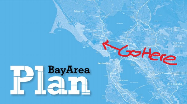
Image from Plan Bay Area; drawing inspired by Lydia DePillis To ABAG Staff:

Congratulations!  You've been invited to testify at a couple of Corte Madera town council meetings.  I know it's far away and I know it's a tiny town, but please resist the urge to blow off these meetings.  Corte Madera deserves to know why it is projected to grow and how it's expected to grow when it feels as though it's already built out.  Luckily, the town council isn't terribly familiar with the Plan Bay Area process.  For example, Corte Madera's representative to ABAG, Councilwoman Carla Condon, only recently learned that Plan Bay Area involves more agencies than just ABAG!  There is a great opportunity to educate the council on what you do, why you do it, why it's important for Corte Madera, and why it's important for the region.

To prepare you for the task, I've assembled a bit of a cheat sheet of the questions you'll get and what you should do in preparation to answer.  Each of these could be its own article, but hopefully I can point you in the right direction to find this out on your own.

Why is Plan Bay Area necessary?

Don't simply say that the state mandated it, and don't simply parrot a line about Smart Growth.  Give the background on the subject.  For reference, make sure to read the articles Planetizen has gathered under its SB 375 tag, including the ones critical of the legislation.  That's your homework, because you need to argue for SB 375 just as hard as you argue for ABAG.

In short, Plan Bay Area is necessary to do exactly what makes the most sense: concentrate growth where there already is infrastructure to support residents; to build up our central cities; to reduce particulate pollution; to promote active living for a range of public health reasons; and to ensure growth builds up our region rather than weakens it.

Doesn't higher density growth lead to more greenhouse gases?

This is an argument popularized in Marin by Mill Valley resident Bob Silvestri, a kind of home-grown Wendell Cox.  His opus on the subject argues that low-density housing is more environmentally friendly than medium-density housing.  Mayor Bob Ravasio believes this, too.

Though there are a number of problems with his argument, the least obvious is that Silvestri argues as though no growth is a viable alternative.  Of course constructing buildings produces greenhouse gases, but the point is to reduce per-capita greenhouse gas production, not absolute production.  This means moving people to their feet where possible and transit where not, and that means that growth should happen with moderately higher densities.

Be prepared to answer criticisms like Silvestri's.

Doesn't ABAG want Corte Madera to become a high-rise city?

Assocated questions are: isn't Corte Madera already built out?  Where would we put more people?  ABAG's vice president stuck a foot in her mouth when she answered this question with a finger pointed in the air, saying, If you say your town is built out, then build up.  For towns in Marin, her statement played right into the image of ABAG as a soul-sucking, social-experimenting, power-mad agency that wants to destroy town character.  Never, ever, say that Marin needs to build up.

Not only does it sound bad to Marinites, but it's also not accurate. Instead of such a ham-fisted answer, you need to emphasize that Plan Bay Area wants to move the region back to how we used to build cities. To illustrate, talk about the parts of Marin that Marinites like.  We love the places like downtown Mill Valley, downtown Corte Madera, downtown San Anselmo, downtown Larkspur, etc.  When we think about small-town feel, we think of these commercial strips.  Contrast this with those areas we don't like as much: Smith Ranch, Terra Linda, Vintage Oaks.  The distinguishing factor between the two types of areas are what they were oriented around. The places Marinites like are old transit-oriented development, built around train stations and people walking.  The places Marinites don't like are car-oriented development, built around parking lots.

What Plan Bay Area envisions is a return to traditional town planning in those places that were built with the parking lot in mind.  In Corte Madera, allowing residential uses on the parking lots of the Town Center shopping mall, even if they're just townhomes, would be more than enough growth for many RHNA cycles and certainly more than expected over the next 28 years of Plan Bay Area.

People don't walk or bike now, so why would new residents?

To address this question, bring solid research and charts.  Remember that the densities you're talking about for Corte Madera are in the range of 4,000 people per square mile, and that it's proximity to transit amenities and bicycle infrastructure more than population densities that will induce people to use their feet and the bus.

Take, for example, the new study from the Arizona Department of Transportation.  Even at very low housing densities, moving people closer together brings down the number of vehicle miles traveled.  The goal isn't to eliminate driving but to give people the option to walk, bike, or use transit without it being an undue burden.  Also, it's also not solely focused on commutes.  Someone who drives to work but walks to Corte Madera Cafe on Saturday - Plan Bay Area promotes more of that.

Oh, and nearly one in five commutes in Corte Madera are already by transit, bike, or foot, so someone's doing some walking.

What good has ABAG ever done for Corte Madera?

Talk to the Council about what ABAG does on a regular basis for Marin County as a whole and what they expect to do for Corte Madera in the future. ABAG, for example, manages federal grant money as a metropolitan planning organization.  It also provides financial services for members; provides research data on population and housing in the region; and a host of other things (PDF).  If appropriate, talk about the role of Corte Madera's representative to ABAG and how you would love to work with her more.

What is the methodology used to create your growth numbers?

Bring a modelling expert with you who can answer questions about growth methodology.  This is important, so I'll say it again: bring a modelling expert with you to answer questions.  For Corte Madera, the whole dispute boils down to what is happening inside the modelling black box.  The council is worried that your agency will destroy Corte Madera's character out of negligence, so bring someone who can answer their questions and open up that black box.

Corte Madera has some legitimate questions that need legitimate answers.  You cannot sleepwalk through this presentation or the Q&A afterwards.  You will likely face a hostile public that will call you a fascist for doing regional planning.  You cannot zone that out either.  You need to be engaged and engaging.  You need to educate the Council about what One Bay Area is doing, why they're doing it, how they're doing it, and what it all means for Corte Madera and Marin.

In all honesty, I'd love to have the answers to some of these questions.  What is the proper role of a representative to ABAG?  What is the exact work that went into Corte Madera's projected growth?  I'll look forward to your testimony almost as much as the Council, I'm sure.

In any event, this is your chance to change the conversation in Corte Madera and the rest of the Bay Area.  This is your chance to reboot your messaging.  This is your chance to justify your agency's existence.  Don't let that chance slip away.

Come support Corte Madera in ABAG

Corte Madera will consider whether to finalize its departure from ABAG tomorrow (Tuesday) at 7:30. Come out and voice your opposition! I'll be speaking at the public comment time and I would love to have more than me there. As a reminder, Corte Madera voted to quit ABAG over what it saw as overreach by the association in housing mandates and the One Bay Area process. I strenuously opposed the decision, calling it a dramatic overreaction to nonexistent problems. It will hurt the town, in that it will get housing mandates from the state after the upcoming RHNA cycle is over in 2021, and will hurt the region as a whole, in that a growth model that fails Corte Madera may be failing the rest of the Bay Area. I will make the same arguments during the public comment period.

From the Archives: Crosswalks and Walkability

Tonight, I'm taking a break. I need to pack, and I've finally finished my San Anselmo spider map (PDF) in preparation for my trip back home, but I don't want to leave you hanging. I've gone through the archives and found a good piece from last year dealing with crosswalks and walkability in San Anselmo.  I'll see you at this Thursday's happy hour.

Walkability seems to be all the rage these days, and for good reason.  Any merchant will tell you that foot traffic is good for business, and any public health expert will tell you walking is good for your health.  It gets people out of cars for trips of less than a mile and puts people where they can see each other, generating the vibrant sort of street life where friends and acquaintances run into each.  It’s a win for residents, a win for businesses, and a win for the city’s health.

Crosswalks are key to ensuring good walkability.  A road system isn’t much of a road system if you need to drive 15 minutes out of your way to turn, and a sidewalk system isn’t much good if one needs to walk 15 minutes to cross the street.  A good crosswalk will enhance an entire streetscape, making it more inviting to pedestrians and more lively for all users.  In contrast, a streetscape without crosswalks can be dangerous.  If crosswalks are far enough apart, the two halves of the street will be cut off from each other, dramatically reducing the walkability of the area.

Read the rest...

Tempest in a Teapot

Teapot, W1042 When Plan Bay Area released its draft preliminary growth numbers (yes, they’re that speculative), a cry went out around Marin that ABAG wants to cram growth down the gullet of stable and ungrowing county.  For years, Marin has lost jobs and so either lost housing units or grew at a snail’s pace.  We aren’t like the bankrupt towns of the East Bay or Delta, with vast tracts of new, identical houses.  Sadly, if regional and state agencies have  their way such reckless and unrestrained growth would come to our counties and you might as well kiss the Marinite way of life goodbye.

It’s a good narrative, but as with most sensationalist narratives of the government losing all reason, it’s pure nonsense.

Plan Bay Area, the sustainable communities strategy mandated by California, needs to accomplish a simply stated task: find out where people will live and work in 30 years, funnel that growth away from open space, and provide an effective way for people to get around without a car.  The first task requires projections of job and housing growth, the second utilizes the state-mandated Regional Housing Needs Allocation (RHNA) process, and the third uses grants to localities that want to expand or maintain their transit infrastructure.

The fear among opponents is that projections of housing growth will mean that the state will mandate that level of growth.  I suppose it’s an easy mistake to make.  RHNA numbers are released in a similar fashion, and those really are mandates for zoning to accommodate the growth.  Thankfully, Plan Bay Area projections are intended to inform the whole sustainability strategy; they don’t constitute growth mandates.  Yet even if they did, they would mandate slower growth for the county than has occurred in the recent past, though you wouldn’t know it listening to the plan’s opponents.

Between 2000 and 2010, Marin added about 622 housing units per year.  Nearly every incorporated town (excepting Larkspur and Belvedere) and every unincorporated village added housing over the past decade.  Plan Bay Area projects that growth will slow to only 272 units per year, less than half the rate of the past decade.  This rate of growth includes both affordable and market-rate housing.  RHNA will be informed by these projections, and so will mandate even less housing.

Besides, the “mandates” aren’t even mandates.  As we’ve discussed before, RHNA requires a city to do two things: zone for affordable housing, and come up with a plan to maybe have it get built.  That rarely happens.

So Marin will likely grow faster than Plan Bay Area projects, will likely be required to build less affordable housing than it has been required to in the past, and so things will carry on in much the same way they always have.  There is no vast usurpation of local control, there is no growth mandate handed down from One Bay Area, there is no UN plot to confiscate your home.  You may notice fewer news stories about grants for roads and more about grants for bikes and transit, and I guess that will be kind of disruptive.

A Radical Proposal for Biking in San Rafael

San Rafael has written off Second and Third for too long and ignored the benefits reaped from promoting bicycling.  To change it, San Rafael should take the radical step of installing a cycle track on Third, reclaiming at least that part of the city for people. Bicycling is a major part of life in San Anselmo and Fairfax.  Though both towns have a long way to go before practical cycling is feasible on its thoroughfares, both are home to the serious Bikers [Youtube] that hang out around downtown and form the heart of Marin’s bicycling culture.  Though proximity to open space may play a role, both towns have done what they could to build a biking culture by installing racks, painting sharrows (Class III lanes) and bike lanes (of the Class II variety), and planning for Class I lanes on arterials.  San Rafael, in contrast, has reserved its downtown roads for the car, pushing bikes and even people out of the way to make room for more Ross Valley car commuters.

This is odd for a number of reasons.  San Rafael doesn’t have a major population west of downtown, so the Second/Third arterials almost exclusively serve residents outside their jurisdiction.  Yet, the population they do serve are those bicycle-mad San Anselmoans and Fairfaxians.  Rather than draw on the best habits of Ross Valley, the arterials draw on its worst.

To remedy this, I propose the San Rafael Bikeway, a two-way separated Class I cycle track.  Modeled after Washington, DC’s 15th Street cycle track, the bikeway would be 11 feet wide: four feet for westbound cyclists, four feet for eastbound cyclists, and a three foot buffer.  With the complementary Class II bike lanes east of Grand Ave., the Bikeway would run two miles through the whole of downtown San Rafael.

Practically, the Bikeway would be a major boon to San Rafael.  Not only would it take some of the pressure off the roads by putting more people on bikes – a much smaller form of transportation – but it would calm traffic along Third and make the sidewalks along Third much more pedestrian-friendly.  Bike lanes of the Class I and II varieties calm traffic, meaning they bring down vehicle speeds and road noise, and the protection of a bicycle lane makes the sidewalk more inviting.  Calmer streets also tend to have more efficient traffic flow, so Level of Service would likely remain the same.

Perhaps most important is that calmer streets are safer streets.  Heavy arterials like Second and Third promote higher driving speeds and cause more severe injury crashes.  Putting in the Bikeway and calming even Third would make it a far safer street than it is today.

Bicyclists also tend to shop more and spend more than drivers.  As the Third Street merchants would be the ones with the best exposure, they would have more to gain from the track’s installation than Fourth Street, rebalancing the downtown.

Politically, the Bikeway would be a major pain for the city.  The plan envisions that the 47 parking spaces along Third Street would be next to the Bikeway during off-peak hours, providing further protection against traffic.  During rush hour, the parking lane would be a traffic lane, ensuring that cars are still easily whisked back to Ross Valley.

Though the 47 spaces represent less than 4% of parking in the area – 975 spaces are available in the Third Street garages alone – merchants and drivers view parking as sacrosanct.  Removing even a single space can lead to legislative gridlock, and displacing 47 would likely raise a righteous anger not seen in San Rafael.  On the other hand, removing a lane to make space for parking, even during off-peak hours, would likely raise stiff opposition from drivers.

To help allay such fears, San Rafael should approach the problem methodically before even announcing the details of the project.  Among the unknowns to study: how many Third Street drivers shop on Third; what’s the typical occupancy of those parking spaces; how many cyclists are expected to use the route in 5 years; and how many people will use the intersections per hour in 5 years, and what share of those are riding bikes.  The city must be ready to answer its critics from Day One.

There are a few practical design issues as well.  The route has a huge number of curb cuts, which diminish the effectiveness of the Class I concept.  The hill at Third and E is a relatively steep one for a casual bicyclist.  The Second Street segment is incredibly complicated - if Third can be narrowed without removing a traffic lane between Ritter and Union, that would make the eastern half of the route much more simple.  However, none of these problems are technically infeasible, and can be properly addressed with enough thought.

This is a radical plan, not because of the technical challenge, but because it would require San Rafael to be bold in a way it hasn’t been in the past, and to put people before cars in a way it has definitely not in the recent past.  This plan, or something like it, will reshape both the city and Ross Valley and provide an alternative infrastructure to serve Marin's cyclists.

The Limit of Marin's NIMBYism

I try not to use that term lightly.  NIMBY (standing for Not In My Back Yard) is a pretty loaded pejorative, connoting a sense of entitlement to an unchanging landscape, and an irrational opposition to the project at hand.

With Grady Ranch, I think that’s exactly what we had.

If you follow Marin’s development news, even in passing, you’ll know that George Lucas’s Skywalker Properties pulled out of an ambitious project over neighborhood opposition.  The Grady Ranch proposal was to be studio and production space on Lucas Valley Road, though all the buildings were to be shielded from view from the road.  It would have included a huge amount of land preservation and a good deal of creek restoration work.  The Lucas Valley Estates Homeowners Assocation (LVE) vehemently opposed the project, however, on environmental, quality-of-life, and other grounds.  After the County Supervisors were poised to approve the project when federal and state officials voiced concern over its environmental ramifications.  This, and the likelihood of continuing neighborhood opposition, caused Skywalker Properties to drop its proposal.

In a clearly bitter letter, the company wrote [PDF], “Marin is… committed to building subdivisions, not business.”  The company plans to sell the land for affordable housing because, “[i]f everyone feels housing is less impactful on the land, then we hope that those who need it the most will benefit.”

After the company announced it will abandon its plans, Marin’s supervisors went into crisis mode.  They offered to help defend any effort to delay the project, to approve the proposal as-is, and more, but as of Sunday night all signs indicated that the project was dead.

The whole sequence of events has left Marinites aghast.  Hundreds of potential jobs were lost.  Marin’s most prominent resident and strong county benefactor had been rebuffed.  We still remember the sting of loss when much of Lucas’ operation moved to the Presidio.

Encouraging to activists like me was how quickly the political channel has changed.  We aren’t talking about ABAG and housing quotas anymore.  The dialogue has swung away from, “We can’t possibly grow,” to the exact opposite.  Keep Marin Working, a business advocacy umbrella group, wrote in an op-ed, “Unless we take immediate steps to make Marin more business friendly, the Lucasfilm decision could be a preview of coming attractions.”  An IJ editorial wrote, “Lucas is frustrated and has had enough. It's hard to blame him.”  The Board of Supervisors wrote [PDF] that they were “deeply disappointed” over the news.  Outrage over the news reached beyond the newspaper page, though I suspect we won’t see its fullness until Tuesday morning, when supporters invited by Supervisor Judy Arnold will speak their mind in support of the project at a supervisorial meeting.

I can identify three lessons from the wreckage of Grady Ranch.

First, NIMBYism is just as repugnant to Marinites as it is to developers.  The county’s residents do want jobs and development, as long as they don’t conflict with our environmental goals of open space protection or threaten town character.  Grady Ranch was environmentally friendly and kept with the rural feel of Lucas Valley.  Though it was a greenfield development some ways from transit, it maintained open space and bolstered the environmental value of the land.  People noticed.

Second, policymakers need to limit the number of procedural hurdles a project needs to jump through, as a neighborhood will always put up more.  Our boards and councils must always be cognizant of the potential for well-educated, well-heeled residents to abuse the system, and we should seek to limit their capacity to do so.  Grady Ranch took 16 years get to the finish line because of neighborhood intransigence and died because what seemed like the end really wouldn’t be.

Third, supporters need to be vocal.  The Board of Supervisors would have approved Grady Ranch unanimously if given the chance, and that is thanks in part to vocal local support.  This was thanks to George Lucas' strong track record of development and community service.  Any other developer needs to do the same, showing that it invests in Marin and cares about its future, not just profiteering.  Supporters need to get the word out there – in editorials, letters, and in council and board meetings.  One ought never concede the conversation to conservatives through silence.

Alas, Grady Ranch may be fully dead.  Lucasfilm needs the space for filming now and will look elsewhere if they think there will be any further delays.  However, supporters of a strong and dynamic Marin should seize on Grady Ranch as a turning point, and look to the fights ahead: Mill Valley's Blithedale Terrace development, SMART station area plans, and Plan Bay Area.

The Centrality of Housing

In the 1970s, the progressive view was to get people out of the city and back to the land, to grow your own food, make your own power, and retreat from the devastation wreaked by cities on the environment.  The idyllic life waited where the pavement ended, and many of those who embraced that lifestyle moved to Marin.  We didn’t realize then what we know now: cities are our best hope for the future, and that where we live is intimately connected with the health of our planet and our communities.  As Marin engages in a great and necessary debate over regionalism and housing, it is important that we not choose self-destructive conservatism over conservation. The conservative line is that Marin cannot accommodate anyone else, and that growth must remain slow or stagnant for the good of the county and the planet.   Bob Silvestri, a Mill Valley community activist, has said that density and transit-oriented development are bad for the environment and increase, rather than reduce, greenhouse gas emissions.  Greenhouse gases, he says, should be limited in industry and power but not in our personal lives.  Accommodating more people in Marin would ultimately increase our carbon footprint per capita and reduce our overall quality of life.

The conservationist line is that people will move somewhere, and Marin is better placed that elsewhere to limit sprawl at the outskirts of the region.  Density brings more efficient use of infrastructure and energy, happier and healthier people, and a more dynamic city.  The Natural Resources Defense Council actively advocates for more compact towns and cities through infill development, arguing that they reduce overall energy usage and keep open space safe from development.

Everything I have seen since leaving Marin has shown me that the conservationist's view conforms more closely with reality than the conservative's. From walkable city centers to small towns in Vermont, the best places, the areas where I felt most at home, were the ones that were more compact, where housing is within walking distance of stores, offices, parks, schools, and mass transit.

Having amenities and housing within walking distance of each other is itself a good.  Though you could ask a patron of Sun Valley Market or a resident of downtown Mill Valley, or think back on that European trip, you could also look at a 2011 research review from the Victoria Transport Policy Institute.  It says, in part, that promoting walking as part of everyday life, such as in a daily commute, has measurable health benefits.  A study from New Zealand showed that for every mile walked rather than driven the country saves 48¢, and for every mile biked the country saves 19¢.  Given the higher health costs in the US, that could be significantly higher.

Walkers also spend more.  A study from the United Kingdom, also cited by the Victoria review, shows those who primarily walk to shop spend £91 per week while those who principally drive spend only £64 per week.  Given that the shoppers are walking, they will necessarily support whatever retail is nearby.  Infill development near town centers, then, will bring shops their best customers.  Others have described that bicyclists also spend more than drivers.  Encouraging walking and biking to and around a downtown, then, will be a local economic stimulus.  Providing housing in or near downtown will install permanent, well-paying, healthier customers for retailers.

Environmentally, housing location and housing density matters as well.  If we avoid greenhouse gasses and transportation for a moment, we find that denser and more walkable housing decreases the amount of runoff per-capita and decreases the amount of lawn fertilizers and such that get washed into waterways.  A single paved acre will cause just as much runoff whether it has 1 family or 30 living on it.  Spreading those 30 families out to 30 different houses that need roads connecting all of them and parking lots to store their cars (an average of three are built for every car added to the road) will result in far more than a single acre of impervious surface.

Greenhouse gases are trickier to tease out.  While studies (PDF) show (PDF) that transportation-related greenhouse gases drop precipitously once people move away from car usage, Silvestri recently cited a study of New York City that finds higher rates of greenhouse gas emissions per capita than lower-density developments.  This directly contradicts studies done by the United Nations, New York City itself, and many others.  I couldn't find the New York City study, but similar research done on Australia finds essentially the same point.  In such instances, it is the common energy consumption - common areas, parking garages, and the like - that sucks up the excess energy, as well as increased overall consumption.  A broader study (PDF) examining the United States find an opposite relationship, so it may be that Australian development patterns are not translatable to the American urban reality.

Parsing the two opposite conclusions is not the thrust of this piece.  Suffice it to say that the bulk of research shows that the location and type of housing influences greenhouse gas emissions.  In addition, the densities Marin is contemplating are nowhere approaching Manhattan or Melbourne, and so would fall into the bottom of any conceivable greenhouse gas U curve.  Building more densely would decrease greenhouse gas emissions in transportation - the research on that is essentially unanimous - and any additional costs can be made up in green building strategies that ought to be standard in Marin to begin with.

Lastly, housing location determines how much open space is preserved.  Though our region could go sprawling through the hills of the East Bay and into the Central Valley, it is concomitant upon the already existing towns and cities to build where infrastructure already exists, even if in relatively low densities.  It saves money for the cities out on the edge (just ask Stockton how its sprawl is paying for itself) and preserves open space in areas where land trusts do not tread.  Pushing a slow-growth agenda in Marin just means pushing a faster-growth agenda everywhere else.  The Bay Area will grow, and I'd rather see it happening along Miller Avenue than on Central Valley farmland.

Where conservatives and conservationists ought to agree is that local control is a good thing.  We shouldn’t need regional agencies telling us what to do.  Affordable housing mandates do little to increase affordable housing, and inclusionary zoning decreases the amount of housing built, driving up the market price. Sacramento should stop raiding our housing budgets and allow localities to actually build.

But we cannot be so blinded by the important pursuit of local control that we lose sight of the connections that tie Marin to the rest of the region and country and world.  How and where we build our housing is intimately connected to the health of our residents, the health of our planet, and the health of our communities, and for every resident we turn away another home must be built elsewhere, and there's no guarantee that other place will be as socially conscious as we are.

Keeping the drive through that was always there just because it was always there is not a recipe for sustainability; it’s a recipe for stagnation.  That’s exactly what we’ll get if the county’s conservatives have their way, and we’ll become environmentalists concerned more about preserving our parking lots than preserving the Delta, or coastal San Mateo, or rural Napa, or the Great Plains, health nuts unconcerned by active living, and citizens unmoved by the hardship of downtown merchants.  That's not a Marin I would recognize.

Leverage the Golden Gate Transportation Monopoly

Golden Gate toll plaza // San Francisco // California // USA You may not realize it, but the Golden Gate Bridge Highway and Transit District has an effective monopoly* on travel to San Francisco from Marin.  If you take transit, of course, you’re using GGT, but if even if you drive you have a toll to pay.  This gives the district enormous market power to influence the travel decisions made by Marinites, power that it should use for good.

The Marin-San Francisco transportation market has three principal products – driving, bus travel, and ferry travel.  Directly, the car has a $5 round trip toll, the bus has a $6.80 to $16.40 round trip fare, and the ferry has a $9.70 to $11.40 $17.50 round trip fare.  The car also has fuel, insurance, parking, and depreciation costs as well, but none of these are controlled (save parking costs at park-and-ride lots) by the district.

What strikes me about this situation is that the district charges the least for the most high-impact transportation mode, the car.  The negative externalities of car ownership go far, far beyond simply tailpipe pollution: the cost of car storage that get dumped into housing costs through mandatory minimums; the cost of parking lots on the pedestrian environment; the cost to our mental and physical health driving everywhere; the ongoing slaughter of drivers and pedestrians on the roads; and the sheer cost of maintaining the physical infrastructure needed to carry all these cars around.  By charging significantly less for driving than other modes, the district promotes this kind of unsustainable mode choice.

If the toll were increased to $7, making the cheapest bus fare competitive against driving, one would see a significant boost in bus trips from southern Marin.  If the toll money were plowed back into service improvements, the district would create a positive feedback loop, allowing the district to simultaneously discourage driving and provide a better transit product.  Even better, it would allow the district to move towards its goal of 50% farebox recovery, as the increased ridership would bring in more money and the right transit improvements would decrease costs.

The district did explore a congestion pricing scheme a few years ago that would have bumped the toll to $8 during peak hours.  Though I’m sure San Franciscans would have been happy to have fewer suburban drivers on their roads, the plan was dropped because it was seen as an unnecessary tax on drivers.  Hopefully the plan will be revived to help pay for the district’s $87 million Doyle Drive deficit, though given the district’s belief that ferry riders should pay it through a fare increase I don’t hold out hope.

Though this does sound like a plan to sop the driver for the rider, there are a few things to keep in mind.  First, the driver can always become a rider, and doing so would likely be better for everyone involved, especially if the bus can become competitive with the car in speed as well as cost.  Second, the drivers that don’t switch will see benefits in traffic and, if enough drivers switch to buses, see a significant decrease in travel time.  Though it would cost more for them to drive, they would get a better product than they had before.

In short, the district needs to examine its pricing schemes as a singular system, not as a set of disconnected fares and tolls, and establish a better balance between driving and riding costs.  Doing so would reap benefits for drivers in the form of less congestion, riders in the form of better transit, Marin in the form of more livable and walkable communities, and San Francisco in the form of less suburbanite traffic.

*Yes, I realize Blue & Gold Fleet operates a ferry, but its round-trip fare is double that of Golden Gate's and so isn't terribly important to this discussion.  If we were talking about the transit market in Tiburon, of course, they'd play on center stage.

A Greater Marin

[vimeo http://www.vimeo.com/27744328 w=601&h=338] What’s your favorite place in Marin?  For some, it’s the top of a nearby hill – one can see for miles, in sync with the nature of the place: dry grass, an oak grove to one side, and the smell of the open space.  For others, it’s their downtown, where one can park once and stroll along the main street, eying what’s for sale, meeting neighbors and friends by happenstance.  These two places, nature and the town, are the two pillars that make Marin great.  I love the above video because it captures both.  Yet, though we can safely lock nature away from development, we cannot do the same for our town centers.  Every decision of how we grow, and where we grow, makes our county better or worse.  Here is where we can make a greater Marin, or not, and that is why I started The Greater Marin.

Marin itself was raised on rail, with tiny bits of transit-oriented development blossoming into the towns we have today.  Though downtown San Anselmo is probably the best example, growing as it did from nothing, you can see pockets of it along Center, as you go towards Fairfax.  At the two old platforms that used to be Yolanda and Landsdale station, you can see little bits of commercial zoning amidst the housing.  Odds are, you live in transit-oriented development.

After the Golden Gate Bridge was built with the car, rather than the train, in mind, development in Marin exploded.  The freeway was built, bisecting San Rafael and pushing development north to Terra Linda and beyond.  Though we won out against any more freeways, one can best see the effects of car-oriented design in Terra Linda and Smith Ranch: large parking lots, wide streets, fast cars, and nowhere to walk to.  How many of us have walked from the Civic Center to Northgate, or the Century Theater in Smith Ranch to the strip mall down the street?  They’re not far from one another, but the design is antithetical to the kind of wonderful places that warm our hearts when we think of what makes Marin what it is.

I was born and raised in San Anselmo, and though I moved away to pursue school and a career after high school, my heart, not to mention my family, stayed behind.  One idiosyncrasy Marinites share with New Yorkers is the firmly held belief that our home is the greatest place to live in the country, if not the world.  Though I feel the truth in that, my exposure to other places like Vancouver and Washington, DC, showed me the pride and sense of place other cities feel.  They try to replicate the patterns of growth that created Marin’s centralized structure of small towns clustered around commercial centers, and it works.  The lessons learned by Vancouver and Washington when they try to become Marin can be applied back to Marin.

Yet when I went exploring for thinkers working to make Marin a better place, I found none.  The strongest movement that dealt with transit was RepealSMART, and the only debate of urban affairs was over affordable housing in Novato.

So I dove in, figuring that even my voice, however distant, was better than none at all.  This blog has a vision of Marin with strong, unique towns at its core.  The vision has three elements:

  1. Move away from the car.  Though the car will always be a large part of our low-density county, it needn’t be the principal means of transportation.  Marin’s geography lays our towns in thin strips, and good transit service can serve most of a town without much problem.  In addition, our towns are small enough and weather mild enough that bicycling for most of our trips is a real possibility, provided the infrastructure is there to make it as safe and inviting as hopping in the car.
  2. Focus development around town and transit centers.  What growth does occur, including affordable housing, should be put where it will strengthen town centers, or build new town centers, and strengthen local character.  Our downtowns are often marketed as on the brink of disaster.  Growing downtown means growing the customer base, and that means healthier retail and stronger communities.
  3. Keep Marin, Marin.  The explosive, sprawling growth of San Mateo and Contra Costa are antithetical to what Marin ought to be.  They built density with the car in mind, with large 20 story buildings, wide streets, massive parking lots, and little streetlife.  If we build with the person in mind, our two- or three-story height limits will keep the village character intact, and invite us to walk along what are now pedestrian the wastelands beyond our town centers.  Every new building, every zoning change, should be done with the person, and the streetscape, in mind.  European villages ooze character, and every part of Marin can do the same.

In short, I write with a vision for Marin that is person-oriented, not merely transit-oriented, and one that sees rampant car use as a threat to our county’s character.  I want Marin’s character to grow and strengthen.  We can rest on our necessary victories in the Great Freeway Rebellion and fight all change as an evil, or we can keep exploring how to make a great county greater.  I hope you’ll join the conversation.