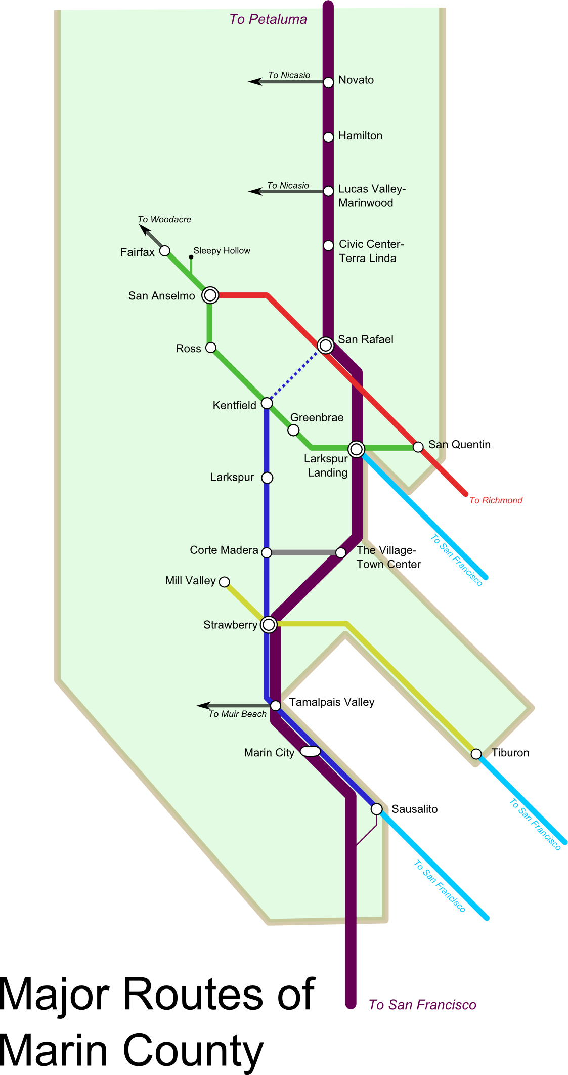
 If there is one thing that gets a transit advocate's heart racing, it's a transit fantasy map. It speaks to our not-so-hidden desire that method by which we get around - trains, buses, cars, bikes and feet - should each occupy a niche in the urban landscape, hopefully without too much spillover into another mode's bailiwick. A fantasy map means that a given area is no longer strictly the domain of the car but is accessible to all travelers.
Sometimes, however, a fantasy map is really not a fantasy at all, but a reimagining of what is already there. Cameron Booth, for example, created a map of the Eisenhower Interstate Highway System as though it were a subway system. Complutense has a fair number of fantastic maps of Bay Area transit. (Marin sure looks lonely with its one little track.) With that, I submit my own - East Marin's roads as metro.
Why? When my eyes drifted from DC's transit network and back to my home, I realized that Marin is laid out in lines thanks to its geography. Not only does this lend itself to diagramming, but it lends itself to frequent buses: the population is forced to travel along these routes, and they already live close enough to them that bus improvements help the whole corridor, not just a few near the stops.
The map will be updated as time goes on. It needs some work, but it has helped me visualize Marin's potential.